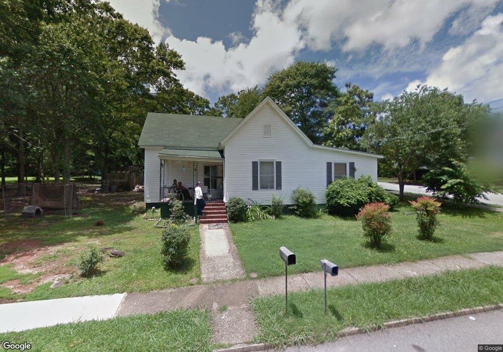
27 Thornton St Lagrange, GA 30241
Estimated Value: $106,000 - $146,000
3
Beds
2
Baths
1,364
Sq Ft
$94/Sq Ft
Est. Value
About This Home
This home is located at 27 Thornton St, Lagrange, GA 30241 and is currently estimated at $127,584, approximately $93 per square foot. 27 Thornton St is a home located in Troup County with nearby schools including Franklin Forest Elementary School, Hollis Hand Elementary School, and Ethel W. Kight Elementary School.
Ownership History
Date
Name
Owned For
Owner Type
Purchase Details
Closed on
Jan 2, 2014
Sold by
Aldridge Rhonda Gail
Bought by
Lambeth Properties Llc
Current Estimated Value
Home Financials for this Owner
Home Financials are based on the most recent Mortgage that was taken out on this home.
Original Mortgage
$27,345
Interest Rate
4.43%
Mortgage Type
New Conventional
Purchase Details
Closed on
Feb 5, 2009
Sold by
Nix Yvonne B
Bought by
Aldridge Rhonda Gail
Purchase Details
Closed on
May 18, 1998
Sold by
Ralph Matthews J
Bought by
Estate Of Yvonne Nix
Purchase Details
Closed on
Jan 1, 1967
Sold by
Charlie Carrington
Bought by
Ralph Matthews J
Create a Home Valuation Report for This Property
The Home Valuation Report is an in-depth analysis detailing your home's value as well as a comparison with similar homes in the area
Home Values in the Area
Average Home Value in this Area
Purchase History
| Date | Buyer | Sale Price | Title Company |
|---|---|---|---|
| Lambeth Properties Llc | $35,000 | -- | |
| Aldridge Rhonda Gail | -- | -- | |
| Aldridge Rhonda Gail | -- | -- | |
| Estate Of Yvonne Nix | -- | -- | |
| Ralph Matthews J | -- | -- |
Source: Public Records
Mortgage History
| Date | Status | Borrower | Loan Amount |
|---|---|---|---|
| Closed | Lambeth Properties Llc | $27,345 |
Source: Public Records
Tax History Compared to Growth
Tax History
| Year | Tax Paid | Tax Assessment Tax Assessment Total Assessment is a certain percentage of the fair market value that is determined by local assessors to be the total taxable value of land and additions on the property. | Land | Improvement |
|---|---|---|---|---|
| 2024 | $1,182 | $43,332 | $5,400 | $37,932 |
| 2023 | $1,016 | $37,268 | $5,400 | $31,868 |
| 2022 | $991 | $35,508 | $5,400 | $30,108 |
| 2021 | $828 | $27,460 | $2,600 | $24,860 |
| 2020 | $828 | $27,460 | $2,600 | $24,860 |
| 2019 | $733 | $24,304 | $2,600 | $21,704 |
| 2018 | $733 | $24,304 | $2,600 | $21,704 |
| 2017 | $733 | $24,304 | $2,600 | $21,704 |
| 2016 | $727 | $24,104 | $2,600 | $21,504 |
| 2015 | $423 | $14,000 | $1,510 | $12,490 |
| 2014 | $352 | $21,490 | $2,600 | $18,890 |
| 2013 | -- | $23,088 | $2,600 | $20,488 |
Source: Public Records
Map
Nearby Homes
- 5 Curran Ave
- 15 Fulton St
- 130 Clara Jean Ct
- 0 N Barnard Ave
- 113 Lenox Cir
- Coleman Plan at Crossvine Village
- 0 Mill Creek Pkwy Unit PHASE 5 10313564
- Beckman Plan at Crossvine Village
- 0 Mill Creek Pkwy Unit PHASE 4 10313585
- Fairfield Plan at Crossvine Village
- Broadmoor Plan at Crossvine Village
- Dover Plan at Crossvine Village
- 305 Lenox Cir
- 105 Lenox Cir
- 101 Lenox Cir
- 227 River Meadow Dr Unit H14
- 231 River Meadow Dr
- 412 Sweetwood Ct Unit A36
- 906 Georgia Ave
- 902 Georgia Ave
- 25 Thornton St
- 29 Thornton St
- 23 Thornton St
- 28 Thornton St
- 30 Barnard Ave
- 26 Thornton St
- 28 Barnard Ave
- 31 Thornton St
- 32 Barnard Ave
- 30 Thornton St
- 31 Barnard Ave
- 0 Thornton St Unit 8461780
- 0 Thornton St Unit 8283320
- 0 Thornton St Unit 7149707
- 24 Thornton St
- 26 Barnard Ave
- 21 Thornton St
- 34 Barnard Ave
- 32 Thornton St
- 208 Newnan St