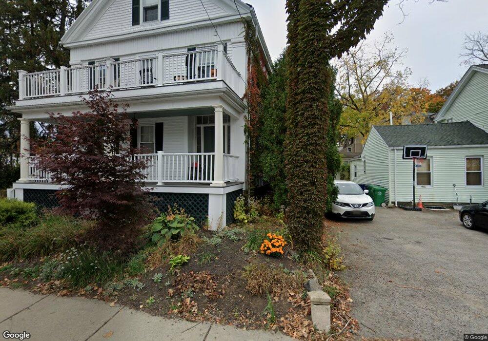
27 Thornton St Newton, MA 02458
Newton Corner NeighborhoodEstimated Value: $1,196,529 - $1,234,000
6
Beds
3
Baths
2,740
Sq Ft
$445/Sq Ft
Est. Value
About This Home
This home is located at 27 Thornton St, Newton, MA 02458 and is currently estimated at $1,218,132, approximately $444 per square foot. 27 Thornton St is a home located in Middlesex County with nearby schools including Lincoln-Eliot Elementary School, Bigelow Middle School, and Newton North High School.
Ownership History
Date
Name
Owned For
Owner Type
Purchase Details
Closed on
Dec 5, 2024
Sold by
Lillian Friel T and Lillian Arsenault
Bought by
Arsenault Ellen and Friel Mark
Current Estimated Value
Purchase Details
Closed on
Oct 29, 2014
Sold by
Friel Lillian
Bought by
Lillian Friel T and Lillian Friel
Purchase Details
Closed on
Jan 3, 2007
Sold by
Friel Nt and Friel
Bought by
Friel Lillian
Create a Home Valuation Report for This Property
The Home Valuation Report is an in-depth analysis detailing your home's value as well as a comparison with similar homes in the area
Home Values in the Area
Average Home Value in this Area
Purchase History
| Date | Buyer | Sale Price | Title Company |
|---|---|---|---|
| Arsenault Ellen | -- | None Available | |
| Arsenault Ellen | -- | None Available | |
| Lillian Friel T | -- | -- | |
| Lillian Friel T | -- | -- | |
| Friel Lillian | -- | -- | |
| Friel Lillian | -- | -- |
Source: Public Records
Mortgage History
| Date | Status | Borrower | Loan Amount |
|---|---|---|---|
| Previous Owner | Friel Lillian | $91,000 | |
| Previous Owner | Friel Lillian | $70,000 |
Source: Public Records
Tax History Compared to Growth
Tax History
| Year | Tax Paid | Tax Assessment Tax Assessment Total Assessment is a certain percentage of the fair market value that is determined by local assessors to be the total taxable value of land and additions on the property. | Land | Improvement |
|---|---|---|---|---|
| 2025 | $8,749 | $892,800 | $639,800 | $253,000 |
| 2024 | $8,460 | $866,800 | $621,200 | $245,600 |
| 2023 | $7,990 | $784,900 | $492,700 | $292,200 |
| 2022 | $7,646 | $726,800 | $456,200 | $270,600 |
| 2021 | $5,264 | $666,800 | $418,500 | $248,300 |
| 2020 | $6,961 | $666,800 | $418,500 | $248,300 |
| 2019 | $3,490 | $623,200 | $391,100 | $232,100 |
| 2018 | $4,735 | $591,800 | $367,400 | $224,400 |
| 2017 | $6,037 | $542,900 | $337,100 | $205,800 |
| 2016 | $5,668 | $498,100 | $309,300 | $188,800 |
| 2015 | $5,404 | $465,500 | $289,100 | $176,400 |
Source: Public Records
Map
Nearby Homes
- 1 Channing St
- 34 Channing St Unit 1
- 34 Channing St Unit 2
- 15-17 Jewett Place Unit 2
- 12 Richardson St Unit 14
- 30 Boyd St Unit 30
- 90 Waban Park Unit 2
- 164 Galen St Unit 88
- 164 Galen St Unit 65
- 10 Williams St Unit 39
- 10 Williams St Unit 56
- 77 Pond Ave Unit 1103
- 14 Summit St
- 14 Summit St Unit 14-F
- 141 Morse St
- 68 Vernon St
- 324 Adams St Unit 2
- 66 Aldrich Rd Unit B
- 169 Washington St Unit 7
- 327 Franklin St
- 21 Thornton St
- 79 Avon Place
- 30 Thornton St
- 30 Thornton St Unit 30
- 30 Thornton St Unit A
- 30 Thornton St Unit B
- 36 Thornton St Unit 38
- 11 Avon Place
- 12 Waban St Unit 3
- 12 Waban St Unit 2
- 12 Waban St Unit 1
- 26 Thornton St
- 15 Avon Place
- 6 Thornton Place
- 17 Avon Place
- 42 Thornton St
- 18 Thornton St
- 1 Waban St
- 1 Waban St Unit 2
- 1 Waban St Unit 1