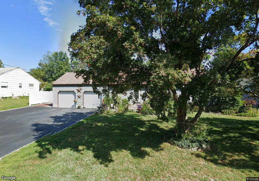
27 Toner Rd Boonton, NJ 07005
Estimated Value: $587,000 - $673,216
--
Bed
--
Bath
1,616
Sq Ft
$388/Sq Ft
Est. Value
About This Home
This home is located at 27 Toner Rd, Boonton, NJ 07005 and is currently estimated at $627,054, approximately $388 per square foot. 27 Toner Rd is a home located in Morris County with nearby schools including School Street Elementary School, John Hill Elementary School, and Boonton High School.
Ownership History
Date
Name
Owned For
Owner Type
Purchase Details
Closed on
Apr 12, 2011
Sold by
Carcich Michael C
Bought by
Donnelly Gerald
Current Estimated Value
Home Financials for this Owner
Home Financials are based on the most recent Mortgage that was taken out on this home.
Original Mortgage
$311,888
Outstanding Balance
$214,671
Interest Rate
4.75%
Mortgage Type
FHA
Estimated Equity
$412,383
Purchase Details
Closed on
Mar 17, 2011
Sold by
Carcich Geraldine
Bought by
Carcich Michael C
Home Financials for this Owner
Home Financials are based on the most recent Mortgage that was taken out on this home.
Original Mortgage
$311,888
Outstanding Balance
$214,671
Interest Rate
4.75%
Mortgage Type
FHA
Estimated Equity
$412,383
Purchase Details
Closed on
Dec 22, 2003
Sold by
Carcich Geraldine
Bought by
Carcich Michael
Home Financials for this Owner
Home Financials are based on the most recent Mortgage that was taken out on this home.
Original Mortgage
$190,000
Interest Rate
5.89%
Create a Home Valuation Report for This Property
The Home Valuation Report is an in-depth analysis detailing your home's value as well as a comparison with similar homes in the area
Home Values in the Area
Average Home Value in this Area
Purchase History
| Date | Buyer | Sale Price | Title Company |
|---|---|---|---|
| Donnelly Gerald | $320,000 | Stewart Title Guaranty Co | |
| Carcich Michael C | -- | None Available | |
| Carcich Michael | -- | -- |
Source: Public Records
Mortgage History
| Date | Status | Borrower | Loan Amount |
|---|---|---|---|
| Open | Donnelly Gerald | $311,888 | |
| Previous Owner | Carcich Michael | $190,000 |
Source: Public Records
Tax History Compared to Growth
Tax History
| Year | Tax Paid | Tax Assessment Tax Assessment Total Assessment is a certain percentage of the fair market value that is determined by local assessors to be the total taxable value of land and additions on the property. | Land | Improvement |
|---|---|---|---|---|
| 2025 | $11,631 | $344,100 | $196,000 | $148,100 |
| 2024 | $11,324 | $344,100 | $196,000 | $148,100 |
| 2023 | $11,324 | $344,100 | $196,000 | $148,100 |
| 2022 | $10,732 | $344,100 | $196,000 | $148,100 |
| 2021 | $10,732 | $344,100 | $196,000 | $148,100 |
| 2020 | $10,289 | $344,100 | $196,000 | $148,100 |
| 2019 | $10,423 | $344,100 | $196,000 | $148,100 |
| 2018 | $10,148 | $344,100 | $196,000 | $148,100 |
| 2017 | $9,724 | $344,100 | $196,000 | $148,100 |
| 2016 | $9,470 | $344,100 | $196,000 | $148,100 |
| 2015 | $9,315 | $342,500 | $196,000 | $146,500 |
| 2014 | $9,066 | $342,500 | $196,000 | $146,500 |
Source: Public Records
Map
Nearby Homes
- 215 Fulton St
- 8 Highland Ave
- 19 Montville Ave
- 18 Country Meadows Ln
- 141 Roessler St
- 168 Kanouse St
- 150 Kanouse St
- 725 Cornelia St
- 646 Cornelia St
- 411 William St
- 315 William St
- 34 Lenox Ct
- 113 Old Boonton Rd
- 7 Joan Dr
- 209 William St
- 331 Church St
- 314 Cornelia St
- 314 Cornelia St Unit 4
- 712 Wootton St
- 609 Birch St