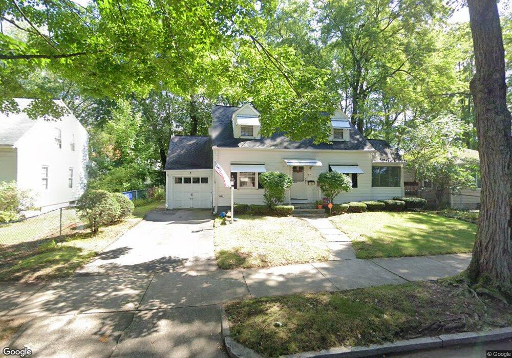
27 Vail St Springfield, MA 01118
East Forest Park NeighborhoodEstimated Value: $159,000 - $326,000
3
Beds
2
Baths
1,568
Sq Ft
$172/Sq Ft
Est. Value
About This Home
This home is located at 27 Vail St, Springfield, MA 01118 and is currently estimated at $269,077, approximately $171 per square foot. 27 Vail St is a home located in Hampden County with nearby schools including Frederick Harris Elementary School, M Marcus Kiley Middle, and Springfield High School of Science and Technology.
Ownership History
Date
Name
Owned For
Owner Type
Purchase Details
Closed on
Jun 27, 2025
Sold by
Parrott Gregory C
Bought by
Parrott Amanda
Current Estimated Value
Home Financials for this Owner
Home Financials are based on the most recent Mortgage that was taken out on this home.
Original Mortgage
$25,000
Outstanding Balance
$24,512
Interest Rate
6.81%
Mortgage Type
Second Mortgage Made To Cover Down Payment
Estimated Equity
$244,565
Purchase Details
Closed on
Mar 19, 2020
Sold by
Crum Janet S and Crum James E
Bought by
Parrott Gregory C
Home Financials for this Owner
Home Financials are based on the most recent Mortgage that was taken out on this home.
Original Mortgage
$137,464
Interest Rate
3.4%
Mortgage Type
FHA
Purchase Details
Closed on
Apr 19, 2018
Sold by
Crum Janet S
Bought by
Crum Janet S and Crum James E
Purchase Details
Closed on
Mar 21, 2018
Sold by
Perosino Shirley J Est and Crum
Bought by
Crum Janet S
Purchase Details
Closed on
Apr 3, 1979
Bought by
Perosino Shirley J
Create a Home Valuation Report for This Property
The Home Valuation Report is an in-depth analysis detailing your home's value as well as a comparison with similar homes in the area
Home Values in the Area
Average Home Value in this Area
Purchase History
| Date | Buyer | Sale Price | Title Company |
|---|---|---|---|
| Parrott Amanda | $153,000 | -- | |
| Parrott Amanda | $153,000 | -- | |
| Parrott Gregory C | $135,000 | None Available | |
| Crum Janet S | -- | -- | |
| Crum Janet S | -- | -- | |
| Crum Janet S | -- | -- | |
| Crum Janet S | -- | -- | |
| Perosino Shirley J | -- | -- |
Source: Public Records
Mortgage History
| Date | Status | Borrower | Loan Amount |
|---|---|---|---|
| Open | Parrott Amanda | $25,000 | |
| Closed | Parrott Amanda | $25,000 | |
| Previous Owner | Parrott Gregory C | $137,464 |
Source: Public Records
Tax History
| Year | Tax Paid | Tax Assessment Tax Assessment Total Assessment is a certain percentage of the fair market value that is determined by local assessors to be the total taxable value of land and additions on the property. | Land | Improvement |
|---|---|---|---|---|
| 2025 | $4,014 | $256,000 | $46,900 | $209,100 |
| 2024 | $3,801 | $236,700 | $46,900 | $189,800 |
| 2023 | $3,497 | $205,100 | $44,700 | $160,400 |
| 2022 | $3,555 | $188,900 | $44,700 | $144,200 |
| 2021 | $2,947 | $155,900 | $40,600 | $115,300 |
| 2020 | $3,054 | $156,400 | $40,600 | $115,800 |
| 2019 | $2,974 | $151,100 | $40,600 | $110,500 |
| 2018 | $3,153 | $160,200 | $40,600 | $119,600 |
| 2017 | $2,819 | $143,400 | $40,600 | $102,800 |
| 2016 | $2,603 | $132,400 | $40,600 | $91,800 |
| 2015 | $2,703 | $137,400 | $40,600 | $96,800 |
Source: Public Records
Map
Nearby Homes
- 13 Bither St
- 1088 Sumner Ave
- 119 Powell Ave
- 79 Roosevelt Ave
- 34 Castle St
- 161 Dorset St
- 79 Arvilla St
- 77 Dorset St
- 134 Eddywood St
- 88 Brunswick St
- 46 Eckington St
- 854-856 Sumner Ave
- 170 Plumtree Rd
- 7 Ashbrook St
- 46 Hadley St
- 59 Daviston St
- 125 Manor Ct Unit 125
- 19 Manor Ct Unit 19
- 914-916 Belmont Ave
- 22 Eleanor Rd
Your Personal Tour Guide
Ask me questions while you tour the home.