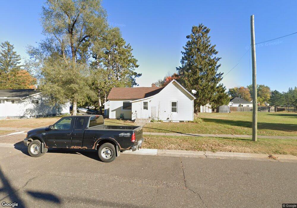
27 W Franklin Ave Barron, WI 54812
Estimated Value: $84,000 - $173,000
--
Bed
--
Bath
--
Sq Ft
8,712
Sq Ft Lot
About This Home
This home is located at 27 W Franklin Ave, Barron, WI 54812 and is currently estimated at $124,575. 27 W Franklin Ave is a home located in Barron County with nearby schools including Barron High School, Advanced Learning Academy of Wisconsin, and Barron Christian School.
Ownership History
Date
Name
Owned For
Owner Type
Purchase Details
Closed on
Dec 1, 2022
Sold by
Rasmussen Bruce A
Bought by
Blihovde Rodney A
Current Estimated Value
Purchase Details
Closed on
Dec 29, 2020
Sold by
Rasmussen Ethel
Bought by
Rasmussen Bruce A
Home Financials for this Owner
Home Financials are based on the most recent Mortgage that was taken out on this home.
Interest Rate
2.79%
Create a Home Valuation Report for This Property
The Home Valuation Report is an in-depth analysis detailing your home's value as well as a comparison with similar homes in the area
Home Values in the Area
Average Home Value in this Area
Purchase History
| Date | Buyer | Sale Price | Title Company |
|---|---|---|---|
| Blihovde Rodney A | $45,000 | T.M. Title Services, Inc. | |
| Rasmussen Bruce A | $24,000 | -- | |
| Rasmussen Bruce A | $24,000 | -- |
Source: Public Records
Mortgage History
| Date | Status | Borrower | Loan Amount |
|---|---|---|---|
| Previous Owner | Rasmussen Bruce A | -- |
Source: Public Records
Tax History Compared to Growth
Tax History
| Year | Tax Paid | Tax Assessment Tax Assessment Total Assessment is a certain percentage of the fair market value that is determined by local assessors to be the total taxable value of land and additions on the property. | Land | Improvement |
|---|---|---|---|---|
| 2024 | $1,023 | $78,200 | $13,200 | $65,000 |
| 2023 | $737 | $39,800 | $8,600 | $31,200 |
| 2022 | $981 | $39,800 | $8,600 | $31,200 |
| 2021 | $1,032 | $39,800 | $8,600 | $31,200 |
| 2020 | $970 | $39,800 | $8,600 | $31,200 |
| 2019 | $880 | $39,800 | $8,600 | $31,200 |
| 2018 | $903 | $39,800 | $8,600 | $31,200 |
| 2017 | $888 | $39,800 | $8,600 | $31,200 |
| 2016 | $894 | $39,800 | $8,600 | $31,200 |
| 2015 | $843 | $39,800 | $8,600 | $31,200 |
| 2014 | $863 | $39,800 | $8,600 | $31,200 |
| 2013 | $888 | $39,800 | $8,600 | $31,200 |
Source: Public Records
Map
Nearby Homes
- 115 E Division Ave
- 429 W Division Ave
- 309 E River Ave
- Lots 13-17 Candy Ln
- 111 Golfview Ave
- 431 S 3rd St
- 261 Rolling Oaks Dr
- 0 S 6th St
- 1388 13 1 2 Ave
- 1242 13 1 2 Ave
- Lot 12 Candy Ln
- 526 Jean-Marie St Unit 1-8
- Lot 4 E Taylor Ave
- 511 E Wisconsin Ave
- 1034 E La Salle Ave
- 990 Memorial Dr
- 0 N 15th St
- Lot 5 Guy Ave
- Lot 7 Guy Ave
- Lot 4 Guy Ave
- 35 W Franklin Ave
- 130 N Park St
- 109 N Park St
- 34 N Park St
- 135 N Park St
- 27 N Mill St
- 117 W Franklin Ave
- 7 E Franklin Ave
- 107 N Mill St
- 33 N Mill St
- 15 E Franklin Ave
- 35 N Park St
- 127 W Franklin Ave
- 27 N Park St
- 32 N Mill St
- 17 E Franklin Ave
- 15 E Franklin St
- 14 E Grove Ave
- 6 E Grove Ave
- 126 W Franklin Ave