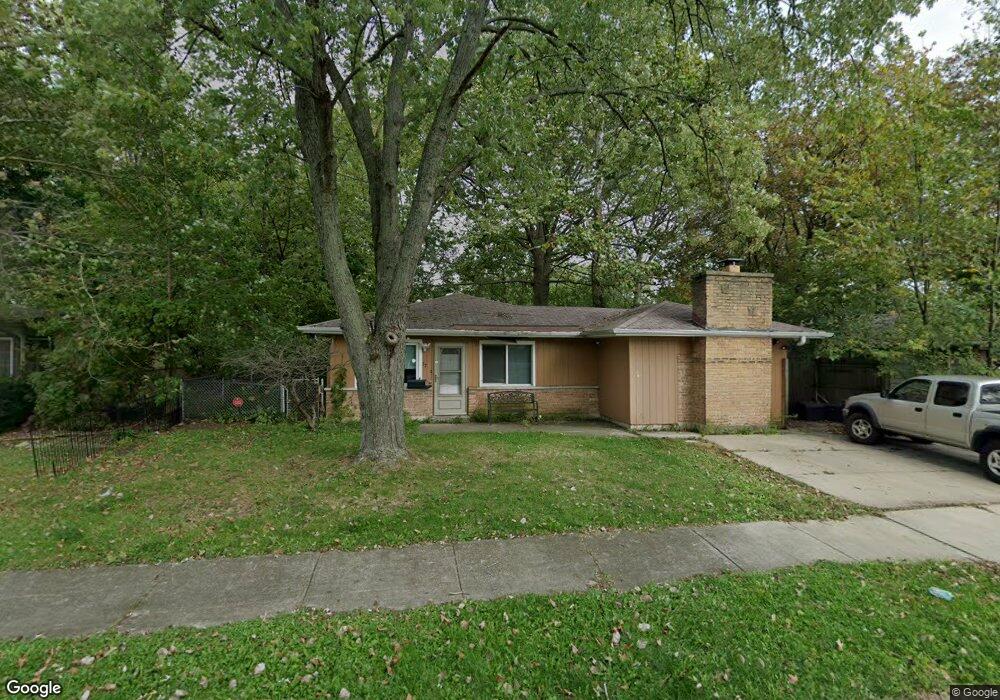
27 W Rocket Cir Park Forest, IL 60466
Estimated Value: $157,000 - $193,000
3
Beds
2
Baths
1,450
Sq Ft
$118/Sq Ft
Est. Value
About This Home
This home is located at 27 W Rocket Cir, Park Forest, IL 60466 and is currently estimated at $170,878, approximately $117 per square foot. 27 W Rocket Cir is a home located in Cook County with nearby schools including Michelle Obama School of Technology, Mohawk Primary Center, and Barack Obama School of Leadership and STEM.
Ownership History
Date
Name
Owned For
Owner Type
Purchase Details
Closed on
Oct 20, 2015
Sold by
Fannie Mae
Bought by
Owens Patrick
Current Estimated Value
Purchase Details
Closed on
Mar 12, 2003
Sold by
Baecher Viola O
Bought by
Owens Patrick H
Home Financials for this Owner
Home Financials are based on the most recent Mortgage that was taken out on this home.
Original Mortgage
$84,000
Interest Rate
7.5%
Mortgage Type
Unknown
Purchase Details
Closed on
Nov 1, 2001
Sold by
Baecher Frank E
Bought by
Baecher Viola O
Purchase Details
Closed on
Sep 26, 2001
Sold by
Baecher Frank E
Bought by
Baecher Viola O
Create a Home Valuation Report for This Property
The Home Valuation Report is an in-depth analysis detailing your home's value as well as a comparison with similar homes in the area
Home Values in the Area
Average Home Value in this Area
Purchase History
| Date | Buyer | Sale Price | Title Company |
|---|---|---|---|
| Owens Patrick | $34,200 | Central Illinois Title Co | |
| Owens Patrick H | $84,000 | Multiple | |
| Baecher Viola O | -- | -- | |
| Baecher Viola O | -- | -- |
Source: Public Records
Mortgage History
| Date | Status | Borrower | Loan Amount |
|---|---|---|---|
| Previous Owner | Owens Patrick H | $84,000 |
Source: Public Records
Tax History
| Year | Tax Paid | Tax Assessment Tax Assessment Total Assessment is a certain percentage of the fair market value that is determined by local assessors to be the total taxable value of land and additions on the property. | Land | Improvement |
|---|---|---|---|---|
| 2025 | $7,089 | $13,000 | $2,524 | $10,476 |
| 2024 | $7,089 | $13,000 | $2,524 | $10,476 |
| 2023 | $3,747 | $13,000 | $2,524 | $10,476 |
| 2022 | $3,747 | $6,209 | $2,344 | $3,865 |
| 2021 | $3,796 | $6,207 | $2,343 | $3,864 |
| 2020 | $3,735 | $6,207 | $2,343 | $3,864 |
| 2019 | $4,862 | $7,896 | $2,163 | $5,733 |
| 2018 | $4,679 | $7,896 | $2,163 | $5,733 |
| 2017 | $4,713 | $7,896 | $2,163 | $5,733 |
| 2016 | $5,602 | $8,132 | $1,983 | $6,149 |
| 2015 | $5,352 | $8,132 | $1,983 | $6,149 |
| 2014 | $5,246 | $8,132 | $1,983 | $6,149 |
| 2013 | $4,092 | $7,473 | $1,983 | $5,490 |
Source: Public Records
Map
Nearby Homes
- 28 W Rocket Cir
- 18 E Rocket Cir
- 417 Lakewood Blvd
- 433 Lakewood Blvd
- 239 Indianwood Blvd
- 241 Indianwood Blvd
- 270 Green St
- 300 Meota St
- 289 Westwood Dr
- 218 Marquette St
- 251 Westwood Dr
- 3 Rich Ct
- 142 Marquette St
- 131 Sauk Trail
- 314 Meota St
- 308 Shabbona Dr
- 223 S Orchard Dr
- 226 S Orchard Dr
- 318 Marquette St
- 4 Lakewood Ct
- 25 W Rocket Cir
- 29 W Rocket Cir
- 24 E Rocket Cir
- 23 W Rocket Cir
- 22 E Rocket Cir
- 20 E Rocket Cir
- 32 W Rocket Cir
- 30 W Rocket Cir
- 21 W Rocket Cir
- 34 W Rocket Cir
- 26 W Rocket Cir
- 33 E Rocket Cir
- 19 W Rocket Cir
- 37 E Rocket Cir
- 36 W Rocket Cir
- 35 E Rocket Cir
- 205 Gold St
- 207 Gold St
- 38 W Rocket Cir
- 203 Gold St
Your Personal Tour Guide
Ask me questions while you tour the home.