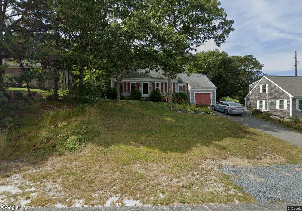
27 Wager Ln South Dennis, MA 02660
South Dennis NeighborhoodEstimated Value: $461,000 - $654,000
3
Beds
2
Baths
1,501
Sq Ft
$394/Sq Ft
Est. Value
About This Home
This home is located at 27 Wager Ln, South Dennis, MA 02660 and is currently estimated at $590,987, approximately $393 per square foot. 27 Wager Ln is a home located in Barnstable County with nearby schools including Dennis-Yarmouth Regional High School.
Ownership History
Date
Name
Owned For
Owner Type
Purchase Details
Closed on
Jun 26, 2025
Sold by
Messersmith Robert E and Larrain Maria C
Bought by
Larrain Maria C
Current Estimated Value
Purchase Details
Closed on
May 20, 2013
Sold by
Larrain Maria C
Bought by
Larrain Maria C and Messersmith Robert E
Home Financials for this Owner
Home Financials are based on the most recent Mortgage that was taken out on this home.
Original Mortgage
$185,500
Interest Rate
3%
Mortgage Type
Adjustable Rate Mortgage/ARM
Purchase Details
Closed on
Jun 16, 2008
Sold by
Vonhausen Christian
Bought by
Larrain Maria Carolina
Purchase Details
Closed on
May 20, 2005
Sold by
Vonhausen Christian
Bought by
Vonhausen Christian and Larrain Maria Carolina
Purchase Details
Closed on
Jun 22, 1999
Sold by
Billings Bridget E and Billings John A
Bought by
Vonhausen \Christian
Home Financials for this Owner
Home Financials are based on the most recent Mortgage that was taken out on this home.
Original Mortgage
$138,000
Interest Rate
6.99%
Mortgage Type
Purchase Money Mortgage
Create a Home Valuation Report for This Property
The Home Valuation Report is an in-depth analysis detailing your home's value as well as a comparison with similar homes in the area
Home Values in the Area
Average Home Value in this Area
Purchase History
| Date | Buyer | Sale Price | Title Company |
|---|---|---|---|
| Larrain Maria C | -- | -- | |
| Messersmith Robert E | -- | -- | |
| Larrain Maria C | -- | -- | |
| Larrain Maria Carolina | -- | -- | |
| Larrain Maria Carolina | -- | -- | |
| Vonhausen Christian | -- | -- | |
| Vonhausen Christian | -- | -- | |
| Vonhausen \Christian | $138,000 | -- | |
| Vonhausen \Christian | $138,000 | -- |
Source: Public Records
Mortgage History
| Date | Status | Borrower | Loan Amount |
|---|---|---|---|
| Previous Owner | Vonhausen \Christian | $185,500 | |
| Previous Owner | Vonhausen Christian | $110,600 | |
| Previous Owner | Vonhausen \Christian | $138,000 |
Source: Public Records
Tax History Compared to Growth
Tax History
| Year | Tax Paid | Tax Assessment Tax Assessment Total Assessment is a certain percentage of the fair market value that is determined by local assessors to be the total taxable value of land and additions on the property. | Land | Improvement |
|---|---|---|---|---|
| 2025 | $2,429 | $560,900 | $123,000 | $437,900 |
| 2024 | $2,365 | $538,700 | $118,300 | $420,400 |
| 2023 | $2,287 | $489,800 | $107,600 | $382,200 |
| 2022 | $2,189 | $390,900 | $107,700 | $283,200 |
| 2021 | $8,222 | $329,900 | $105,500 | $224,400 |
| 2020 | $1,934 | $317,000 | $105,500 | $211,500 |
| 2019 | $1,879 | $304,600 | $113,800 | $190,800 |
| 2018 | $1,780 | $280,800 | $98,500 | $182,300 |
| 2017 | $6,408 | $280,800 | $98,500 | $182,300 |
| 2016 | $1,667 | $255,300 | $103,400 | $151,900 |
| 2015 | $1,634 | $255,300 | $103,400 | $151,900 |
| 2014 | $1,462 | $230,200 | $88,700 | $141,500 |
Source: Public Records
Map
Nearby Homes
- 15 Captain Jud Rd
- 153 Bayridge Dr
- 17 Margate Ln
- 32 Captain Walsh Dr
- 4 Ebb Rd
- 13 Covey Dr
- 10 Joanne Dr
- 25 Skerry Rd
- 59 Main St Unit 19-2
- 59 Route 6a Unit 29-4
- 111 Merchant Ave
- 17 Fairmount Rd
- 6 Nimble Hill Dr
- 118 Driftwood Ln
- 59 Massachusetts 6a Unit 19-2
- 17 Fairmount Rd
- 7 Vinland Dr
- 21 Compass Ln
- 268 Main St
- 1 Norseman Dr