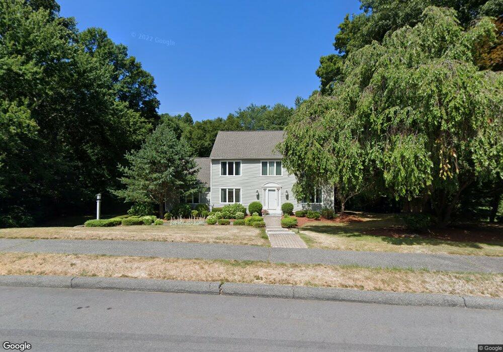
27 Wayside Rd Westborough, MA 01581
Estimated Value: $980,365 - $1,167,000
4
Beds
3
Baths
2,684
Sq Ft
$404/Sq Ft
Est. Value
About This Home
This home is located at 27 Wayside Rd, Westborough, MA 01581 and is currently estimated at $1,083,341, approximately $403 per square foot. 27 Wayside Rd is a home located in Worcester County with nearby schools including Westborough High School, Ebridge Montessori School, and Westboro Knowledge Beginnings.
Ownership History
Date
Name
Owned For
Owner Type
Purchase Details
Closed on
Aug 31, 1989
Sold by
English Peter
Bought by
Wollin Michael
Current Estimated Value
Home Financials for this Owner
Home Financials are based on the most recent Mortgage that was taken out on this home.
Original Mortgage
$240,000
Interest Rate
9.7%
Mortgage Type
Purchase Money Mortgage
Create a Home Valuation Report for This Property
The Home Valuation Report is an in-depth analysis detailing your home's value as well as a comparison with similar homes in the area
Home Values in the Area
Average Home Value in this Area
Purchase History
| Date | Buyer | Sale Price | Title Company |
|---|---|---|---|
| Wollin Michael | $300,000 | -- | |
| Wollin Michael | $300,000 | -- |
Source: Public Records
Mortgage History
| Date | Status | Borrower | Loan Amount |
|---|---|---|---|
| Closed | Wollin Michael | $202,300 | |
| Closed | Wollin Michael | $240,000 |
Source: Public Records
Tax History
| Year | Tax Paid | Tax Assessment Tax Assessment Total Assessment is a certain percentage of the fair market value that is determined by local assessors to be the total taxable value of land and additions on the property. | Land | Improvement |
|---|---|---|---|---|
| 2025 | $13,736 | $843,200 | $360,000 | $483,200 |
| 2024 | $13,108 | $798,800 | $342,800 | $456,000 |
| 2023 | $12,603 | $748,400 | $323,400 | $425,000 |
| 2022 | $11,645 | $629,800 | $257,400 | $372,400 |
| 2021 | $11,486 | $619,500 | $247,100 | $372,400 |
| 2020 | $11,441 | $624,500 | $261,500 | $363,000 |
| 2019 | $2,597 | $589,500 | $257,400 | $332,100 |
| 2018 | $2,538 | $545,100 | $247,100 | $298,000 |
| 2017 | $9,703 | $545,100 | $247,100 | $298,000 |
| 2016 | $9,738 | $548,000 | $247,100 | $300,900 |
| 2015 | $9,269 | $498,600 | $218,300 | $280,300 |
Source: Public Records
Map
Nearby Homes
- 14 Baldwin Ct Unit 14
- 15 Quick Farm Rd
- 11 Quick Farm Rd
- 19 Armstrong Dr
- 4 Quick Farm Rd
- 248 W Main St
- 29 Kay St
- 22 Capt Samuel Forbush Rd
- 192 W Main St
- 256 W Main St
- LL43 Libbey Ln
- 55 Nourse St
- 26 Mount Pleasant St
- LL39 Libbey Ln
- 60 Belknap St
- 215 North St
- 51 Lackey St
- 46 Lackey St
- 4 W End Ave
- 27 Spring Rd
- 25 Wayside Rd
- 29 Wayside Rd
- 28 Wayside Rd
- 30 Wayside Rd
- 23 Wayside Rd
- 26 Wayside Rd
- 31 Wayside Rd
- 24 Wayside Rd
- 32 Wayside Rd
- 34 Wayside Rd
- 21 Wayside Rd
- 3 Stone Hill Rd
- 3 Stone Hill Rd Unit 3
- 22 Wayside Rd
- 33 Wayside Rd
- 36 Wayside Rd
- 20 Wayside Rd
- 18 Woodcrest Rd
- 19 Wayside Rd
- 19 Wayside Rd Unit 19
Your Personal Tour Guide
Ask me questions while you tour the home.