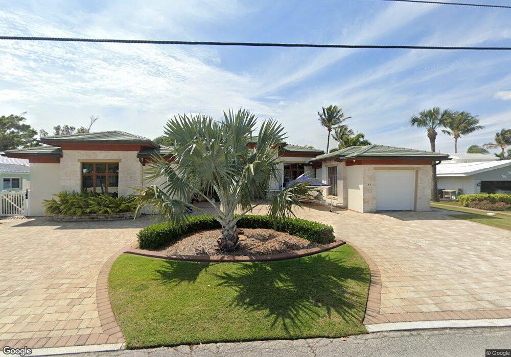
27 West Point Dr Cocoa Beach, FL 32931
Estimated Value: $1,282,000 - $2,197,000
4
Beds
4
Baths
3,127
Sq Ft
$599/Sq Ft
Est. Value
About This Home
This home is located at 27 West Point Dr, Cocoa Beach, FL 32931 and is currently estimated at $1,873,018, approximately $598 per square foot. 27 West Point Dr is a home located in Brevard County with nearby schools including Theodore Roosevelt Elementary School, Cocoa Beach Junior/Senior High School, and Cocoa Beach Christian School.
Ownership History
Date
Name
Owned For
Owner Type
Purchase Details
Closed on
Dec 26, 2024
Sold by
Guerrero Gregorio S and Guerrero Margaret N
Bought by
Gregorio S Guerrero Trust and Margaret N Guerrero Trust
Current Estimated Value
Purchase Details
Closed on
Jul 6, 1999
Sold by
Morgan Jeffrey A and Morgan Cynthia S
Bought by
Guerrero Gregorio S and Guerrero Margaret N
Home Financials for this Owner
Home Financials are based on the most recent Mortgage that was taken out on this home.
Original Mortgage
$260,000
Interest Rate
7.23%
Purchase Details
Closed on
Mar 13, 1997
Sold by
Morgan Cynthia S and Morgan Jeffrey A
Bought by
Morgan Jeffrey A and Morgan Cynthia S
Create a Home Valuation Report for This Property
The Home Valuation Report is an in-depth analysis detailing your home's value as well as a comparison with similar homes in the area
Home Values in the Area
Average Home Value in this Area
Purchase History
| Date | Buyer | Sale Price | Title Company |
|---|---|---|---|
| Gregorio S Guerrero Trust | $100 | None Listed On Document | |
| Gregorio S Guerrero Trust | $100 | None Listed On Document | |
| Guerrero Gregorio S | $325,000 | -- | |
| Morgan Jeffrey A | -- | -- |
Source: Public Records
Mortgage History
| Date | Status | Borrower | Loan Amount |
|---|---|---|---|
| Previous Owner | Guerrero Gregorio S | $260,000 |
Source: Public Records
Tax History Compared to Growth
Tax History
| Year | Tax Paid | Tax Assessment Tax Assessment Total Assessment is a certain percentage of the fair market value that is determined by local assessors to be the total taxable value of land and additions on the property. | Land | Improvement |
|---|---|---|---|---|
| 2025 | $9,346 | $804,280 | -- | -- |
| 2024 | $9,267 | $781,620 | -- | -- |
| 2023 | $9,267 | $758,860 | $0 | $0 |
| 2022 | $8,640 | $736,760 | $0 | $0 |
| 2021 | $8,977 | $715,310 | $0 | $0 |
| 2020 | $8,960 | $705,440 | $0 | $0 |
| 2019 | $8,958 | $689,580 | $0 | $0 |
| 2018 | $9,101 | $676,730 | $0 | $0 |
| 2017 | $9,286 | $662,820 | $0 | $0 |
| 2016 | $9,526 | $649,190 | $335,000 | $314,190 |
| 2015 | $9,884 | $644,680 | $265,000 | $379,680 |
| 2014 | $9,986 | $639,570 | $265,000 | $374,570 |
Source: Public Records
Map
Nearby Homes
- 1790 Bayshore Dr
- 1529 Bayshore Dr
- 1441 Bayshore Dr
- 30 Indian Village Trail
- 1630 S Atlantic Ave
- 2050 S Atlantic Ave
- 1700 S Atlantic Ave Unit 104
- 1525 S Atlantic Ave Unit 401
- 1527 S Atlantic Ave Unit 201
- 1563 S Atlantic Ave Unit 13
- 1279 S Orlando Ave Unit 4A
- 2001 Julep Dr Unit 206- 3rd Floor
- 1277 S Orlando Ave Unit 4B
- 1305 S Atlantic Ave Unit 350
- 1305 S Atlantic Ave Unit 450
- 2021 S Orlando Ave
- 2022 Julep Dr Unit 304
- 1251 S Atlantic Ave Unit 403
- 1132 & 1134 S Brevard Ave
- 1181 S Atlantic Ave
- 28 West Point Dr
- 26 West Point Dr
- 29 W Point Dr
- 29 West Point Dr
- 25 West Point Dr
- 8 W Point Dr
- 25 W Point Dr
- 9 W Point Dr
- 9 West Point Dr
- 8 West Point Dr
- 7 W Point Dr
- 10 West Point Dr
- 30 W Point Dr
- 7 West Point Dr
- 30 West Point Dr
- 24 West Point Dr
- 11 West Point Dr
- 11 W Point Dr
- 6 West Point Dr
- 31 W Point Dr