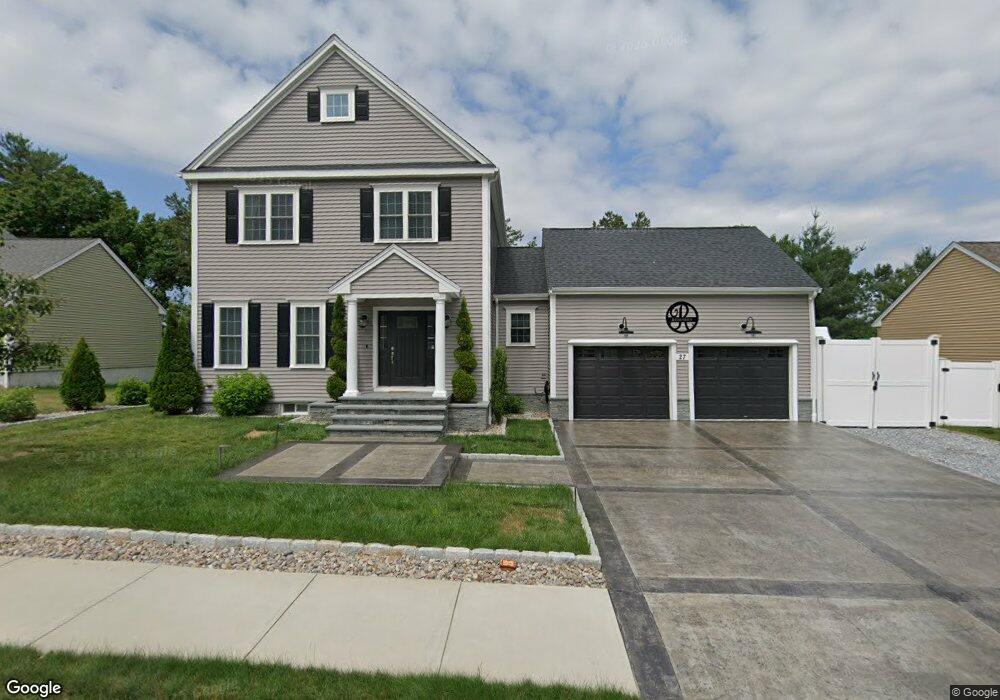
27 Westview Ave Millbury, MA 01527
Estimated Value: $678,000 - $760,000
3
Beds
3
Baths
2,194
Sq Ft
$325/Sq Ft
Est. Value
About This Home
This home is located at 27 Westview Ave, Millbury, MA 01527 and is currently estimated at $712,192, approximately $324 per square foot. 27 Westview Ave is a home with nearby schools including Elmwood Street Elementary School, Raymond E. Shaw Elementary School, and Millbury Junior/Senior High School.
Ownership History
Date
Name
Owned For
Owner Type
Purchase Details
Closed on
Jul 5, 2017
Sold by
Hayr Llc
Bought by
Resendes Marco L and Resendes Sheila
Current Estimated Value
Home Financials for this Owner
Home Financials are based on the most recent Mortgage that was taken out on this home.
Original Mortgage
$384,776
Outstanding Balance
$320,210
Interest Rate
3.95%
Mortgage Type
New Conventional
Estimated Equity
$391,982
Create a Home Valuation Report for This Property
The Home Valuation Report is an in-depth analysis detailing your home's value as well as a comparison with similar homes in the area
Home Values in the Area
Average Home Value in this Area
Purchase History
| Date | Buyer | Sale Price | Title Company |
|---|---|---|---|
| Resendes Marco L | $415,975 | -- | |
| Resendes Marco L | $415,975 | -- |
Source: Public Records
Mortgage History
| Date | Status | Borrower | Loan Amount |
|---|---|---|---|
| Open | Resendes Marco L | $384,776 | |
| Closed | Resendes Marco L | $384,776 |
Source: Public Records
Tax History Compared to Growth
Tax History
| Year | Tax Paid | Tax Assessment Tax Assessment Total Assessment is a certain percentage of the fair market value that is determined by local assessors to be the total taxable value of land and additions on the property. | Land | Improvement |
|---|---|---|---|---|
| 2025 | $9,056 | $676,300 | $128,000 | $548,300 |
| 2024 | $8,316 | $628,600 | $118,500 | $510,100 |
| 2023 | $7,976 | $552,000 | $83,100 | $468,900 |
| 2022 | $6,738 | $449,200 | $79,800 | $369,400 |
| 2021 | $2 | $430,400 | $79,800 | $350,600 |
| 2020 | $2 | $424,100 | $79,800 | $344,300 |
| 2019 | $6,218 | $392,300 | $60,400 | $331,900 |
| 2018 | $2 | $60,400 | $60,400 | $0 |
| 2017 | $2 | $19,290 | $19,290 | $0 |
Source: Public Records
Map
Nearby Homes
- 11 Westview Ave
- 12 Irene Ct
- 1 Pineland Ave
- 2 Diane St
- 86 Wheelock Ave
- 1 Broadmeadow Ave
- 3 May St
- 330 Millbury Ave
- 27 A-B Grafton St
- 497 Massasoit Rd
- 3 Stidsen Way
- 232 Weatherstone Dr
- 76 Weatherstone Dr
- 11 Maplewood Rd
- 12 Alstead Path
- 90 Macarthur Dr
- 1203 Grafton St Unit 38
- 1201 Grafton St Unit 73
- 1195 Grafton St Unit 3
- 11 Margin St
- 29 Westview Ave
- 25 Westview Ave
- 26 Westview Ave
- 14 Nightview Place
- 23 Westview Ave
- 16 Nightview Place
- 28 Westview Ave
- 24 Westview Ave
- 12 Nightview Place
- 18 Nightview Place
- 30 Westview Ave
- 33 Westview Ave
- 21 Westview Ave
- 10 Nightview Place
- 22 Westview Ave
- 20 Nightview Place
- 32 Westview Ave
- 7 Nightview Place
- 9 Nightview Place
- 35 Westview Ave