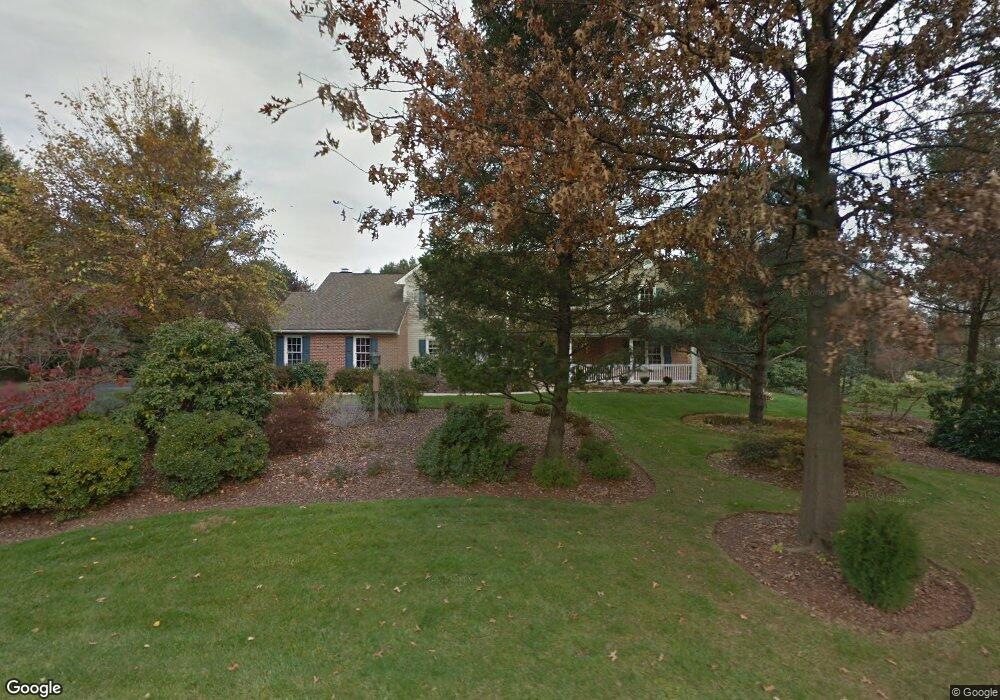
27 Wetherill Ln Chester Springs, PA 19425
West Vincent Township NeighborhoodEstimated Value: $837,833 - $993,000
5
Beds
3
Baths
3,514
Sq Ft
$255/Sq Ft
Est. Value
About This Home
This home is located at 27 Wetherill Ln, Chester Springs, PA 19425 and is currently estimated at $896,458, approximately $255 per square foot. 27 Wetherill Ln is a home located in Chester County with nearby schools including West Vincent Elementary School, Owen J Roberts Middle School, and Owen J Roberts High School.
Ownership History
Date
Name
Owned For
Owner Type
Purchase Details
Closed on
Feb 25, 1998
Sold by
Truesdale Larry K and Truesdale Velia G
Bought by
Alexander Michael L and Alexander Mary M
Current Estimated Value
Home Financials for this Owner
Home Financials are based on the most recent Mortgage that was taken out on this home.
Original Mortgage
$227,000
Outstanding Balance
$41,161
Interest Rate
6.92%
Estimated Equity
$855,297
Create a Home Valuation Report for This Property
The Home Valuation Report is an in-depth analysis detailing your home's value as well as a comparison with similar homes in the area
Home Values in the Area
Average Home Value in this Area
Purchase History
| Date | Buyer | Sale Price | Title Company |
|---|---|---|---|
| Alexander Michael L | $285,000 | -- |
Source: Public Records
Mortgage History
| Date | Status | Borrower | Loan Amount |
|---|---|---|---|
| Open | Alexander Michael L | $227,000 |
Source: Public Records
Tax History Compared to Growth
Tax History
| Year | Tax Paid | Tax Assessment Tax Assessment Total Assessment is a certain percentage of the fair market value that is determined by local assessors to be the total taxable value of land and additions on the property. | Land | Improvement |
|---|---|---|---|---|
| 2025 | $10,643 | $258,550 | $55,320 | $203,230 |
| 2024 | $10,643 | $258,550 | $55,320 | $203,230 |
| 2023 | $10,490 | $258,550 | $55,320 | $203,230 |
| 2022 | $540 | $258,550 | $55,320 | $203,230 |
| 2021 | $10,194 | $258,550 | $55,320 | $203,230 |
| 2020 | $9,932 | $258,550 | $55,320 | $203,230 |
| 2019 | $9,746 | $258,550 | $55,320 | $203,230 |
| 2018 | $10,741 | $290,590 | $55,320 | $235,270 |
| 2017 | $10,487 | $290,590 | $55,320 | $235,270 |
| 2016 | $8,788 | $290,590 | $55,320 | $235,270 |
| 2015 | $8,788 | $290,590 | $55,320 | $235,270 |
| 2014 | $8,788 | $290,590 | $55,320 | $235,270 |
Source: Public Records
Map
Nearby Homes
- 618 Kent Ct
- 955 Pinehurst Dr
- 475 Fairmont Dr Unit 237
- 214 Windgate Dr
- 2290 Horseshoe Trail
- 1623 Hilltop Rd
- 684 Churchill Rd
- 1816 Pottstown Pike
- 2326 Conestoga Rd
- 1420 Hollow Rd
- 1381 School House Ln
- 1284 School House Ln
- 1672 Hollow Rd
- 3896 Coventryville Rd
- 1700 Saint Matthews Rd
- 1910 Cavalier Ln
- 45 Wyndemere Lake Dr
- 570 Font Rd
- 2 Carriage Ln
- 1630 Sheeder Mill Rd
- 17 Wetherill Ln
- 32 Wetherill Ln
- 30 Wetherill Ln
- 18 Wetherill Ln
- 7 Wetherill Ln
- 10 Wetherill Ln
- 2939 Horseshoe Trail
- 0 Birchrun Rd
- 2928 Horseshoe Trail
- 930 Birchrun Rd
- 904 Birchrun Rd
- 916 Birchrun Rd
- 9 Brighton Way
- 2948 Horseshoe Trail
- 27 Brighton Way
- 21 Brighton Way
- 10 Brighton Way
- 933 Jaine Ln
- 20 Brighton Way