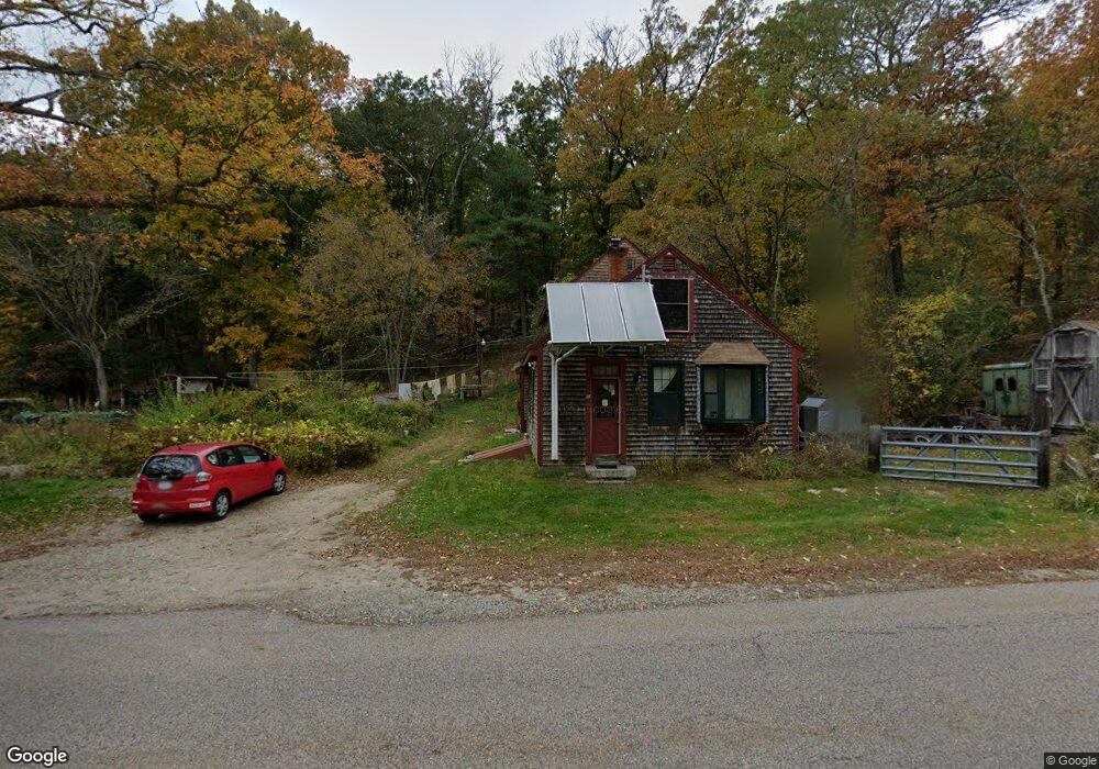
27 Whitins Rd Sutton, MA 01590
Estimated Value: $401,629 - $485,000
2
Beds
2
Baths
1,421
Sq Ft
$319/Sq Ft
Est. Value
About This Home
This home is located at 27 Whitins Rd, Sutton, MA 01590 and is currently estimated at $452,907, approximately $318 per square foot. 27 Whitins Rd is a home located in Worcester County with nearby schools including Sutton Elementary School, Sutton Middle School, and Sutton High School.
Create a Home Valuation Report for This Property
The Home Valuation Report is an in-depth analysis detailing your home's value as well as a comparison with similar homes in the area
Home Values in the Area
Average Home Value in this Area
Tax History
| Year | Tax Paid | Tax Assessment Tax Assessment Total Assessment is a certain percentage of the fair market value that is determined by local assessors to be the total taxable value of land and additions on the property. | Land | Improvement |
|---|---|---|---|---|
| 2025 | $4,304 | $323,600 | $142,300 | $181,300 |
| 2024 | $4,357 | $315,300 | $136,400 | $178,900 |
| 2023 | $4,345 | $288,300 | $123,700 | $164,600 |
| 2022 | $3,786 | $237,300 | $98,800 | $138,500 |
| 2021 | $3,786 | $216,000 | $98,800 | $117,200 |
| 2020 | $3,604 | $208,900 | $98,800 | $110,100 |
| 2019 | $4,916 | $202,500 | $98,800 | $103,700 |
| 2018 | $1,825 | $181,500 | $84,000 | $97,500 |
| 2017 | $1,850 | $173,700 | $73,700 | $100,000 |
| 2016 | $3,114 | $173,700 | $73,700 | $100,000 |
| 2015 | $3,030 | $168,700 | $73,700 | $95,000 |
| 2014 | $3,067 | $168,500 | $73,000 | $95,500 |
Source: Public Records
Map
Nearby Homes
- 12 Whitins Rd
- 10 Whitins Rd
- 8 B Whitins Rd Unit B
- 8 Whitins Rd Unit 1
- 8 Whitins Rd Unit B
- 8 Whitins Rd Unit A
- 8A Whitins Rd Unit A
- 8 Whitins Rd
- 8A Whitins Rd Unit A
- 8 Whitins Rd Unit 2
- 8A Whitins Rd Unit 8A
- 17 Morse Rd
- 19 Morse Rd
- 11 Morse Rd
- 8 Canal St
- 5 Whitins Rd
- 7 Morse Rd
- 8 River St
- 7 Whitins Rd
- 6 Canal St Unit A
Your Personal Tour Guide
Ask me questions while you tour the home.