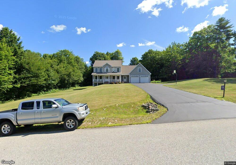
27 Wilderness Way Turner, ME 04282
Estimated Value: $452,857 - $550,000
3
Beds
3
Baths
2,100
Sq Ft
$237/Sq Ft
Est. Value
About This Home
This home is located at 27 Wilderness Way, Turner, ME 04282 and is currently estimated at $498,714, approximately $237 per square foot. 27 Wilderness Way is a home located in Androscoggin County with nearby schools including Tripp Middle School and Leavitt Area High School.
Ownership History
Date
Name
Owned For
Owner Type
Purchase Details
Closed on
Aug 27, 2009
Sold by
Madison Marco M and Madison Rachel C
Bought by
Madison Marco M and Madison Rachel C
Current Estimated Value
Home Financials for this Owner
Home Financials are based on the most recent Mortgage that was taken out on this home.
Original Mortgage
$8,000
Interest Rate
5.17%
Mortgage Type
Unknown
Purchase Details
Closed on
Apr 14, 2009
Sold by
Harvey Robbin L and Harvey Robert B
Bought by
Madison Marco M and Madison Rachel C
Home Financials for this Owner
Home Financials are based on the most recent Mortgage that was taken out on this home.
Original Mortgage
$212,000
Interest Rate
4.94%
Mortgage Type
Purchase Money Mortgage
Purchase Details
Closed on
Jul 21, 2008
Sold by
Dwm Properties Llc
Bought by
Harvey Robert B and Harvey Robbin L
Home Financials for this Owner
Home Financials are based on the most recent Mortgage that was taken out on this home.
Original Mortgage
$220,000
Interest Rate
6.17%
Mortgage Type
Unknown
Create a Home Valuation Report for This Property
The Home Valuation Report is an in-depth analysis detailing your home's value as well as a comparison with similar homes in the area
Home Values in the Area
Average Home Value in this Area
Purchase History
| Date | Buyer | Sale Price | Title Company |
|---|---|---|---|
| Madison Marco M | -- | -- | |
| Madison Marco M | -- | -- | |
| Harvey Robert B | -- | -- |
Source: Public Records
Mortgage History
| Date | Status | Borrower | Loan Amount |
|---|---|---|---|
| Open | Harvey Robert B | $208,800 | |
| Closed | Harvey Robert B | $8,000 | |
| Previous Owner | Harvey Robert B | $212,000 | |
| Previous Owner | Harvey Robert B | $220,000 |
Source: Public Records
Tax History Compared to Growth
Tax History
| Year | Tax Paid | Tax Assessment Tax Assessment Total Assessment is a certain percentage of the fair market value that is determined by local assessors to be the total taxable value of land and additions on the property. | Land | Improvement |
|---|---|---|---|---|
| 2025 | $3,975 | $292,300 | $69,600 | $222,700 |
| 2024 | $3,727 | $292,300 | $69,600 | $222,700 |
| 2023 | $3,668 | $292,300 | $69,600 | $222,700 |
| 2022 | $3,332 | $292,300 | $69,600 | $222,700 |
| 2021 | $3,332 | $292,300 | $69,600 | $222,700 |
| 2020 | $3,240 | $181,000 | $32,300 | $148,700 |
| 2019 | $3,258 | $181,000 | $32,300 | $148,700 |
| 2018 | $3,213 | $181,000 | $32,300 | $148,700 |
| 2016 | $3,052 | $181,000 | $32,300 | $148,700 |
| 2015 | $2,878 | $181,000 | $32,300 | $148,700 |
| 2014 | $2,842 | $181,000 | $32,300 | $148,700 |
| 2013 | $2,711 | $181,000 | $32,300 | $148,700 |
Source: Public Records
Map
Nearby Homes
- Lot16 Torrey Hill Rd
- 8 Sunrise Trail
- 574 Howes Corner Rd
- 410 Pleasant Pond Rd
- 77 Appleseed Dr
- 2539 Auburn Rd
- 35 Mason Rd
- Lot 45-8 Wyatt's Way
- 528 N Parish Rd
- 497 N Parish Rd
- 183 Pleasant Pond Rd
- 454 N Parish Rd
- 1785 Federal Rd
- 27 Mountain View Rd
- 113 Turkey Ln
- 1671 Federal Rd
- 18 Thurlow Dr
- 51 Church St
- 137 Canton Rd
- Lot 5-D Drewry Dr
- 15 Wilderness Way
- 37 Wilderness Way
- 0 Wilderness Way
- 12 Wilderness Way
- 11 Wilderness Way
- 64 Wilderness Way
- 20 Wilderness Way
- 13 Wilderness Way
- 0 Lot#13 Wilderness Way
- 13 Wilderness Run Lot#4
- 10 Wilderness Way
- 52 Wilderness Way
- 6 Wilderness Way
- 60 Wilderness Way
- 3 Wilderness Way
- 72 Wilderness Way
- 24 Mavis Dr
- 0 Lot#11 Wilderness Way
- Lot#11 Wilderness Way
- 8 Wilderness Way