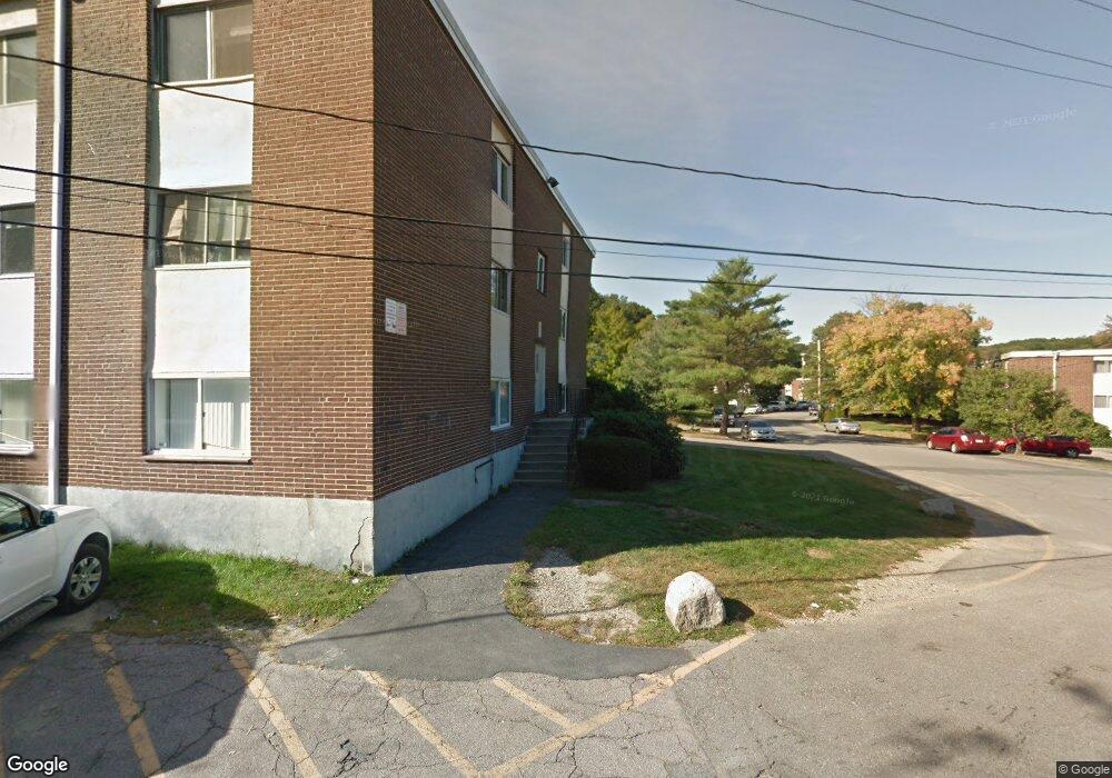
27 Willis St Unit 38 Framingham, MA 01702
Estimated Value: $241,000 - $335,000
2
Beds
2
Baths
880
Sq Ft
$332/Sq Ft
Est. Value
About This Home
This home is located at 27 Willis St Unit 38, Framingham, MA 01702 and is currently estimated at $292,421, approximately $332 per square foot. 27 Willis St Unit 38 is a home located in Middlesex County with nearby schools including Framingham High School, Happy Hollow School, and Marian High School.
Ownership History
Date
Name
Owned For
Owner Type
Purchase Details
Closed on
Jan 10, 2001
Sold by
Vrp Rt and Patel Vinod R
Bought by
Ramalho Milton and Ramalho Marlene
Current Estimated Value
Home Financials for this Owner
Home Financials are based on the most recent Mortgage that was taken out on this home.
Original Mortgage
$88,350
Outstanding Balance
$32,834
Interest Rate
7.64%
Mortgage Type
Purchase Money Mortgage
Estimated Equity
$259,587
Purchase Details
Closed on
Aug 31, 1995
Sold by
Majac Rt and Alkon Robert R
Bought by
Kariotis Michail E and Chiumento Brian F
Home Financials for this Owner
Home Financials are based on the most recent Mortgage that was taken out on this home.
Original Mortgage
$29,600
Interest Rate
7.61%
Mortgage Type
Purchase Money Mortgage
Create a Home Valuation Report for This Property
The Home Valuation Report is an in-depth analysis detailing your home's value as well as a comparison with similar homes in the area
Home Values in the Area
Average Home Value in this Area
Purchase History
| Date | Buyer | Sale Price | Title Company |
|---|---|---|---|
| Ramalho Milton | $93,000 | -- | |
| Kariotis Michail E | $30,000 | -- |
Source: Public Records
Mortgage History
| Date | Status | Borrower | Loan Amount |
|---|---|---|---|
| Open | Kariotis Michail E | $88,350 | |
| Previous Owner | Kariotis Michail E | $29,600 |
Source: Public Records
Tax History Compared to Growth
Tax History
| Year | Tax Paid | Tax Assessment Tax Assessment Total Assessment is a certain percentage of the fair market value that is determined by local assessors to be the total taxable value of land and additions on the property. | Land | Improvement |
|---|---|---|---|---|
| 2025 | $2,906 | $243,400 | $0 | $243,400 |
| 2024 | $2,835 | $227,500 | $0 | $227,500 |
| 2023 | $2,708 | $206,900 | $0 | $206,900 |
| 2022 | $2,606 | $189,700 | $0 | $189,700 |
| 2021 | $2,505 | $178,300 | $0 | $178,300 |
| 2020 | $2,410 | $160,900 | $0 | $160,900 |
| 2019 | $2,232 | $145,100 | $0 | $145,100 |
| 2018 | $2,045 | $125,300 | $0 | $125,300 |
| 2017 | $1,646 | $98,500 | $0 | $98,500 |
| 2016 | $1,712 | $98,500 | $0 | $98,500 |
| 2015 | $1,492 | $83,700 | $0 | $83,700 |
Source: Public Records
Map
Nearby Homes
- 26 Willis St Unit 33
- 6 Clarks Hill Ln Unit 6
- 155 Bishop Dr
- 159 Bishop St
- 126 Bishop Dr
- 126 Beaver St Unit 3
- 126 Beaver St Unit 121
- 88 Pond St Unit 88
- 287 W Central St
- 9 Village Hill Ln Unit 24
- 6 Village Rock Ln Unit 17
- 131 2nd St
- 16 3rd St
- 18 Beaver Ct
- 44 Village Hill Ln
- 143 Howe St
- 4 Village Hill Ln Unit 16
- 11 Village Hill Ln Unit 9
- 150 2nd St Unit 204
- 150 2nd St Unit 310
- 27 Willis St Unit 37
- 27 Willis St Unit 36
- 27 Willis St Unit 35
- 27 Willis St Unit 34
- 27 Willis St Unit 33
- 27 Willis St Unit 32
- 27 Willis St Unit 31
- 27 Willis St Unit 30
- 27 Willis St Unit 29
- 27 Willis St Unit 28
- 27 Willis St
- 27 Willis St Unit 26
- 27 Willis St Unit 25
- 27 Willis St Unit 24
- 27 Willis St Unit 23
- 27 Willis St Unit 22
- 27 Willis St Unit 21
- 27 Willis St Unit 20
- 27 Willis St Unit 19
- 27 Willis St Unit 18