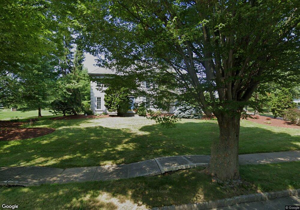
27 Wilson Way N Princeton Junction, NJ 08550
Estimated Value: $1,037,032 - $1,164,000
--
Bed
--
Bath
2,760
Sq Ft
$402/Sq Ft
Est. Value
About This Home
This home is located at 27 Wilson Way N, Princeton Junction, NJ 08550 and is currently estimated at $1,110,008, approximately $402 per square foot. 27 Wilson Way N is a home located in Mercer County with nearby schools including Maurice Hawk Elementary School, Millstone River School, and Community Middle School.
Ownership History
Date
Name
Owned For
Owner Type
Purchase Details
Closed on
Aug 31, 1998
Sold by
Colligan Donald
Bought by
Benfer William and Benfer Linda
Current Estimated Value
Home Financials for this Owner
Home Financials are based on the most recent Mortgage that was taken out on this home.
Original Mortgage
$140,000
Outstanding Balance
$29,906
Interest Rate
6.9%
Mortgage Type
Purchase Money Mortgage
Estimated Equity
$1,080,102
Purchase Details
Closed on
Nov 29, 1990
Sold by
Calton Homes Inc
Bought by
Colligan Donald J and Colligan Brenda J
Create a Home Valuation Report for This Property
The Home Valuation Report is an in-depth analysis detailing your home's value as well as a comparison with similar homes in the area
Home Values in the Area
Average Home Value in this Area
Purchase History
| Date | Buyer | Sale Price | Title Company |
|---|---|---|---|
| Benfer William | $350,000 | -- | |
| Colligan Donald J | $278,400 | -- |
Source: Public Records
Mortgage History
| Date | Status | Borrower | Loan Amount |
|---|---|---|---|
| Open | Benfer William | $140,000 |
Source: Public Records
Tax History Compared to Growth
Tax History
| Year | Tax Paid | Tax Assessment Tax Assessment Total Assessment is a certain percentage of the fair market value that is determined by local assessors to be the total taxable value of land and additions on the property. | Land | Improvement |
|---|---|---|---|---|
| 2025 | $19,423 | $633,700 | $267,000 | $366,700 |
| 2024 | $18,612 | $633,700 | $267,000 | $366,700 |
| 2023 | $18,612 | $633,700 | $267,000 | $366,700 |
| 2022 | $18,251 | $633,700 | $267,000 | $366,700 |
| 2021 | $18,098 | $633,700 | $267,000 | $366,700 |
| 2020 | $17,769 | $633,700 | $267,000 | $366,700 |
| 2019 | $17,566 | $633,700 | $267,000 | $366,700 |
| 2018 | $17,401 | $633,700 | $267,000 | $366,700 |
| 2017 | $17,040 | $633,700 | $267,000 | $366,700 |
| 2016 | $16,673 | $633,700 | $267,000 | $366,700 |
| 2015 | $16,286 | $633,700 | $267,000 | $366,700 |
| 2014 | $16,096 | $633,700 | $267,000 | $366,700 |
Source: Public Records
Map
Nearby Homes
- 32 W Kincaid Dr
- 5 Glengarry Way
- 7 Camas Ct
- 2 Colonial Ct
- 19 Shadow Dr
- 42 Nassau Place
- 3 Beechtree Ln
- 12 Ziff Ln
- 12 Ziff La
- 2 Joanne St
- Downeaster Plan at Townes at West Windsor
- Endeavor Plan at Townes at West Windsor
- Beneteau Plan at Townes at West Windsor
- Cape Dory Plan at Townes at West Windsor
- Alberg Plan at Townes at West Windsor
- 12 Corio Ct
- 90 Princeton Hightstown Rd
- 3801 Jordan Dr
- 20 Berkshire Dr
- 3704 Jordan Dr Unit 3701
- 29 Wilson Way N
- 25 Wilson Way N
- 4 Doris St
- 23 Wilson Way N
- 77 Saratoga Dr
- 73 Saratoga Dr
- 75 Saratoga Dr
- 28 Wilson Way N
- 24 Wilson Way N
- 31 Wilson Way N
- 79 Saratoga Dr
- 3 Ruthies Run
- 22 Wilson Way N
- 1 Ruthies Run
- 30 Wilson Way N
- 21 Wilson Way N
- 12 Perrine Path
- 8 Perrine Path
- 14 Perrine Path
- 10 Perrine Path