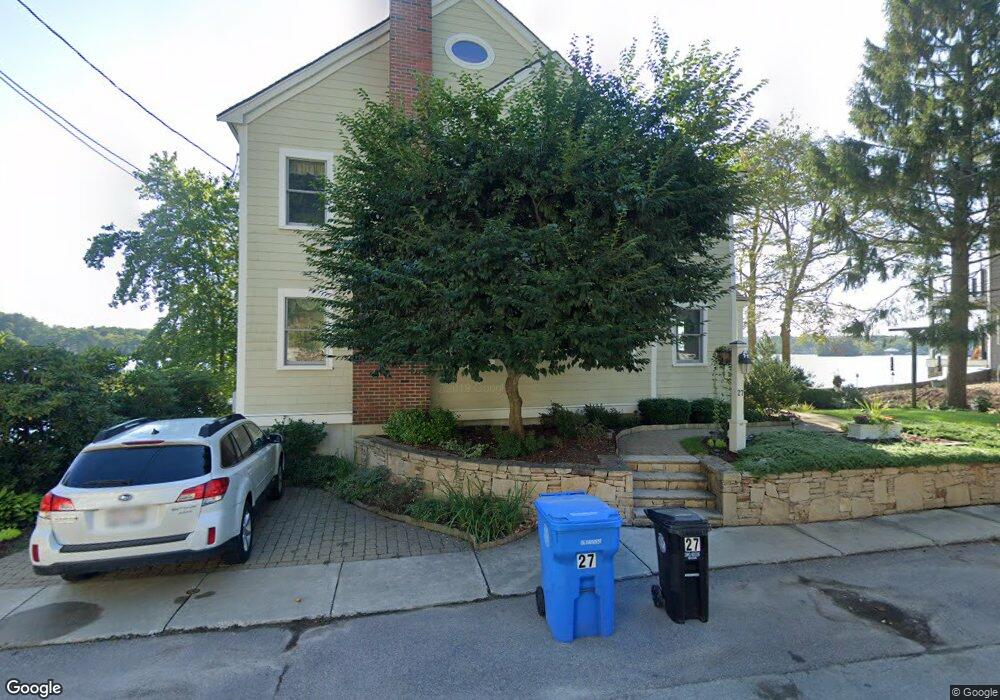
27 Woolford Rd Wrentham, MA 02093
Estimated Value: $755,000 - $969,000
3
Beds
3
Baths
2,012
Sq Ft
$428/Sq Ft
Est. Value
About This Home
This home is located at 27 Woolford Rd, Wrentham, MA 02093 and is currently estimated at $860,609, approximately $427 per square foot. 27 Woolford Rd is a home located in Norfolk County with nearby schools including Delaney Elementary School and Charles E Roderick.
Ownership History
Date
Name
Owned For
Owner Type
Purchase Details
Closed on
Feb 28, 2005
Sold by
Raymond Joanne E and Cummings Joanne R
Bought by
Cummings Joanne R and Cummings Paul A
Current Estimated Value
Home Financials for this Owner
Home Financials are based on the most recent Mortgage that was taken out on this home.
Original Mortgage
$275,000
Outstanding Balance
$140,525
Interest Rate
5.73%
Mortgage Type
Purchase Money Mortgage
Estimated Equity
$720,084
Purchase Details
Closed on
Feb 29, 1984
Bought by
Cummings Joanne R and Cummings Paul A
Create a Home Valuation Report for This Property
The Home Valuation Report is an in-depth analysis detailing your home's value as well as a comparison with similar homes in the area
Home Values in the Area
Average Home Value in this Area
Purchase History
| Date | Buyer | Sale Price | Title Company |
|---|---|---|---|
| Cummings Joanne R | -- | -- | |
| Cummings Joanne R | -- | -- |
Source: Public Records
Mortgage History
| Date | Status | Borrower | Loan Amount |
|---|---|---|---|
| Open | Cummings Joanne R | $275,000 |
Source: Public Records
Tax History Compared to Growth
Tax History
| Year | Tax Paid | Tax Assessment Tax Assessment Total Assessment is a certain percentage of the fair market value that is determined by local assessors to be the total taxable value of land and additions on the property. | Land | Improvement |
|---|---|---|---|---|
| 2025 | $10,715 | $924,500 | $460,000 | $464,500 |
| 2024 | $10,385 | $865,400 | $460,000 | $405,400 |
| 2023 | $9,715 | $769,800 | $412,300 | $357,500 |
| 2022 | $8,747 | $639,900 | $339,200 | $300,700 |
| 2021 | $9,172 | $651,900 | $374,900 | $277,000 |
| 2020 | $9,746 | $683,900 | $381,600 | $302,300 |
| 2019 | $9,655 | $683,800 | $395,200 | $288,600 |
| 2018 | $9,324 | $654,800 | $376,900 | $277,900 |
| 2017 | $9,096 | $638,300 | $369,600 | $268,700 |
| 2016 | $8,928 | $625,200 | $358,900 | $266,300 |
| 2015 | $8,970 | $598,800 | $345,000 | $253,800 |
| 2014 | $8,860 | $578,700 | $331,900 | $246,800 |
Source: Public Records
Map
Nearby Homes
- 570 Franklin St
- 131 Creek St Unit 7
- Lot 3 - 14 Earle Stewart Ln
- 11 Earle Stewart Ln
- Lot 1 - Blueberry 2 Car Plan at King Philip Estates
- Lot 8 - Blueberry 2 Car Plan at King Philip Estates
- Lot 5 - Hughes 2 car Plan at King Philip Estates
- Lot 6 - Blueberry 3 Car Plan at King Philip Estates
- Lot 2 - Camden 2 Car Plan at King Philip Estates
- Lot 7 - Cedar Plan at King Philip Estates
- Lot 4 - Hemingway 2 Car Plan at King Philip Estates
- Lot 3 - Blueberry 2 Car Plan at King Philip Estates
- 50 Reed Fulton Ave Unit Lot 61
- 10 Nature View Dr
- 15 Nature View Dr
- 440 Chestnut St
- 791 South St Unit 5
- 6 Woodchester Rd
- 55 Lawrence Dr Unit 55
- 45 Joshua Rd
- 41 Woolford Rd
- 30 Woolford Rd
- 25 Woolford Rd
- 47 Woolford Rd
- 48 Woolford Rd
- 20 Woolford Rd
- 51 Woolford Rd
- 14 Woolford Rd
- 14 Woolford Rd Unit 1
- 10 Woolford Rd
- 10 Woolford Rd Unit R
- 10 Woolford Rd
- 10 Woolford Rd Unit (REAR)
- 50 Woolford Rd
- 57 Woolford Rd
- 40 Woolford Rd
- 60 Woolford Rd
- 10 Woolford Road (Rear)
- 10 Woolford Road (Rear)
- 68 Woolford Rd