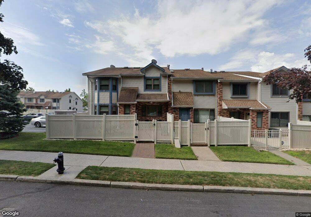
270 Ashworth Ave Unit 232 Staten Island, NY 10314
New Springville NeighborhoodEstimated Value: $545,200 - $601,000
3
Beds
2
Baths
1,233
Sq Ft
$472/Sq Ft
Est. Value
About This Home
This home is located at 270 Ashworth Ave Unit 232, Staten Island, NY 10314 and is currently estimated at $582,050, approximately $472 per square foot. 270 Ashworth Ave Unit 232 is a home located in Richmond County with nearby schools including P.S. 69 - Daniel D. Tompkins, Is 72 Rocco Laurie, and Susan E Wagner High School.
Ownership History
Date
Name
Owned For
Owner Type
Purchase Details
Closed on
Apr 8, 2021
Sold by
Petrizzo Michael and Petrizzo Patricia
Bought by
Valle Anne Marie Della
Current Estimated Value
Purchase Details
Closed on
Aug 22, 2014
Sold by
Petrizzo Michael and Petrizzo Patricia
Bought by
Petrizzo Michael and Petrizzo Patricia
Purchase Details
Closed on
May 24, 2002
Sold by
Carroll Eugene J
Bought by
Petrizzo Michael and Petrizzo Patricia
Purchase Details
Closed on
Mar 6, 1998
Sold by
Meo Albert P and English Doreen Ann
Bought by
Carroll Eugene J
Create a Home Valuation Report for This Property
The Home Valuation Report is an in-depth analysis detailing your home's value as well as a comparison with similar homes in the area
Home Values in the Area
Average Home Value in this Area
Purchase History
| Date | Buyer | Sale Price | Title Company |
|---|---|---|---|
| Valle Anne Marie Della | -- | None Available | |
| Petrizzo Michael | -- | Commonwealth Land Title Insu | |
| Petrizzo Michael | $247,000 | -- | |
| Carroll Eugene J | $121,500 | -- |
Source: Public Records
Tax History Compared to Growth
Tax History
| Year | Tax Paid | Tax Assessment Tax Assessment Total Assessment is a certain percentage of the fair market value that is determined by local assessors to be the total taxable value of land and additions on the property. | Land | Improvement |
|---|---|---|---|---|
| 2025 | $1,720 | $30,857 | $2,600 | $28,257 |
| 2024 | $1,824 | $26,873 | $2,957 | $23,916 |
| 2023 | $1,584 | $23,368 | $2,656 | $20,712 |
| 2022 | $1,541 | $25,145 | $3,214 | $21,931 |
| 2021 | $1,477 | $22,567 | $3,214 | $19,353 |
| 2020 | $1,542 | $23,292 | $3,214 | $20,078 |
| 2019 | $1,496 | $20,643 | $3,214 | $17,429 |
| 2016 | $1,111 | $17,332 | $2,760 | $14,572 |
| 2015 | $1,038 | $17,332 | $2,617 | $14,715 |
| 2014 | $1,038 | $17,172 | $2,953 | $14,219 |
Source: Public Records
Map
Nearby Homes
- 252 Ashworth Ave Unit A
- 252A Ashworth Ave Unit 220
- 29 Shirra Ave Unit 249
- 28A Mcdivitt Ave Unit 11
- 8 Mcdivitt Ave Unit A
- 35 Monarch Ct
- 11 Shirra Ave Unit A
- 20 Sweetgum Ln
- 69 Gina Ct Unit 289
- 143 Monahan Ave
- 186 Monahan Ave
- 222 Monahan Ave
- 45 Braisted Ave
- 101 McVeigh Ave
- 42 Greenway Ave
- 181 McVeigh Ave
- 63 Monahan Ave
- 127 Keating Place
- 8 Carpenter Ave
- 22 Braisted Ave
- 272 Ashworth Ave Unit 233
- 270A Ashworth Ave Unit 231
- 272A Ashworth Ave Unit 230
- 272 Ashworth Ave Unit A
- 274 Ashworth Ave Unit 234
- 274A Ashworth Ave Unit 229
- 274 Ashworth Ave Unit A
- 278 Ashworth Ave Unit 236
- 276 Ashworth Ave Unit 235
- 276A Ashworth Ave Unit 228
- 278A Ashworth Ave Unit 227
- 276 Ashworth Ave Unit A
- 17 Lovell Ave Unit 166
- 17 Lovell Ave Unit A
- 15A Lovell Ave Unit 168
- 15 Lovell Ave Unit 165
- 15 Lovell Ave Unit A
- 11A Lovell Ave Unit 169
- 11 Lovell Ave Unit 164
- 258 Ashworth Ave Unit 226