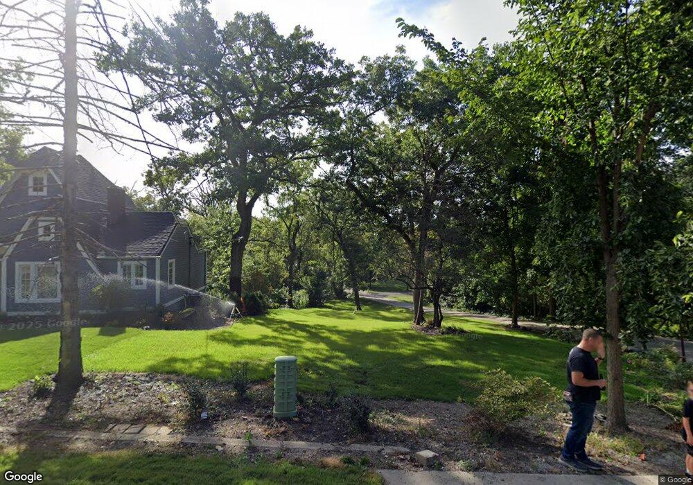
270 Biltmore Dr Unit 1 North Barrington, IL 60010
Estimated Value: $48,014 - $256,000
--
Bed
1
Bath
1,359
Sq Ft
$101/Sq Ft
Est. Value
About This Home
This home is located at 270 Biltmore Dr Unit 1, North Barrington, IL 60010 and is currently estimated at $137,004, approximately $100 per square foot. 270 Biltmore Dr Unit 1 is a home located in Lake County with nearby schools including North Barrington Elementary School, Barrington Mdle School- Prairie Cmps, and Barrington High School.
Ownership History
Date
Name
Owned For
Owner Type
Purchase Details
Closed on
Jul 26, 2022
Sold by
Reynolds Valerie K
Bought by
Koelper James and Koelper Crystal
Current Estimated Value
Purchase Details
Closed on
Sep 28, 1994
Sold by
Calfee Brian T and Calfee Patricia A
Bought by
Reynolds Valerie K
Home Financials for this Owner
Home Financials are based on the most recent Mortgage that was taken out on this home.
Original Mortgage
$164,050
Interest Rate
8.75%
Create a Home Valuation Report for This Property
The Home Valuation Report is an in-depth analysis detailing your home's value as well as a comparison with similar homes in the area
Home Values in the Area
Average Home Value in this Area
Purchase History
| Date | Buyer | Sale Price | Title Company |
|---|---|---|---|
| Koelper James | $40,000 | Piercey & Associates | |
| Reynolds Valerie K | $193,000 | Chicago Title Insurance Co |
Source: Public Records
Mortgage History
| Date | Status | Borrower | Loan Amount |
|---|---|---|---|
| Previous Owner | Reynolds Valerie K | $164,050 |
Source: Public Records
Tax History Compared to Growth
Tax History
| Year | Tax Paid | Tax Assessment Tax Assessment Total Assessment is a certain percentage of the fair market value that is determined by local assessors to be the total taxable value of land and additions on the property. | Land | Improvement |
|---|---|---|---|---|
| 2024 | $3,210 | $5,696 | $5,696 | -- |
| 2023 | $4,165 | $44,681 | $5,399 | $39,282 |
| 2022 | $4,165 | $63,981 | $6,108 | $57,873 |
| 2021 | $4,110 | $62,893 | $6,004 | $56,889 |
| 2020 | $3,997 | $62,698 | $5,985 | $56,713 |
| 2019 | $4,178 | $66,088 | $5,827 | $60,261 |
| 2018 | $3,649 | $60,236 | $6,942 | $53,294 |
| 2017 | $3,598 | $59,026 | $6,803 | $52,223 |
| 2016 | $3,558 | $56,799 | $6,546 | $50,253 |
| 2015 | $3,326 | $53,273 | $6,140 | $47,133 |
| 2014 | $3,700 | $55,294 | $6,159 | $49,135 |
| 2012 | $3,595 | $56,245 | $6,265 | $49,980 |
Source: Public Records
Map
Nearby Homes
- 520 Eton Dr
- 240 Oxford Rd
- 455 Eton Dr
- 208 Biltmore Dr
- 47 S Wynstone Dr
- 600 Eton Dr
- 59 Thornhill Ln Unit K176
- 78 Foxwood Ln Unit M169
- 24334 N Grandview Dr
- 68 Thornhill Ln
- 39 Deverell Dr
- 220 Thornhill Ct Unit D
- 414 Brookmont Ln
- 25 Shoreline Rd Unit B
- 15 S Wynstone Dr
- 557 Signal Hill Rd
- 535 Woodview Rd
- 356 Kim Trail
- 209 Shoreline Rd Unit B
- 95 Beech Dr
- 268 Biltmore Dr
- 271 Biltmore Dr
- 278 Biltmore Dr Unit 1
- 264 Biltmore Dr
- 277 Biltmore Dr Unit 1
- 270 E Drury Ln
- 262 E Drury Ln
- 259 Biltmore Dr
- 256 E Drury Ln
- 284 Biltmore Dr
- 267 E Drury Ln
- 255 Oxford Rd
- 285 Biltmore Dr
- 261 E Drury Ln Unit 1
- 253 Biltmore Dr Unit 1
- 254 E Drury Ln
- 268 Shady Ln
- 257 E Drury Ln
- 497 Brookside Rd Unit 1
- 536 Eton Dr
