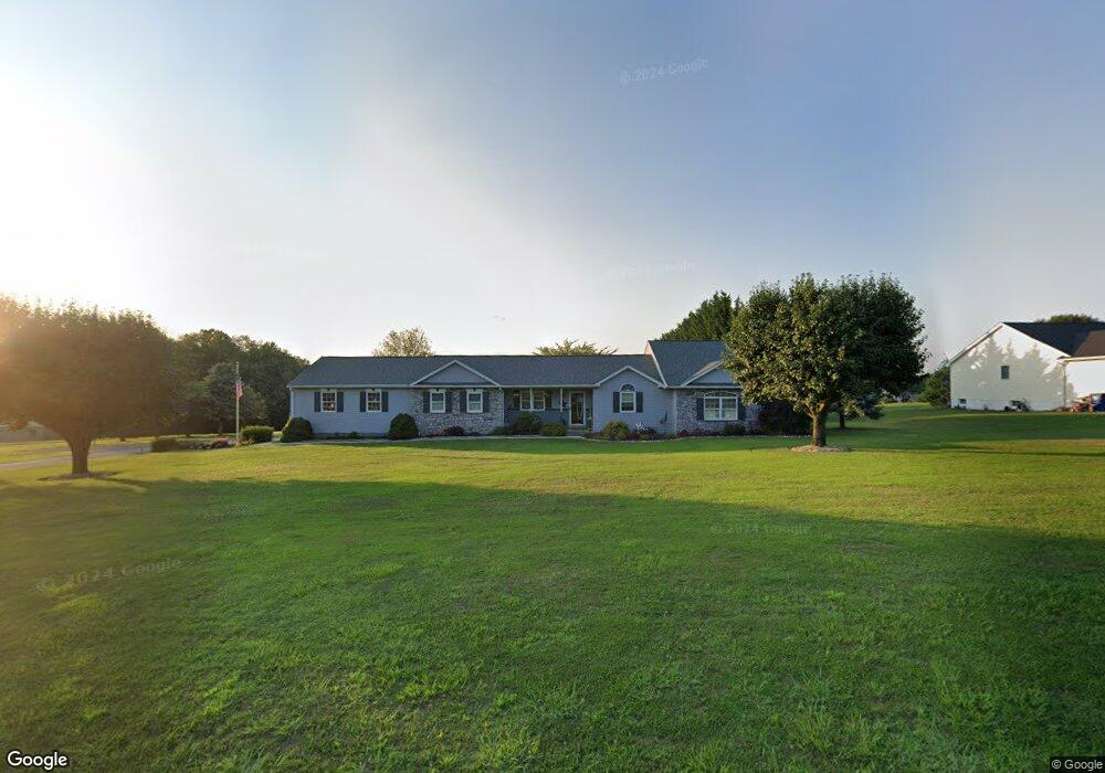
270 Bollinger Rd Unit 10 Littlestown, PA 17340
Estimated Value: $470,000 - $548,000
3
Beds
3
Baths
2,112
Sq Ft
$240/Sq Ft
Est. Value
About This Home
This home is located at 270 Bollinger Rd Unit 10, Littlestown, PA 17340 and is currently estimated at $506,618, approximately $239 per square foot. 270 Bollinger Rd Unit 10 is a home located in Adams County with nearby schools including Rolling Acres El School, Maple Avenue Middle School, and Littlestown Senior High School.
Ownership History
Date
Name
Owned For
Owner Type
Purchase Details
Closed on
Jun 16, 2009
Sold by
Hall Norman L
Bought by
Hall Norman L and Hall Jayne
Current Estimated Value
Create a Home Valuation Report for This Property
The Home Valuation Report is an in-depth analysis detailing your home's value as well as a comparison with similar homes in the area
Home Values in the Area
Average Home Value in this Area
Purchase History
| Date | Buyer | Sale Price | Title Company |
|---|---|---|---|
| Hall Norman L | -- | -- |
Source: Public Records
Tax History Compared to Growth
Tax History
| Year | Tax Paid | Tax Assessment Tax Assessment Total Assessment is a certain percentage of the fair market value that is determined by local assessors to be the total taxable value of land and additions on the property. | Land | Improvement |
|---|---|---|---|---|
| 2025 | $6,246 | $330,000 | $144,700 | $185,300 |
| 2024 | $6,004 | $330,000 | $144,700 | $185,300 |
| 2023 | $5,853 | $330,000 | $144,700 | $185,300 |
| 2022 | $5,810 | $330,000 | $144,700 | $185,300 |
| 2021 | $5,603 | $330,000 | $144,700 | $185,300 |
| 2020 | $5,522 | $330,000 | $144,700 | $185,300 |
| 2019 | $5,404 | $330,000 | $144,700 | $185,300 |
| 2018 | $5,243 | $330,000 | $144,700 | $185,300 |
| 2017 | $5,079 | $330,000 | $144,700 | $185,300 |
| 2016 | -- | $330,000 | $144,700 | $185,300 |
| 2015 | -- | $330,000 | $144,700 | $185,300 |
| 2014 | -- | $330,000 | $144,700 | $185,300 |
Source: Public Records
Map
Nearby Homes
- 9 Darlyn Dr
- 630 Mehring Rd Unit 4
- 640 Bollinger Rd
- LOT 9 Mehring Rd
- 574 Mathias Rd Unit 9
- 2100 Blacks School House Rd
- 567 Lumber St
- 28 Gettysburg Ct Unit 60
- 591 Lumber St
- 1175 Bollinger Rd
- 211 E King St
- 13 Fieldcrest Dr Unit 154
- 449 Glenwyn Dr
- 118 Mount Carmel Dr Unit 192
- 115 Charles St
- 117 Charles St
- 15 Yorktowne Ct Unit 97
- 41 Smith Cir
- 74 W King St
- 129 W King St
- 286 Bollinger Rd Unit 9
- 275 Bollinger Rd
- 291 Bollinger Rd
- 320 Bollinger Rd Unit 8
- 265 Bollinger Rd
- 253 Bollinger Rd Unit 3
- 75 Logan Cir Unit 19
- 330 Bollinger Rd Unit 7
- 5 Lucas Dr Unit 20
- 74 Logan Cir Unit 18
- 231 Bollinger Rd Unit 5
- 19 Lucas Dr Unit 21
- 325 Bollinger Rd
- 350 Bollinger Rd Unit 6
- 0 Lucas Dr Unit 1006341042
- Lucas Dr
- 0 Lucas Dr Unit AD7191361
- 112 Marcey Ct Unit 3
- 219 Bollinger Rd Unit 6
- 90 Marcey Ct Unit 2