Estimated payment $2,154/month
Highlights
- Backs to Trees or Woods
- No HOA
- Sitting Room
- Wood Flooring
- Home Gym
- Stainless Steel Appliances
About This Home
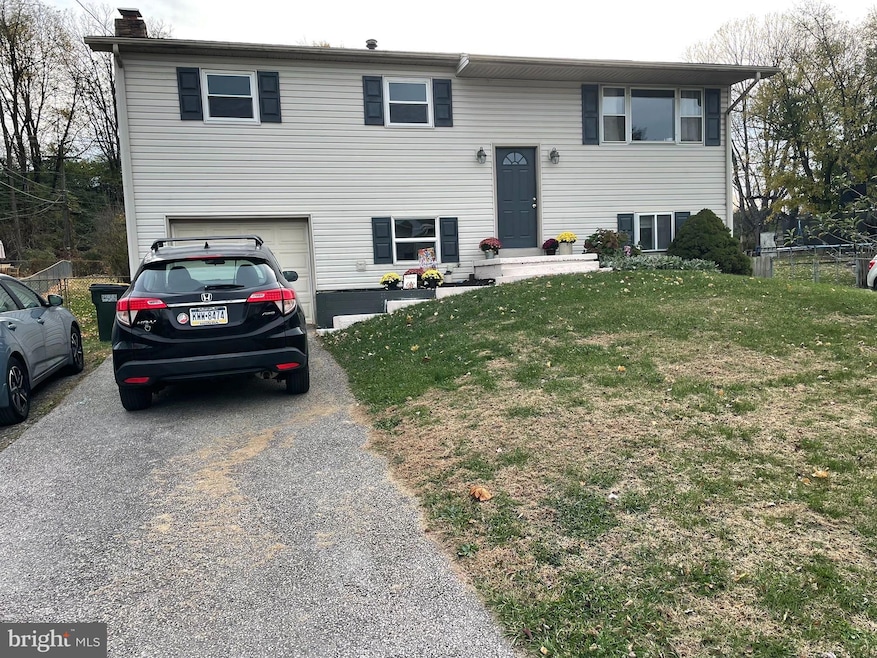
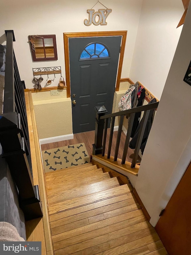
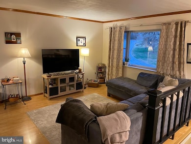
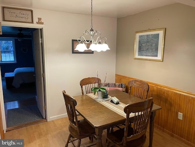
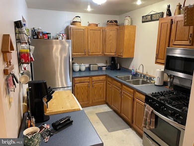
Nestled in the serene West York Estates, this charming split foyer home offers a perfect blend of comfort and functionality. With 5 spacious bedrooms and 2 full bathrooms, this residence is designed to accommodate your lifestyle needs. The inviting interior features a combination dining and living area, adorned with crown moldings and recessed lighting, creating a warm atmosphere for gatherings. The kitchen is equipped with stainless steel appliances, including a built-in microwave and gas oven/range, making meal preparation a breeze. The primary bath offers a relaxing tub shower, while the laundry chute adds convenience to your daily routine. Enjoy the cozy ambiance provided by ceiling fans and the plush carpet underfoot, complemented by beautiful wood floors throughout. Step outside to a generous 0.52-acre lot that backs to tranquil trees, providing a peaceful retreat. The level yard is perfect for outdoor activities, and the no-thru street ensures a quiet environment. Parking is a breeze with an oversized attached garage, driveway space, and ample on-street options. Additional features include a daylight basement with garage access and shelving for extra storage, along with insulated replacement windows that enhance energy efficiency. This home is not just a place to live; it's a sanctuary where memories are made. Don't miss the opportunity to make it yours!
Listing Agent
(717) 324-2500 george@georgewoodsteam.com LPT Realty, LLC License #RS212539L Listed on: 11/17/2025

Home Details
Home Type
- Single Family
Est. Annual Taxes
- $3,771
Year Built
- Built in 1970
Lot Details
- 0.52 Acre Lot
- Chain Link Fence
- No Through Street
- Level Lot
- Backs to Trees or Woods
- Back Yard
Parking
- 1 Car Direct Access Garage
- 2 Driveway Spaces
- Basement Garage
- Oversized Parking
- Front Facing Garage
- On-Street Parking
- Off-Street Parking
Home Design
- Split Foyer
- Block Foundation
- Architectural Shingle Roof
- Vinyl Siding
Interior Spaces
- Property has 2 Levels
- Crown Molding
- Ceiling Fan
- Recessed Lighting
- Replacement Windows
- Insulated Windows
- Window Treatments
- Sitting Room
- Living Room
- Dining Room
- Open Floorplan
- Storage Room
- Home Gym
Kitchen
- Gas Oven or Range
- Built-In Microwave
- Dishwasher
- Stainless Steel Appliances
Flooring
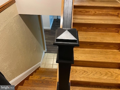
- Wood
- Carpet
Bedrooms and Bathrooms
- En-Suite Bathroom
- Bathtub with Shower
Laundry
- Laundry Room
- Laundry Chute
Basement
- Garage Access
- Rear Basement Entry
- Shelving
- Laundry in Basement
- Natural lighting in basement
Outdoor Features
- Shed
Schools
- West York Area Middle School
- West York Area High School
Utilities
- Cooling System Mounted In Outer Wall Opening
- 90% Forced Air Heating System
- 200+ Amp Service
- Natural Gas Water Heater
- Municipal Trash
Community Details
- No Home Owners Association
- West York Estates Subdivision
Listing and Financial Details
- Tax Lot 0081
- Assessor Parcel Number 51-000-20-0081-00-00000
Map
Home Values in the Area
Average Home Value in this Area
Tax History
| Year | Tax Paid | Tax Assessment Tax Assessment Total Assessment is a certain percentage of the fair market value that is determined by local assessors to be the total taxable value of land and additions on the property. | Land | Improvement |
|---|---|---|---|---|
| 2025 | $3,662 | $108,600 | $33,780 | $74,820 |
| 2024 | $3,570 | $108,600 | $33,780 | $74,820 |
| 2023 | $3,570 | $108,600 | $33,780 | $74,820 |
| 2022 | $3,570 | $108,600 | $33,780 | $74,820 |
| 2021 | $3,461 | $108,600 | $33,780 | $74,820 |
| 2020 | $3,461 | $108,600 | $33,780 | $74,820 |
| 2019 | $3,396 | $108,600 | $33,780 | $74,820 |
| 2018 | $3,369 | $108,600 | $33,780 | $74,820 |
| 2017 | $3,266 | $108,600 | $33,780 | $74,820 |
| 2016 | $0 | $108,600 | $33,780 | $74,820 |
| 2015 | -- | $108,600 | $33,780 | $74,820 |
| 2014 | -- | $108,600 | $33,780 | $74,820 |
Property History
| Date | Event | Price | List to Sale | Price per Sq Ft |
|---|---|---|---|---|
| 11/17/2025 11/17/25 | For Sale | $349,900 | -- | $105 / Sq Ft |
Purchase History
| Date | Type | Sale Price | Title Company |
|---|---|---|---|
| Deed | -- | None Listed On Document |
Mortgage History
| Date | Status | Loan Amount | Loan Type |
|---|---|---|---|
| Open | $160,000 | New Conventional | |
| Previous Owner | $93,500 | New Conventional | |
| Previous Owner | $92,720 | New Conventional | |
| Previous Owner | $52,900 | No Value Available | |
| Closed | $10,000 | No Value Available |
Source: Bright MLS
MLS Number: PAYK2093424
APN: 51-000-20-0081.00-00000
Disclaimer: Certain information contained herein is derived from information provided by parties other than Homes.com. All information provided is deemed reliable, but is not guaranteed to be accurate and should be independently verified.
![]() The data relating to real estate for sale on this website appears in part through the BRIGHT Internet Data Exchange program, a voluntary cooperative exchange of property listing data between licensed real estate brokerage firms, and is provided by BRIGHT through a licensing agreement.
The data relating to real estate for sale on this website appears in part through the BRIGHT Internet Data Exchange program, a voluntary cooperative exchange of property listing data between licensed real estate brokerage firms, and is provided by BRIGHT through a licensing agreement.
Listing information is from various brokers who participate in the Bright MLS IDX program and not all listings may be visible on the site.
The property information being provided on or through the website is for the personal, non-commercial use of consumers and such information may not be used for any purpose other than to identify prospective properties consumers may be interested in purchasing.
Some properties which appear for sale on the website may no longer be available because they are for instance, under contract, sold or are no longer being offered for sale.
Property information displayed is deemed reliable but is not guaranteed.
Copyright 2025 Bright MLS, Inc.
- 91 Hull Dr
- 203 Hillside Terrace
- 117 N Forrest St
- 105 N Gotwalt St
- 413 Weldon Dr
- 2000 Filbert St
- 1616 W Poplar Terrace
- 865 Taxville Rd
- 1825 W Philadelphia St
- 39 S Sumner St
- 1995 Worth St
- 1280 Greenwood Rd
- 1802 Filbert St
- 23 N Sumner St
- 0 Trinity Rd Unit PAYK2057290
- 1826 Orange St
- 1745 Filbert Rear St Unit REAR
- 1622 W Philadelphia St
- 4075 Rolling Meadow Ct
- 4160 W Market St
- 1 Lark Cir
- 76 Lark Cir
- 3601 W Market St
- 21 N Diamond St Unit GARAGE
- 1422 W Market St
- 50 S Highland Ave
- 1701 Taxville Rd
- 1336 W Philadelphia St Unit 1ST FLOOR
- 6 Heiges Ave Unit GARAGE 2
- 1 Heiges Ave Unit GARAGE 4
- 1060 Crest Way
- 1134 W King St Unit 2
- 719 W Philadelphia St Unit 1
- 700 Linden Ave
- 702 W Philadelphia St Unit 2
- 2178 Golden Eagle Dr Unit 122
- 1700 Yorktowne Dr
- 638 Roosevelt Ave Unit 1
- 1800 Kenneth Rd
- 442 W Market St Unit 1