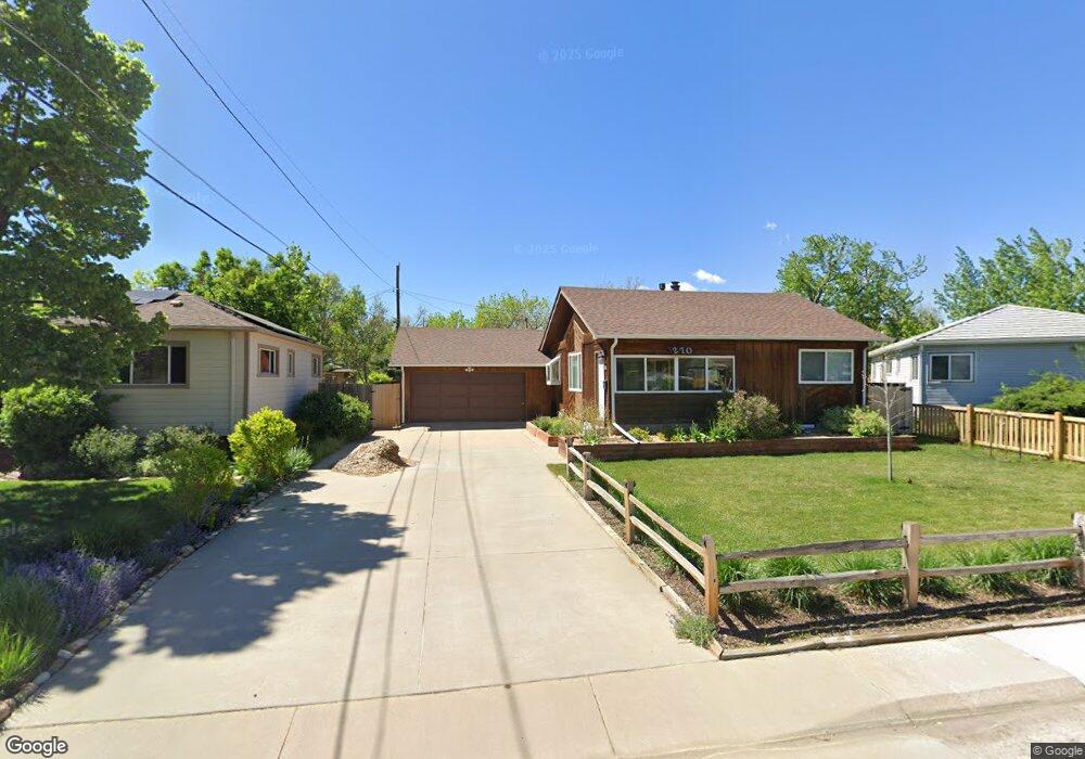
270 Chenango Cir Englewood, CO 80113
Bellewood NeighborhoodEstimated Value: $493,000 - $539,212
4
Beds
2
Baths
1,457
Sq Ft
$356/Sq Ft
Est. Value
About This Home
This home is located at 270 Chenango Cir, Englewood, CO 80113 and is currently estimated at $518,553, approximately $355 per square foot. 270 Chenango Cir is a home located in Arapahoe County with nearby schools including Cherrelyn Elementary School, Englewood Middle School, and Englewood High School.
Ownership History
Date
Name
Owned For
Owner Type
Purchase Details
Closed on
Aug 6, 2021
Sold by
Mailes Colton and Mailes Audrey
Bought by
Deoliveira Margaret Marie and De Oliveira Ilan
Current Estimated Value
Home Financials for this Owner
Home Financials are based on the most recent Mortgage that was taken out on this home.
Original Mortgage
$436,500
Outstanding Balance
$397,505
Interest Rate
3%
Mortgage Type
New Conventional
Estimated Equity
$121,048
Purchase Details
Closed on
Jul 31, 2013
Sold by
Mccaw Douglas C and Wolfswinkel Melinda R
Bought by
Mailes Colton and Mailes Audrey
Home Financials for this Owner
Home Financials are based on the most recent Mortgage that was taken out on this home.
Original Mortgage
$176,800
Interest Rate
3.93%
Mortgage Type
New Conventional
Purchase Details
Closed on
May 30, 2003
Sold by
Edmunds Grant
Bought by
Mccaw Douglas C and Wolfswinkel Melinda R
Home Financials for this Owner
Home Financials are based on the most recent Mortgage that was taken out on this home.
Original Mortgage
$196,402
Interest Rate
5.56%
Mortgage Type
FHA
Purchase Details
Closed on
Aug 26, 1999
Sold by
Allen William Ross and Allen Selket Athena
Bought by
Edmunds Grant
Home Financials for this Owner
Home Financials are based on the most recent Mortgage that was taken out on this home.
Original Mortgage
$152,750
Interest Rate
7.58%
Purchase Details
Closed on
Mar 27, 1998
Sold by
Strickland Pamela L
Bought by
Allen William Ross and Allen Selket Athena
Home Financials for this Owner
Home Financials are based on the most recent Mortgage that was taken out on this home.
Original Mortgage
$127,645
Interest Rate
7.04%
Mortgage Type
FHA
Purchase Details
Closed on
Jun 12, 1992
Sold by
Foster John D Foster Tamara E
Bought by
Strickland Pamela L
Purchase Details
Closed on
Nov 29, 1989
Sold by
Quigley Jane Unrein Anthony Jr Unrein Marg
Bought by
Foster John D Foster Tamara E
Purchase Details
Closed on
Mar 27, 1987
Sold by
Conversion Arapco
Bought by
Quigley Jane Unrein Anthony Jr Unrein Marg
Purchase Details
Closed on
Feb 1, 1985
Sold by
Conversion Arapco
Bought by
Conversion Arapco
Purchase Details
Closed on
Jul 4, 1776
Bought by
Conversion Arapco
Create a Home Valuation Report for This Property
The Home Valuation Report is an in-depth analysis detailing your home's value as well as a comparison with similar homes in the area
Home Values in the Area
Average Home Value in this Area
Purchase History
| Date | Buyer | Sale Price | Title Company |
|---|---|---|---|
| Deoliveira Margaret Marie | $485,000 | Canyon Title | |
| Mailes Colton | $221,000 | Fidelity National Title Insu | |
| Mccaw Douglas C | $199,900 | Chicago Title Co | |
| Edmunds Grant | $157,500 | -- | |
| Allen William Ross | $129,000 | -- | |
| Strickland Pamela L | -- | -- | |
| Foster John D Foster Tamara E | -- | -- | |
| Quigley Jane Unrein Anthony Jr Unrein Marg | -- | -- | |
| Conversion Arapco | -- | -- | |
| Conversion Arapco | -- | -- |
Source: Public Records
Mortgage History
| Date | Status | Borrower | Loan Amount |
|---|---|---|---|
| Open | Deoliveira Margaret Marie | $436,500 | |
| Previous Owner | Mailes Colton | $176,800 | |
| Previous Owner | Mccaw Douglas C | $196,402 | |
| Previous Owner | Edmunds Grant | $152,750 | |
| Previous Owner | Allen William Ross | $127,645 |
Source: Public Records
Tax History Compared to Growth
Tax History
| Year | Tax Paid | Tax Assessment Tax Assessment Total Assessment is a certain percentage of the fair market value that is determined by local assessors to be the total taxable value of land and additions on the property. | Land | Improvement |
|---|---|---|---|---|
| 2024 | $2,376 | $33,781 | -- | -- |
| 2023 | $2,376 | $33,781 | $0 | $0 |
| 2022 | $2,020 | $27,731 | $0 | $0 |
| 2021 | $2,012 | $27,731 | $0 | $0 |
| 2020 | $2,045 | $27,850 | $0 | $0 |
| 2019 | $2,032 | $27,850 | $0 | $0 |
| 2018 | $1,761 | $22,522 | $0 | $0 |
| 2017 | $1,745 | $22,522 | $0 | $0 |
| 2016 | $1,507 | $18,419 | $0 | $0 |
| 2015 | $1,244 | $18,419 | $0 | $0 |
| 2014 | $1,141 | $15,681 | $0 | $0 |
| 2013 | -- | $16,190 | $0 | $0 |
Source: Public Records
Map
Nearby Homes
- 4874 S Lincoln St
- 4822 S Grant St
- 4720 S Grant St
- 4703 S Sherman St
- 5108 S Pennsylvania St
- 664 S Washington Cir
- 4794 S Pearl St
- 4680 S Sherman St
- 5180 S Logan St
- 4728 S Acoma St
- 5136 S Pennsylvania St
- 4779 S Bannock St
- 4786 S Cherokee St
- 4816 S Delaware St
- 5261 S Pennsylvania St
- 5215 S Washington St
- 5145 S Clarkson St
- 5280 S Logan St
- 5291 S Sherman St
- 301 W Lehow Ave Unit 11
- 280 Chenango Cir
- 260 Chenango Cir
- 4938 S Sherman St
- 4935 S Grant St
- 4941 S Grant St
- 4942 S Sherman St
- 295 Chenango Cir
- 271 Chenango Cir
- 261 Chenango Cir
- 4947 S Grant St
- 4932 Chenango Cir
- 4933 S Sherman St
- 4925 S Grant St
- 4948 S Sherman St
- 4939 S Sherman St
- 4943 S Sherman St
- 4951 S Grant St
- 4949 S Sherman St
- 4930 S Grant St
- 4936 S Grant St