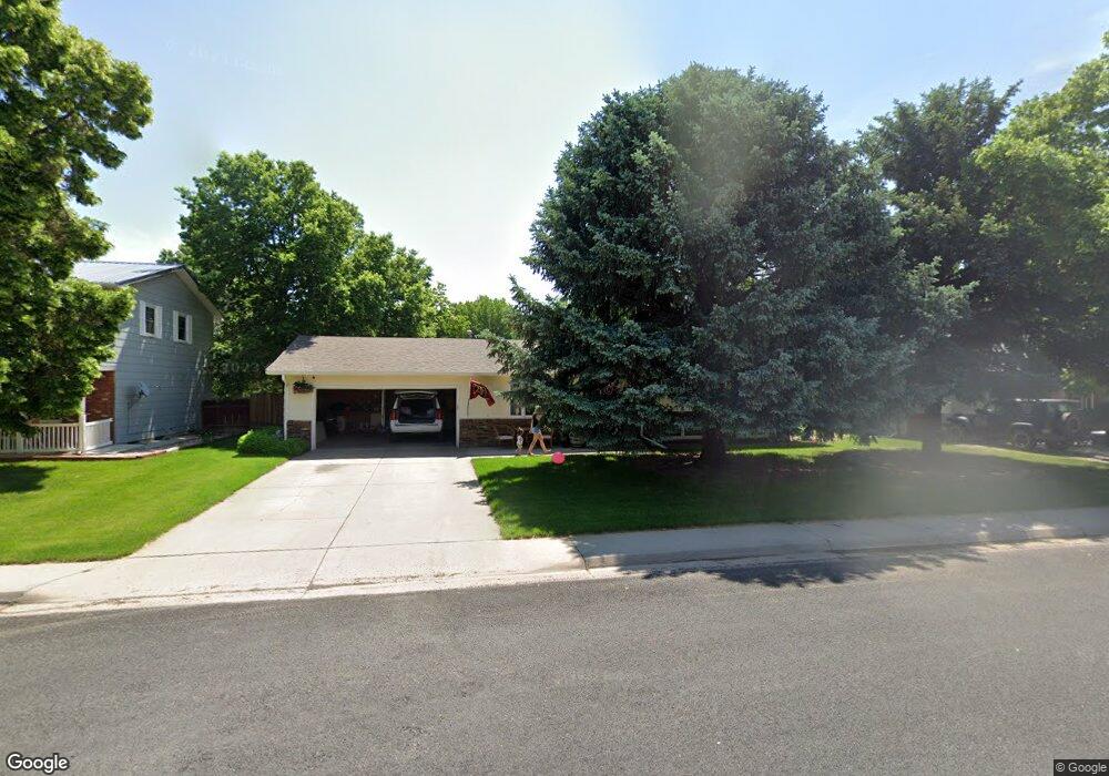
270 Dahlia St Fort Morgan, CO 80701
Estimated Value: $357,000 - $390,000
4
Beds
1
Bath
1,404
Sq Ft
$267/Sq Ft
Est. Value
About This Home
This home is located at 270 Dahlia St, Fort Morgan, CO 80701 and is currently estimated at $374,777, approximately $266 per square foot. 270 Dahlia St is a home located in Adams County with nearby schools including Bennett Elementary School, Bennett Middle School, and Bennett High School.
Ownership History
Date
Name
Owned For
Owner Type
Purchase Details
Closed on
Sep 14, 2022
Sold by
Mccubbin Robert C
Bought by
Morgan Richard H
Current Estimated Value
Home Financials for this Owner
Home Financials are based on the most recent Mortgage that was taken out on this home.
Original Mortgage
$378,140
Outstanding Balance
$360,502
Interest Rate
4.99%
Mortgage Type
VA
Estimated Equity
$14,275
Purchase Details
Closed on
Jun 3, 2019
Sold by
Standridge Dominic Wilson and Standridge Jayleigh Renee
Bought by
Mccubbin Robert C
Home Financials for this Owner
Home Financials are based on the most recent Mortgage that was taken out on this home.
Original Mortgage
$275,910
Interest Rate
5.5%
Mortgage Type
FHA
Purchase Details
Closed on
Nov 20, 2017
Sold by
Church Dennis
Bought by
Standridge Dominic Wilson and Standridge Jayleigh Renee
Home Financials for this Owner
Home Financials are based on the most recent Mortgage that was taken out on this home.
Original Mortgage
$11,782
Interest Rate
3.91%
Mortgage Type
Future Advance Clause Open End Mortgage
Purchase Details
Closed on
Jul 5, 2017
Sold by
Jenkins Ronald
Bought by
Church Dennis
Purchase Details
Closed on
Aug 21, 2008
Sold by
Ponda Paresh S and Ponda Frances M
Bought by
Hud
Purchase Details
Closed on
Oct 28, 1999
Sold by
Foste Steven S
Bought by
Range Robert L and Range Tanya R
Home Financials for this Owner
Home Financials are based on the most recent Mortgage that was taken out on this home.
Original Mortgage
$103,050
Interest Rate
7.85%
Purchase Details
Closed on
Sep 13, 1995
Sold by
Brown Diana L
Bought by
Foste Steven S
Home Financials for this Owner
Home Financials are based on the most recent Mortgage that was taken out on this home.
Original Mortgage
$67,454
Interest Rate
7.78%
Mortgage Type
FHA
Create a Home Valuation Report for This Property
The Home Valuation Report is an in-depth analysis detailing your home's value as well as a comparison with similar homes in the area
Home Values in the Area
Average Home Value in this Area
Purchase History
| Date | Buyer | Sale Price | Title Company |
|---|---|---|---|
| Morgan Richard H | $365,000 | Chicago Title | |
| Mccubbin Robert C | $281,000 | Homestead Title & Escrow | |
| Standridge Dominic Wilson | $240,000 | North American Title | |
| Church Dennis | $125,000 | North American Title | |
| Hud | -- | None Available | |
| Range Robert L | $108,500 | Land Title | |
| Foste Steven S | $67,500 | Land Title |
Source: Public Records
Mortgage History
| Date | Status | Borrower | Loan Amount |
|---|---|---|---|
| Open | Morgan Richard H | $378,140 | |
| Previous Owner | Mccubbin Robert C | $275,910 | |
| Previous Owner | Standridge Dominic Wilson | $11,782 | |
| Previous Owner | Range Robert L | $103,050 | |
| Previous Owner | Foste Steven S | $67,454 |
Source: Public Records
Tax History Compared to Growth
Tax History
| Year | Tax Paid | Tax Assessment Tax Assessment Total Assessment is a certain percentage of the fair market value that is determined by local assessors to be the total taxable value of land and additions on the property. | Land | Improvement |
|---|---|---|---|---|
| 2024 | $1,910 | $21,750 | $3,750 | $18,000 |
| 2023 | $1,922 | $26,180 | $4,460 | $21,720 |
| 2022 | $1,718 | $19,940 | $4,590 | $15,350 |
| 2021 | $1,753 | $19,940 | $4,590 | $15,350 |
| 2020 | $1,517 | $18,010 | $4,720 | $13,290 |
| 2019 | $1,558 | $18,010 | $4,720 | $13,290 |
| 2018 | $1,264 | $13,290 | $2,300 | $10,990 |
| 2017 | $1,276 | $13,290 | $2,300 | $10,990 |
| 2016 | $971 | $10,480 | $2,550 | $7,930 |
| 2015 | $966 | $10,480 | $2,550 | $7,930 |
| 2014 | $834 | $8,930 | $2,390 | $6,540 |
Source: Public Records
Map
Nearby Homes
- 47385 Lily Ave
- 47349 Lily Ave
- 311 Maple St
- 45952 Gentry Ave
- 45915 Wood Thrush Ave
- 45921 Wood Thrush Ave
- 45933 Wood Thrush Ave
- 45946 Gentry Ave
- 45928 Gentry Ave
- 240 Lark Sparrow Way
- 47322 Iris Ave
- 333 Spruce St
- 47375 Lilac Ave
- 47363 Lilac Ave
- 625 Aspen Ave
- 228 Ash St
- 635 Cottonwood Ave
- 1040 View Ridge Rd
- 485 4th St
- 535 N 5th St