Estimated Value: $222,000 - $248,000
3
Beds
2
Baths
1,578
Sq Ft
$149/Sq Ft
Est. Value
About This Home
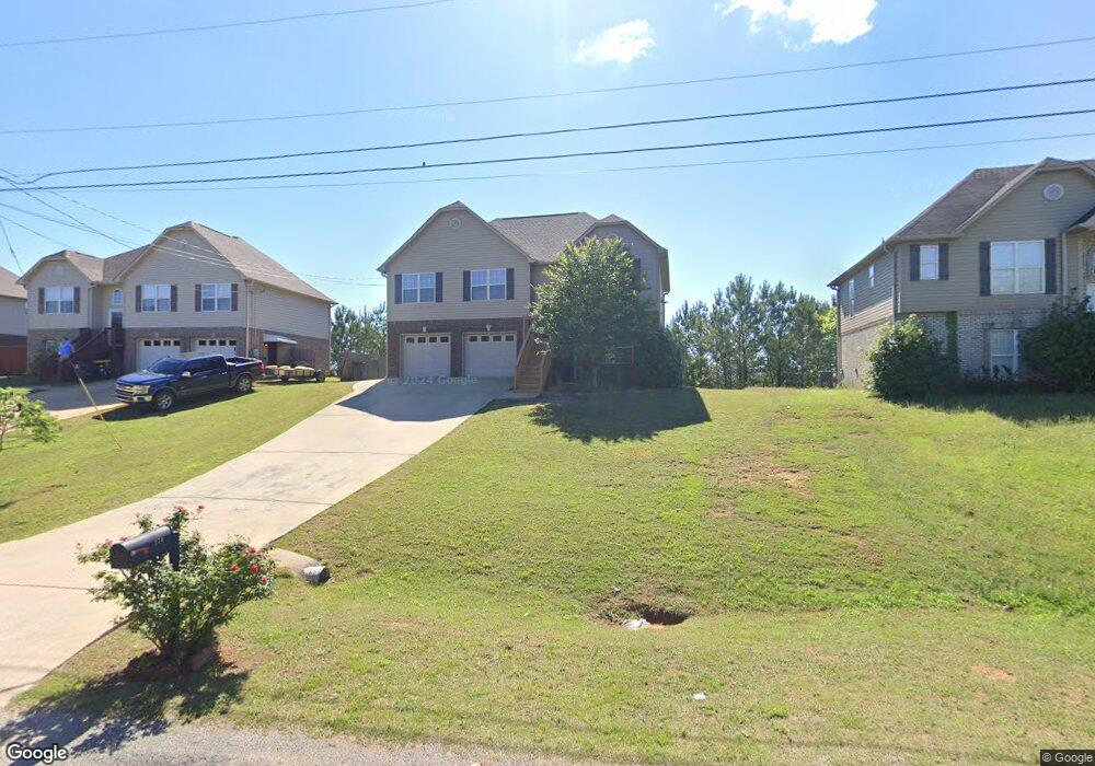
This home is located at 270 Dust Ridge Rd Unit 49, Moody, AL 35004 and is currently estimated at $235,301, approximately $149 per square foot. 270 Dust Ridge Rd Unit 49 is a home located in St. Clair County with nearby schools including Moody Elementary School, Moody Middle School, and Moody High School.
Ownership History
Date
Name
Owned For
Owner Type
Purchase Details
Closed on
Aug 12, 2024
Sold by
Fkh Trs L Llc
Bought by
Jakubowski Kevin L and Jakubowski Brandy M
Current Estimated Value
Home Financials for this Owner
Home Financials are based on the most recent Mortgage that was taken out on this home.
Original Mortgage
$242,424
Outstanding Balance
$238,809
Interest Rate
6.89%
Mortgage Type
New Conventional
Estimated Equity
-$3,508
Purchase Details
Closed on
May 20, 2024
Sold by
Fkh Sfr Llp
Bought by
Fkh Trs L Llc
Purchase Details
Closed on
Jun 24, 2022
Sold by
Stephanie Coleman
Bought by
Fkh Sfr Llp
Purchase Details
Closed on
Sep 18, 2008
Sold by
Fourstar Investments Inc
Bought by
Coleman Stephanie
Home Financials for this Owner
Home Financials are based on the most recent Mortgage that was taken out on this home.
Original Mortgage
$136,734
Interest Rate
6.45%
Mortgage Type
New Conventional
Create a Home Valuation Report for This Property
The Home Valuation Report is an in-depth analysis detailing your home's value as well as a comparison with similar homes in the area
Home Values in the Area
Average Home Value in this Area
Purchase History
| Date | Buyer | Sale Price | Title Company |
|---|---|---|---|
| Jakubowski Kevin L | $240,000 | None Listed On Document | |
| Fkh Trs L Llc | $189,000 | None Listed On Document | |
| Fkh Sfr Llp | $250,000 | England Kyle | |
| Fkh Sfr Llp | $250,000 | England Kyle | |
| Coleman Stephanie | $134,000 | None Available |
Source: Public Records
Mortgage History
| Date | Status | Borrower | Loan Amount |
|---|---|---|---|
| Open | Jakubowski Kevin L | $242,424 | |
| Previous Owner | Coleman Stephanie | $136,734 |
Source: Public Records
Tax History
| Year | Tax Paid | Tax Assessment Tax Assessment Total Assessment is a certain percentage of the fair market value that is determined by local assessors to be the total taxable value of land and additions on the property. | Land | Improvement |
|---|---|---|---|---|
| 2024 | $1,375 | $38,208 | $5,200 | $33,008 |
| 2023 | $1,361 | $37,798 | $5,200 | $32,598 |
| 2022 | $468 | $14,315 | $2,600 | $11,715 |
| 2021 | $468 | $14,315 | $2,600 | $11,715 |
| 2020 | $486 | $14,835 | $2,600 | $12,235 |
| 2019 | $486 | $14,835 | $2,600 | $12,235 |
| 2018 | $437 | $13,460 | $0 | $0 |
| 2017 | $445 | $13,460 | $0 | $0 |
| 2016 | $437 | $13,460 | $0 | $0 |
| 2015 | $445 | $13,460 | $0 | $0 |
| 2014 | $445 | $13,700 | $0 | $0 |
Source: Public Records
Map
Nearby Homes
- 250 Dust Ridge Rd
- 5953 Old Acton Rd
- 125 Bates Ln
- 5970 Old Acton Rd
- 15 Stevens Cove Dr
- 220 Virginia Way Unit 69
- 230 Virginia Way Unit 68
- 260 Virginia Way Unit 65
- 270 Virginia Way Unit 64
- 280 Virginia Way Unit 63
- 290 Virginia Way Unit 62
- 300 Virginia Way Unit 61
- 310 Virginia Way Unit 60
- 1055 Brookhaven Dr
- 2430 W Middlebrooke Crossing
- 1635 Sterling Place
- 1615 Sterling Place
- 1630 Sterling Place
- 1625 Sterling Place
- 2265 W Middlebrooke Crossing
- 270 Dust Ridge Rd
- 280 Dust Ridge Rd
- 280 Dust Ridge Rd Unit 50
- 260 Dust Ridge Rd
- 260 Dust Ridge Rd Unit 48
- 0 Dust Ridge Rd Unit 73 839612
- 0 Dust Ridge Rd Unit 72 839607
- 0 Dust Ridge Rd Unit 70 839602
- 0 Dust Ridge Rd Unit 69 839601
- 0 Dust Ridge Rd Unit 68 839598
- 0 Dust Ridge Rd Unit 67 839595
- 0 Dust Ridge Rd Unit 66 839594
- 0 Dust Ridge Rd Unit 62 839592
- 0 Dust Ridge Rd Unit 64 839591
- 0 Dust Ridge Rd Unit 63 839590
- 0 Dust Ridge Rd Unit 62 839588
- 0 Dust Ridge Rd Unit 60 839586
- 0 Dust Ridge Rd Unit 61 839585
- 0 Dust Ridge Rd Unit 59 839575
- 0 Dust Ridge Rd Unit Lot 59 901454
Your Personal Tour Guide
Ask me questions while you tour the home.