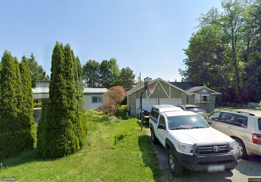
270 Elizabeth Dr Point Roberts, WA 98281
Estimated Value: $1,181,000 - $1,371,247
2
Beds
2
Baths
2,698
Sq Ft
$468/Sq Ft
Est. Value
About This Home
This home is located at 270 Elizabeth Dr, Point Roberts, WA 98281 and is currently estimated at $1,262,062, approximately $467 per square foot. 270 Elizabeth Dr is a home located in Whatcom County with nearby schools including Point Roberts Primary School, Blaine Middle School, and Blaine High School.
Ownership History
Date
Name
Owned For
Owner Type
Purchase Details
Closed on
Jun 19, 2018
Sold by
Barbhart Jerry Robert and Rose Evelyn Frances
Bought by
Hemstock Christopher Allan and Hemstock Brenda Marie
Current Estimated Value
Purchase Details
Closed on
Oct 7, 2004
Sold by
Woods Kristen J
Bought by
The Jerry Robert Barnhart & Evelyn Franc
Purchase Details
Closed on
May 17, 2000
Sold by
Woods Robin James
Bought by
Woods Kristen Joan
Purchase Details
Closed on
Sep 15, 1975
Sold by
Thompson Harry C and Thompson Margaret
Bought by
Nielson Ronald A and Nielson Beverly J
Create a Home Valuation Report for This Property
The Home Valuation Report is an in-depth analysis detailing your home's value as well as a comparison with similar homes in the area
Home Values in the Area
Average Home Value in this Area
Purchase History
| Date | Buyer | Sale Price | Title Company |
|---|---|---|---|
| Hemstock Christopher Allan | $1,175,000 | Whatcom Land Title | |
| The Jerry Robert Barnhart & Evelyn Franc | $295,000 | Whatcom Land Trust | |
| Woods Kristen Joan | -- | -- | |
| Nielson Ronald A | -- | Whatcom Land Title |
Source: Public Records
Tax History Compared to Growth
Tax History
| Year | Tax Paid | Tax Assessment Tax Assessment Total Assessment is a certain percentage of the fair market value that is determined by local assessors to be the total taxable value of land and additions on the property. | Land | Improvement |
|---|---|---|---|---|
| 2024 | $9,982 | $1,327,378 | $506,793 | $820,585 |
| 2023 | $9,982 | $1,281,306 | $460,721 | $820,585 |
| 2022 | $10,194 | $1,170,143 | $420,750 | $749,393 |
| 2021 | $10,150 | $1,088,380 | $364,162 | $724,218 |
| 2020 | $10,076 | $1,007,744 | $337,182 | $670,562 |
| 2019 | $9,294 | $966,653 | $323,433 | $643,220 |
| 2018 | $9,502 | $869,011 | $290,763 | $578,248 |
| 2017 | $8,231 | $829,955 | $277,695 | $552,260 |
| 2016 | $7,520 | $813,681 | $272,250 | $541,431 |
| 2015 | $8,001 | $722,548 | $263,021 | $459,527 |
| 2014 | -- | $755,368 | $274,973 | $480,395 |
| 2013 | -- | $722,512 | $264,083 | $458,429 |
Source: Public Records
Map
Nearby Homes
- 251 Elizabeth Dr
- 302 Boundary Bay Rd
- 4 Boundary Bay Rd
- Lot 35 Boundary Bay Rd
- 2145 Fir St
- 103 Goodman Rd
- 412 High Bluff Dr
- 2138 Benson Rd
- 0 X Weasel Run
- 0 Lot 7 Weasel Run Rd
- 6 Weasel Run Rd
- 0 3 73 Acres Derby Ave
- 500 Moose Trail
- Lot 2 Greenwood Dr
- 1931 Sanders Ct Unit 11
- 1976 Cedar Park Dr
- lot 14 Cedar Park Dr Unit 14
- 1871 Johnson Rd
- 2149 Seabright Loop
- 2045 Apa Rd
- 272 Elizabeth Dr
- 268 Elizabeth Dr
- 258 Elizabeth Dr
- 254 Elizabeth Dr
- 247 Bay View Dr
- 245 Bay View Dr
- 250 Elizabeth Dr
- 276 Elizabeth Dr
- 239 Bay View Dr
- 274 Elizabeth Dr
- 246 Elizabeth Dr
- 266 Elizabeth Dr
- 229 Bay View Dr
- 280 Elizabeth Dr
- 267 Elizabeth Dr
- 262 Elizabeth Dr
- 253 Bay View Dr
- 245 Elizabeth Dr
- 282 Elizabeth Dr
- 261 Elizabeth Dr