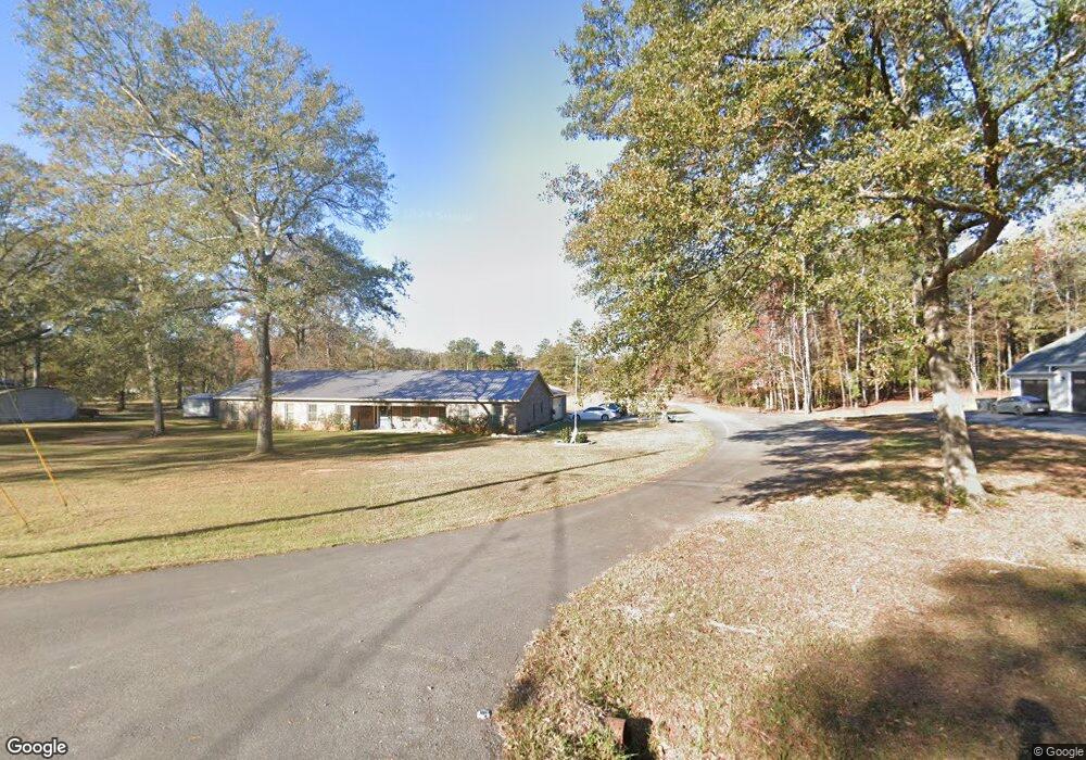
270 Givens Cir West Point, GA 31833
Estimated Value: $161,000 - $431,707
4
Beds
3
Baths
3,124
Sq Ft
$101/Sq Ft
Est. Value
About This Home
This home is located at 270 Givens Cir, West Point, GA 31833 and is currently estimated at $315,677, approximately $101 per square foot. 270 Givens Cir is a home with nearby schools including West Point Elementary School, Long Cane Elementary School, and Berta Weathersbee Elementary School.
Ownership History
Date
Name
Owned For
Owner Type
Purchase Details
Closed on
Apr 1, 2019
Sold by
Jones Kenneth Robert
Bought by
Stone Christopher
Current Estimated Value
Purchase Details
Closed on
Jul 21, 1994
Sold by
South Florence
Bought by
Jones Kenneth Robert
Purchase Details
Closed on
Feb 1, 1992
Sold by
Jones Laverne W
Bought by
South Florence
Purchase Details
Closed on
Mar 1, 1989
Bought by
Jones Laverne W
Purchase Details
Closed on
Jan 1, 1963
Sold by
James John Mrs
Create a Home Valuation Report for This Property
The Home Valuation Report is an in-depth analysis detailing your home's value as well as a comparison with similar homes in the area
Home Values in the Area
Average Home Value in this Area
Purchase History
| Date | Buyer | Sale Price | Title Company |
|---|---|---|---|
| Stone Christopher | $104,000 | -- | |
| Jones Kenneth Robert | $6,500 | -- | |
| South Florence | -- | -- | |
| Jones Laverne W | $12,500 | -- | |
| -- | -- | -- |
Source: Public Records
Tax History Compared to Growth
Tax History
| Year | Tax Paid | Tax Assessment Tax Assessment Total Assessment is a certain percentage of the fair market value that is determined by local assessors to be the total taxable value of land and additions on the property. | Land | Improvement |
|---|---|---|---|---|
| 2024 | $3,665 | $136,360 | $9,480 | $126,880 |
| 2023 | $3,586 | $133,480 | $9,480 | $124,000 |
| 2022 | $3,488 | $126,960 | $9,480 | $117,480 |
| 2021 | $3,529 | $119,000 | $9,160 | $109,840 |
| 2020 | $1,661 | $55,080 | $9,160 | $45,920 |
| 2019 | $378 | $12,520 | $9,160 | $3,360 |
| 2018 | $319 | $10,584 | $7,640 | $2,944 |
| 2017 | $319 | $10,584 | $7,640 | $2,944 |
| 2016 | $320 | $10,608 | $7,664 | $2,944 |
| 2015 | $320 | $10,608 | $7,664 | $2,944 |
| 2014 | $321 | $10,608 | $7,664 | $2,944 |
| 2013 | -- | $10,608 | $7,664 | $2,944 |
Source: Public Records
Map
Nearby Homes
- 1599 Highway 29
- 0 Ga Highway 0116 Unit 10619139
- 1903 Ridgewood Dr
- 508 Pine St
- 1505 Wisteria Dr
- 1410 Roper Ave
- 1314 4th Ave
- 1095 County Road 212
- 1008 E 12th St
- 0 Sunset Dr Unit 10451831
- 1007 4th Ave
- 1103 Clara Dr
- 1109 Clara Dr
- 1111 Clara Dr
- 1105 Clara Dr
- 1107 Clara Dr
- 4517 Georgia 18
- 4509 Georgia 18
- 4523 Georgia 18
- 4527 Georgia 18
- 294 Givens Cir
- 254 Givens Cir
- 306 Givens Cir
- 291 Givens Cir
- 326 Givens Cir
- 303 Givens Cir
- 311 Givens Cir
- 263 Givens Cir Unit Lots 41 & 42
- 263 Givens Cir
- 206 Ann Murphy Rd
- 85 Givens Cir
- 344 Givens Cir
- 280 Ann Murphy Rd
- 216 Givens Cir
- 95 Givens Cir
- 111 Givens Cir
- 123 Givens Cir
- 221 Ann Murphy Rd
- 214 Givens Cir
- 184 Ann Murphy Rd