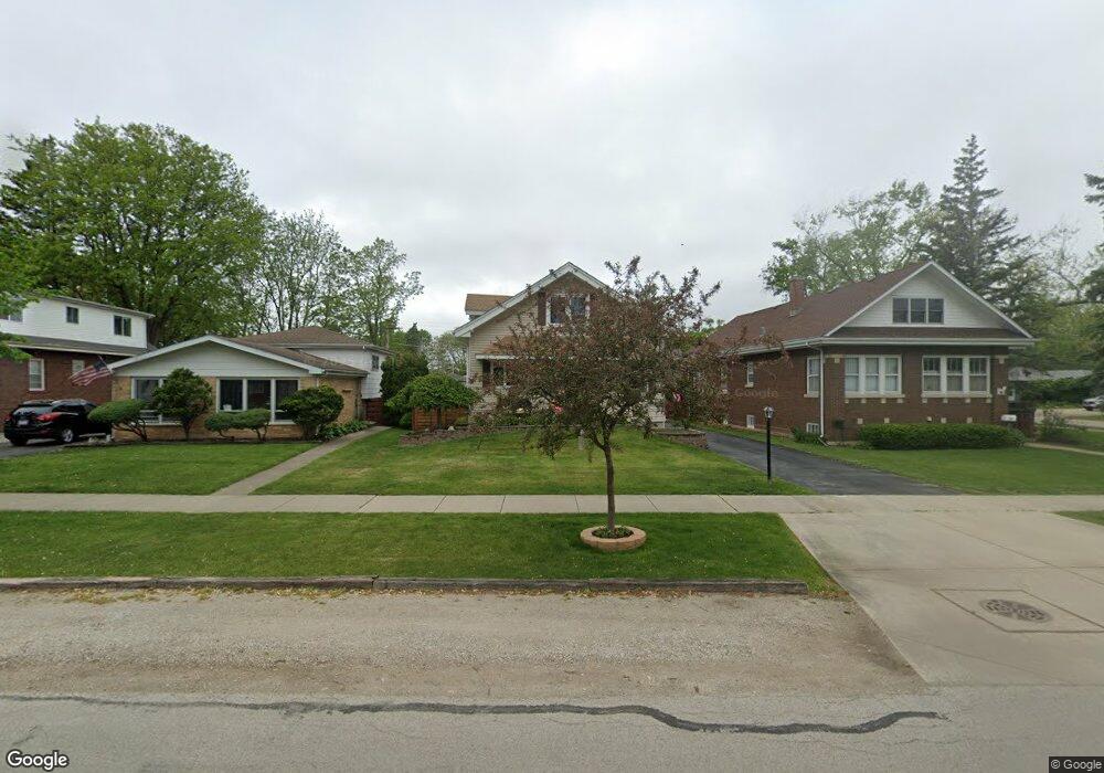
270 Grove Ave Des Plaines, IL 60016
Estimated Value: $311,000 - $404,000
3
Beds
2
Baths
1,459
Sq Ft
$242/Sq Ft
Est. Value
About This Home
This home is located at 270 Grove Ave, Des Plaines, IL 60016 and is currently estimated at $353,583, approximately $242 per square foot. 270 Grove Ave is a home located in Cook County with nearby schools including North Elementary School, Chippewa Middle School, and Maine West High School.
Ownership History
Date
Name
Owned For
Owner Type
Purchase Details
Closed on
Sep 21, 2018
Sold by
Amari Steven G and Amari Patricia A
Bought by
Amari Steven G and Amari Patricia A
Current Estimated Value
Purchase Details
Closed on
Jul 23, 1998
Sold by
Dickinson Amari Patricia A
Bought by
Amari Steven George
Home Financials for this Owner
Home Financials are based on the most recent Mortgage that was taken out on this home.
Original Mortgage
$62,000
Interest Rate
7.07%
Create a Home Valuation Report for This Property
The Home Valuation Report is an in-depth analysis detailing your home's value as well as a comparison with similar homes in the area
Home Values in the Area
Average Home Value in this Area
Purchase History
| Date | Buyer | Sale Price | Title Company |
|---|---|---|---|
| Amari Steven G | -- | Chicago Title Insurance Comp | |
| Amari Steven George | -- | -- | |
| Amari Steven | -- | -- |
Source: Public Records
Mortgage History
| Date | Status | Borrower | Loan Amount |
|---|---|---|---|
| Closed | Amari Steven | $62,000 |
Source: Public Records
Tax History Compared to Growth
Tax History
| Year | Tax Paid | Tax Assessment Tax Assessment Total Assessment is a certain percentage of the fair market value that is determined by local assessors to be the total taxable value of land and additions on the property. | Land | Improvement |
|---|---|---|---|---|
| 2024 | $5,059 | $25,155 | $5,488 | $19,667 |
| 2023 | $2,885 | $27,402 | $5,488 | $21,914 |
| 2022 | $2,885 | $27,402 | $5,488 | $21,914 |
| 2021 | $3,560 | $17,577 | $4,459 | $13,118 |
| 2020 | $3,437 | $17,577 | $4,459 | $13,118 |
| 2019 | $4,333 | $19,531 | $4,459 | $15,072 |
| 2018 | $5,292 | $21,131 | $3,944 | $17,187 |
| 2017 | $5,216 | $21,131 | $3,944 | $17,187 |
| 2016 | $5,178 | $21,131 | $3,944 | $17,187 |
| 2015 | $4,663 | $18,049 | $3,430 | $14,619 |
| 2014 | $4,581 | $18,049 | $3,430 | $14,619 |
| 2013 | $5,035 | $20,076 | $3,430 | $16,646 |
Source: Public Records
Map
Nearby Homes
- 1578 Woodland Ave Unit D
- 430 Oak St
- 1433 Willow Ave
- 394 Alles St Unit 3B
- 365 Graceland Ave Unit 205A
- 555 S River Rd Unit 301
- 395 Graceland Ave Unit 207
- 476 Alles St Unit 508
- 476 Alles St Unit 210
- 501 Alles St Unit 501A
- 1470 Jefferson St Unit 504
- 1470 Jefferson St Unit 405
- 550 Ida St Unit 2NW
- 1389 Perry St Unit 303
- 555 Graceland Ave Unit 206
- 1363 Perry St Unit 1B
- 675 Pearson St Unit 710
- 1353 Perry St Unit 6
- 650 S River Rd Unit 306
- 1675 Mill St Unit 302
- 276 Grove Ave
- 266 Grove Ave
- 280 Grove Ave
- 1637 Sherman Place
- 296 Grove Ave
- 1631 Sherman Place
- 1628 Hills Ave
- 240 Grove Ave
- 269 Grove Ave
- 265 Grove Ave
- 1622 Hills Ave
- 1621 Sherman Place
- 291 Grove Ave
- 295 Grove Ave
- 1632 Sherman Place
- 222 Grove Ave
- 1609 Sherman Place
- 1624 Sherman Place
- 206 Grove Ave
- 206 Grove Ave