Estimated Value: $313,000 - $343,000
4
Beds
3
Baths
1,742
Sq Ft
$189/Sq Ft
Est. Value
About This Home
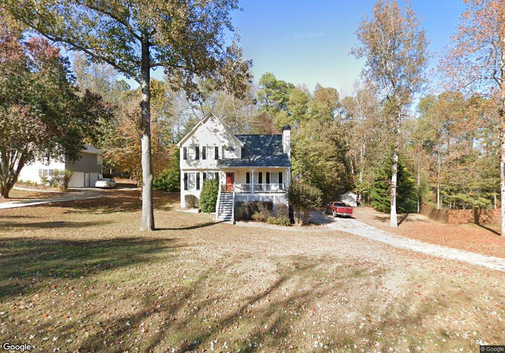
This home is located at 270 Lambeth Dr, Hiram, GA 30141 and is currently estimated at $328,472, approximately $188 per square foot. 270 Lambeth Dr is a home located in Paulding County with nearby schools including Hal Hutchens Elementary School, Irma C. Austin Middle School, and Hiram High School.
Ownership History
Date
Name
Owned For
Owner Type
Purchase Details
Closed on
Oct 5, 2011
Sold by
Lipe Michael W
Current Estimated Value
Purchase Details
Closed on
May 13, 2011
Sold by
Madden Raymond A
Bought by
Lipe Michael W and Lipe Debra A
Home Financials for this Owner
Home Financials are based on the most recent Mortgage that was taken out on this home.
Original Mortgage
$64,000
Interest Rate
4.85%
Mortgage Type
New Conventional
Purchase Details
Closed on
May 19, 2008
Sold by
Ketchum Jennifer L
Bought by
Mckee Raymond A and Madden Tammy
Home Financials for this Owner
Home Financials are based on the most recent Mortgage that was taken out on this home.
Original Mortgage
$131,950
Interest Rate
5.84%
Mortgage Type
FHA
Create a Home Valuation Report for This Property
The Home Valuation Report is an in-depth analysis detailing your home's value as well as a comparison with similar homes in the area
Home Values in the Area
Average Home Value in this Area
Purchase History
| Date | Buyer | Sale Price | Title Company |
|---|---|---|---|
| -- | -- | -- | |
| Lipe Michael W | $80,000 | -- | |
| Mckee Raymond A | $150,000 | -- |
Source: Public Records
Mortgage History
| Date | Status | Borrower | Loan Amount |
|---|---|---|---|
| Previous Owner | Lipe Michael W | $64,000 | |
| Previous Owner | Mckee Raymond A | $131,950 |
Source: Public Records
Tax History Compared to Growth
Tax History
| Year | Tax Paid | Tax Assessment Tax Assessment Total Assessment is a certain percentage of the fair market value that is determined by local assessors to be the total taxable value of land and additions on the property. | Land | Improvement |
|---|---|---|---|---|
| 2024 | $855 | $127,256 | $12,000 | $115,256 |
| 2023 | $1,865 | $116,564 | $12,000 | $104,564 |
| 2022 | $2,269 | $88,920 | $12,000 | $76,920 |
| 2021 | $2,101 | $74,160 | $10,000 | $64,160 |
| 2020 | $2,060 | $71,196 | $10,000 | $61,196 |
| 2019 | $1,762 | $60,348 | $10,000 | $50,348 |
| 2018 | $1,623 | $55,728 | $8,000 | $47,728 |
| 2017 | $1,675 | $56,680 | $8,000 | $48,680 |
| 2016 | $1,442 | $49,552 | $8,000 | $41,552 |
| 2015 | $1,319 | $44,728 | $8,000 | $36,728 |
| 2014 | $1,278 | $42,344 | $8,000 | $34,344 |
| 2013 | -- | $32,840 | $8,000 | $24,840 |
Source: Public Records
Map
Nearby Homes
- 196 Lambeth Dr
- 66 Charlotte Place
- 461 Austin Bridge Rd
- 81 Bridgemill Dr
- 269 Shelby Ln
- 1267 Austin Bridge Rd
- 532 Poole Bridge Rd
- 50 Carrington Hills
- 512 Oakbridge Dr
- 6994 Ridge Rd
- 23 Bomar Ln
- 245 London Ln
- 322 London Ln
- 6652 Ridge Rd
- 178 Hunters Mill Dr
- 496 Hughes Rd
- 232 Bethel Church Rd
- 840 Whitby Dr
- 61 Austin Bridge Ct
- 3061 Dallas Nebo Rd
- 288 Lambeth Dr
- 254 Lambeth Dr
- 1 Misty Ridge Point
- 1 Misty Ridge Point Unit 29
- 304 Lambeth Dr
- 2 Misty Ridge Point
- 277 Lambeth Dr
- 220 Lambeth Dr
- 271 Lambeth Dr
- 10 Misty Ridge Point
- 3 Misty Ridge Point
- 313 Lambeth Dr
- 26 Byron Ct
- 34 Byron Ct
- 209 Lambeth Dr
- 209 Lambeth Dr Unit 110
- 206 Lambeth Dr
- 11 Misty Ridge Point
- 345 Lambeth Dr
- 99 Wren Walk