Estimated Value: $238,258 - $291,000
3
Beds
2
Baths
1,264
Sq Ft
$207/Sq Ft
Est. Value
About This Home
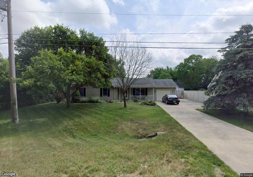
This home is located at 270 Monroe Concord Rd, Troy, OH 45373 and is currently estimated at $261,315, approximately $206 per square foot. 270 Monroe Concord Rd is a home located in Miami County with nearby schools including Concord Elementary School, Van Cleve Elementary School, and Troy Junior High School.
Ownership History
Date
Name
Owned For
Owner Type
Purchase Details
Closed on
Dec 12, 2014
Sold by
Secretary Of Housing & Urban Development
Bought by
Weissbrod Tom
Current Estimated Value
Purchase Details
Closed on
Aug 13, 2002
Sold by
Wilcox James S and Pamela S Wilcox Trust
Bought by
Darrow Ronald E and Hughes Darrow Candace
Home Financials for this Owner
Home Financials are based on the most recent Mortgage that was taken out on this home.
Original Mortgage
$113,998
Interest Rate
6.62%
Mortgage Type
FHA
Purchase Details
Closed on
Jun 28, 1999
Sold by
Mileski Shannon Brook and Zimmer Shannon Brook
Bought by
Wilcox James S and Pamela S Wilcox Trust
Create a Home Valuation Report for This Property
The Home Valuation Report is an in-depth analysis detailing your home's value as well as a comparison with similar homes in the area
Home Values in the Area
Average Home Value in this Area
Purchase History
| Date | Buyer | Sale Price | Title Company |
|---|---|---|---|
| Weissbrod Tom | $82,000 | First Ohio Title Agency | |
| Darrow Ronald E | $114,900 | -- | |
| Wilcox James S | $110,000 | -- |
Source: Public Records
Mortgage History
| Date | Status | Borrower | Loan Amount |
|---|---|---|---|
| Previous Owner | Wilcox James S | $113,998 |
Source: Public Records
Tax History
| Year | Tax Paid | Tax Assessment Tax Assessment Total Assessment is a certain percentage of the fair market value that is determined by local assessors to be the total taxable value of land and additions on the property. | Land | Improvement |
|---|---|---|---|---|
| 2025 | $2,877 | $74,690 | $11,690 | $63,000 |
| 2024 | $2,877 | $60,450 | $13,200 | $47,250 |
| 2023 | $2,557 | $60,450 | $13,200 | $47,250 |
| 2022 | $2,177 | $60,450 | $13,200 | $47,250 |
| 2021 | $1,648 | $44,770 | $9,770 | $35,000 |
| 2020 | $1,650 | $44,770 | $9,770 | $35,000 |
| 2019 | $1,664 | $44,770 | $9,770 | $35,000 |
| 2018 | $1,492 | $38,190 | $10,360 | $27,830 |
| 2017 | $1,505 | $38,190 | $10,360 | $27,830 |
| 2016 | $1,459 | $38,190 | $10,360 | $27,830 |
| 2015 | $1,376 | $36,020 | $9,770 | $26,250 |
| 2014 | $1,376 | $36,020 | $9,770 | $26,250 |
| 2013 | $1,384 | $36,020 | $9,770 | $26,250 |
Source: Public Records
Map
Nearby Homes
- 3135 Honeysuckle Dr
- 2882 Red Oak Cir
- 591 Countryside Dr S
- 974 Stony Brook Ln
- 173 Countryside Dr N
- 20 Boone Dr
- 2685 Merrimont Dr
- 2550 Broken Woods Dr
- 999 Brookwood Dr
- 1704 Chevington Chase
- 1704 Chevington Chase
- 1245 Wind Rock Dr
- 120 Windmere Dr
- 1234 Wind Rock Dr
- 2672 Pleasant View Dr
- 2650 Pleasant View Dr
- 807 Claymore Ct
- 1117 Honeydew Dr
- 0 Lincolnshire Unit 939331
- 735 Chaucer Ln
- 405 Wisteria Dr
- 280 Monroe Concord Rd
- 425 Wisteria Dr
- 320 Green Oak Dr
- 300 Green Oak Dr
- 385 Wisteria Dr
- 290 Green Oak Dr
- 330 Green Oak Dr
- 3015 Dogwood Dr
- 410 Wisteria Dr
- 3033 Dogwood Dr
- 270 Green Oak Dr
- 380 Wisteria Dr
- 450 Wisteria Dr
- 3055 Dogwood Dr
- 374 Brookwood Dr
- 333 Green Oak Dr
- 305 Green Oak Dr
- 3080 Magnolia Dr
- 325 Green Oak Dr
Your Personal Tour Guide
Ask me questions while you tour the home.