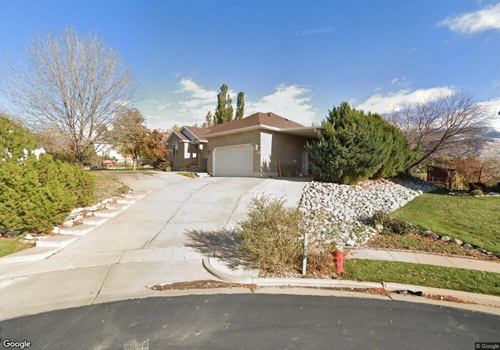
270 N 1550 E Layton, UT 84040
Estimated Value: $669,000 - $769,000
5
Beds
3
Baths
2,874
Sq Ft
$252/Sq Ft
Est. Value
About This Home
This home is located at 270 N 1550 E, Layton, UT 84040 and is currently estimated at $723,963, approximately $251 per square foot. 270 N 1550 E is a home located in Davis County with nearby schools including Whitesides Elementary School, Central Davis Junior High School, and Layton High School.
Ownership History
Date
Name
Owned For
Owner Type
Purchase Details
Closed on
Jul 1, 1998
Sold by
Tidwell Grant F
Bought by
Tidwell Grant F and Tidwell Jolynn
Current Estimated Value
Home Financials for this Owner
Home Financials are based on the most recent Mortgage that was taken out on this home.
Original Mortgage
$134,500
Interest Rate
7.06%
Create a Home Valuation Report for This Property
The Home Valuation Report is an in-depth analysis detailing your home's value as well as a comparison with similar homes in the area
Home Values in the Area
Average Home Value in this Area
Purchase History
| Date | Buyer | Sale Price | Title Company |
|---|---|---|---|
| Tidwell Grant F | -- | Associated Title Company | |
| Tidwell Grant F | -- | Associated Title Company |
Source: Public Records
Mortgage History
| Date | Status | Borrower | Loan Amount |
|---|---|---|---|
| Closed | Tidwell Grant F | $134,500 |
Source: Public Records
Tax History
| Year | Tax Paid | Tax Assessment Tax Assessment Total Assessment is a certain percentage of the fair market value that is determined by local assessors to be the total taxable value of land and additions on the property. | Land | Improvement |
|---|---|---|---|---|
| 2025 | $3,701 | $388,475 | $334,091 | $54,384 |
| 2024 | $3,608 | $381,473 | $334,604 | $46,869 |
| 2023 | $3,610 | $625,000 | $353,985 | $271,015 |
| 2022 | $3,810 | $362,450 | $191,436 | $171,014 |
| 2021 | $3,321 | $473,000 | $290,666 | $182,334 |
| 2020 | $2,999 | $408,000 | $273,039 | $134,961 |
| 2019 | $2,942 | $391,000 | $239,663 | $151,337 |
| 2018 | $2,734 | $363,000 | $223,146 | $139,854 |
| 2016 | $2,358 | $173,189 | $111,049 | $62,140 |
| 2015 | $2,245 | $156,579 | $111,049 | $45,530 |
| 2014 | $2,094 | $149,297 | $111,049 | $38,248 |
| 2013 | -- | $144,409 | $63,579 | $80,830 |
Source: Public Records
Map
Nearby Homes
- 1690 E Gentile St
- 1515 E Gentile St
- 1503 E 530 N
- 479 N 1375 E
- 2877 E Gentile St Unit 2
- 1368 E 275 S
- 1137 Holmes Creek Ln
- 1545 E 975 N
- 187 N Talbot Dr
- 2382 Summerwood Dr
- 508 N Adamswood Rd
- 556 N Fairfield Rd Unit A2
- 556 N Fairfield Rd Unit D1
- 556 N Fairfield Rd Unit D2
- 556 N Fairfield Rd Unit A3
- 556 N Fairfield Rd Unit D3
- 556 N Fairfield Rd Unit D4
- 556 N Fairfield Rd Unit A1
- 556 N Fairfield Rd Unit A4
- 1033 E 825 N
Your Personal Tour Guide
Ask me questions while you tour the home.