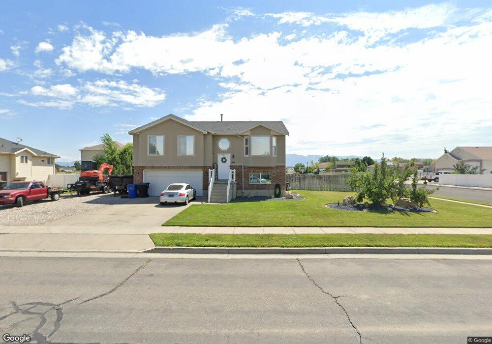
270 N 4750 W West Point, UT 84015
Estimated Value: $443,000 - $582,000
3
Beds
2
Baths
1,764
Sq Ft
$291/Sq Ft
Est. Value
About This Home
This home is located at 270 N 4750 W, West Point, UT 84015 and is currently estimated at $513,204, approximately $290 per square foot. 270 N 4750 W is a home located in Davis County with nearby schools including West Point School, West Point Junior High School, and Syracuse High School.
Ownership History
Date
Name
Owned For
Owner Type
Purchase Details
Closed on
Oct 10, 2019
Sold by
Rich Darren and Rich Katie R
Bought by
Thompson Joshua Patric
Current Estimated Value
Home Financials for this Owner
Home Financials are based on the most recent Mortgage that was taken out on this home.
Original Mortgage
$269,175
Outstanding Balance
$235,290
Interest Rate
3.5%
Mortgage Type
New Conventional
Estimated Equity
$277,914
Purchase Details
Closed on
Aug 8, 2011
Sold by
Federal National Mortgage Association
Bought by
Rich Darren
Home Financials for this Owner
Home Financials are based on the most recent Mortgage that was taken out on this home.
Original Mortgage
$135,000
Interest Rate
4.46%
Mortgage Type
New Conventional
Purchase Details
Closed on
Aug 5, 2011
Sold by
Rich Darren
Bought by
Rich Darren and Rich Katie R
Home Financials for this Owner
Home Financials are based on the most recent Mortgage that was taken out on this home.
Original Mortgage
$135,000
Interest Rate
4.46%
Mortgage Type
New Conventional
Purchase Details
Closed on
Jan 27, 2011
Sold by
Edwards Dustin A and Edwards Amy K
Bought by
Federal National Mortgage Association
Purchase Details
Closed on
Oct 2, 2006
Sold by
Roth Daniel K and Roth Callysa Jean
Bought by
Edwards Dustin A and Edwards Amy K
Home Financials for this Owner
Home Financials are based on the most recent Mortgage that was taken out on this home.
Original Mortgage
$176,000
Interest Rate
6.43%
Mortgage Type
Purchase Money Mortgage
Purchase Details
Closed on
Nov 30, 2004
Sold by
Mark Higley Construction Lc
Bought by
Roth Daniel K and Roth Callysa Jean
Home Financials for this Owner
Home Financials are based on the most recent Mortgage that was taken out on this home.
Original Mortgage
$137,800
Interest Rate
5.65%
Mortgage Type
VA
Purchase Details
Closed on
Apr 19, 2004
Sold by
Paice Farms Llc
Bought by
Mark Higley Construction Lc
Home Financials for this Owner
Home Financials are based on the most recent Mortgage that was taken out on this home.
Original Mortgage
$106,756
Interest Rate
5.39%
Mortgage Type
Purchase Money Mortgage
Purchase Details
Closed on
Apr 16, 2003
Sold by
Mark Higley Construction Lc and Boothe Gordon
Bought by
Paice Farms Llc
Home Financials for this Owner
Home Financials are based on the most recent Mortgage that was taken out on this home.
Original Mortgage
$850,000
Interest Rate
6.22%
Mortgage Type
Seller Take Back
Create a Home Valuation Report for This Property
The Home Valuation Report is an in-depth analysis detailing your home's value as well as a comparison with similar homes in the area
Home Values in the Area
Average Home Value in this Area
Purchase History
| Date | Buyer | Sale Price | Title Company |
|---|---|---|---|
| Thompson Joshua Patric | -- | Investors Title Ins Age | |
| Rich Darren | $150,000 | Us Title Company Of | |
| Rich Darren | -- | Us Title Company Of | |
| Federal National Mortgage Association | -- | Lincoln Title Ins Agency | |
| Edwards Dustin A | -- | Equity Title Ins Agency Inc | |
| Roth Daniel K | -- | Heritage West Title Ins Agen | |
| Mark Higley Construction Lc | -- | Heritage West Title Ins | |
| Paice Farms Llc | -- | Heritage West Title Insuranc |
Source: Public Records
Mortgage History
| Date | Status | Borrower | Loan Amount |
|---|---|---|---|
| Open | Thompson Joshua Patric | $269,175 | |
| Previous Owner | Rich Darren | $135,000 | |
| Previous Owner | Edwards Dustin A | $176,000 | |
| Previous Owner | Roth Daniel K | $137,800 | |
| Previous Owner | Mark Higley Construction Lc | $106,756 | |
| Previous Owner | Paice Farms Llc | $850,000 |
Source: Public Records
Tax History Compared to Growth
Tax History
| Year | Tax Paid | Tax Assessment Tax Assessment Total Assessment is a certain percentage of the fair market value that is determined by local assessors to be the total taxable value of land and additions on the property. | Land | Improvement |
|---|---|---|---|---|
| 2025 | $2,749 | $253,000 | $107,052 | $145,948 |
| 2024 | $2,410 | $222,750 | $96,379 | $126,371 |
| 2023 | $2,330 | $396,000 | $120,061 | $275,939 |
| 2022 | $2,500 | $232,651 | $62,431 | $170,220 |
| 2021 | $2,307 | $321,000 | $97,626 | $223,374 |
| 2020 | $2,029 | $278,000 | $82,000 | $196,000 |
| 2019 | $1,971 | $266,000 | $79,560 | $186,440 |
| 2018 | $1,799 | $239,000 | $79,595 | $159,405 |
| 2016 | $1,548 | $107,910 | $30,796 | $77,114 |
| 2015 | $1,559 | $103,015 | $30,796 | $72,219 |
| 2014 | $1,548 | $103,510 | $30,796 | $72,714 |
| 2013 | -- | $95,340 | $30,260 | $65,080 |
Source: Public Records
Map
Nearby Homes
- 4669 W 75 N
- 4594 W 75 N Unit 405
- 128 N 4500 W
- 477 N 4500 W
- 4366 W 200 N
- 4352 W 300 N
- 4325 W 75 N
- 120 N 4325 W
- 4362 West St Unit 106
- 4358 West St Unit 105
- 4719 W 650 N
- 356 S 4300 W Unit 611
- 364 S 4300 W Unit 610
- 357 N 4000 W
- 3949 W 250 N
- Charleston Plan at Bluff View
- 696 S 4500 W
- 3851 W 50 S Unit 425
- 3849 W 50 S Unit 426
- 3847 W 50 S Unit 428
- 4720 Jean Dr
- 4720 Jean Dr Unit 208
- 4720 W 250 N
- 4717 W 300 N
- 267 N 4750 W
- 224 Pheasant Run
- 283 N 4750 W
- 4719 W 250 N
- 4607 Jean Dr Unit 232
- 239 N 4750 W
- 4692 W 250 N
- 4692 Jean Dr Unit 209
- 4689 W 300 N
- 192 N 4750 W
- 4755 W 300 N
- 195 Green Head Ln Unit 227
- 195 Green Head Ln
- 4776 W 175 N
- 4666 Jean Dr Unit 210
- 222 Green Head Ln Unit 229