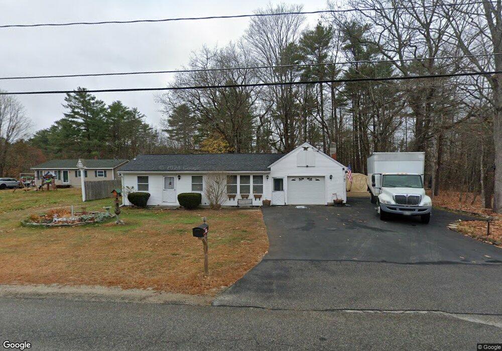
270 N Gorham Rd Gorham, ME 04038
North Gorham NeighborhoodEstimated Value: $187,000 - $435,000
2
Beds
1
Bath
1,080
Sq Ft
$303/Sq Ft
Est. Value
About This Home
This home is located at 270 N Gorham Rd, Gorham, ME 04038 and is currently estimated at $327,046, approximately $302 per square foot. 270 N Gorham Rd is a home located in Cumberland County with nearby schools including Great Falls Elementary School, Gorham Middle School, and Gorham High School.
Ownership History
Date
Name
Owned For
Owner Type
Purchase Details
Closed on
Aug 13, 2021
Sold by
Spink Richard A and Spink Donald P
Bought by
Spink Donald P
Current Estimated Value
Home Financials for this Owner
Home Financials are based on the most recent Mortgage that was taken out on this home.
Original Mortgage
$113,000
Outstanding Balance
$101,637
Interest Rate
2.9%
Mortgage Type
Purchase Money Mortgage
Estimated Equity
$225,409
Purchase Details
Closed on
Nov 18, 2016
Sold by
Spink Arthur M
Bought by
Spink Kenneth W and Spink Richard A
Create a Home Valuation Report for This Property
The Home Valuation Report is an in-depth analysis detailing your home's value as well as a comparison with similar homes in the area
Home Values in the Area
Average Home Value in this Area
Purchase History
| Date | Buyer | Sale Price | Title Company |
|---|---|---|---|
| Spink Donald P | -- | None Available | |
| Spink Kenneth W | -- | -- |
Source: Public Records
Mortgage History
| Date | Status | Borrower | Loan Amount |
|---|---|---|---|
| Open | Spink Donald P | $113,000 |
Source: Public Records
Tax History
| Year | Tax Paid | Tax Assessment Tax Assessment Total Assessment is a certain percentage of the fair market value that is determined by local assessors to be the total taxable value of land and additions on the property. | Land | Improvement |
|---|---|---|---|---|
| 2025 | $3,373 | $227,900 | $62,300 | $165,600 |
| 2024 | $3,350 | $227,900 | $62,300 | $165,600 |
| 2023 | $3,134 | $227,900 | $62,300 | $165,600 |
| 2022 | $2,929 | $227,900 | $62,300 | $165,600 |
| 2021 | $2,415 | $124,500 | $43,400 | $81,100 |
| 2020 | $2,366 | $124,500 | $43,400 | $81,100 |
| 2019 | $2,359 | $124,500 | $43,400 | $81,100 |
| 2018 | $2,266 | $124,500 | $43,400 | $81,100 |
| 2017 | $2,129 | $124,500 | $43,400 | $81,100 |
| 2016 | $2,115 | $124,400 | $43,300 | $81,100 |
| 2015 | $2,028 | $124,400 | $43,300 | $81,100 |
| 2014 | $1,938 | $111,400 | $41,100 | $70,300 |
| 2013 | $1,927 | $111,400 | $41,100 | $70,300 |
Source: Public Records
Map
Nearby Homes
- 215 N Gorham Rd
- 32 Middle Jam Rd
- 32 Patriot Place
- 21 Shyannes Way
- 5 Cardinal Ln
- 81 N Gorham Rd
- 6 Gilman Rd
- 404 Pope Rd
- 34 Stoneridge Dr
- 594 River Rd
- 55 Page Rd
- 18 Cook Rd
- 0 Turning Leaf Dr Unit 1640377
- 81 Hall Rd
- 8 Beaulieu Dr
- 103 Basin Rd
- 34 Robin Ln
- 2 Aerie Dr
- Lot #1 Chamberlain Dr
- 194 Hearthside Rd
- 260 N Gorham Rd
- 271 N Gorham Rd
- 274 N Gorham Rd
- 259A N Gorham Rd
- 259 N Gorham Rd
- 277 N Gorham Rd
- 263 N North Gorham Rd
- 5 Blueberry Ln
- 12 Bemmy Dr
- 251 N Gorham Rd
- 282 N Gorham Rd
- 281 N Gorham Rd
- tbd N Gorham Rd
- Unt 7 Gorham Rd
- 249 N Gorham Rd
- 284 N Gorham Rd
- 290 N Gorham Rd
- 287 N Gorham Rd
- 25 Bell Run
- 0 Standish Neck
Your Personal Tour Guide
Ask me questions while you tour the home.