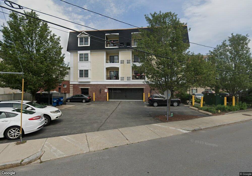
270 N Main St Unit 101 Mansfield, MA 02048
--
Bed
1
Bath
1,509
Sq Ft
--
Built
About This Home
This home is located at 270 N Main St Unit 101, Mansfield, MA 02048. 270 N Main St Unit 101 is a home located in Bristol County with nearby schools including Everett W. Robinson Elementary School, Jordan/Jackson Elementary School, and Harold L. Qualters Middle School.
Ownership History
Date
Name
Owned For
Owner Type
Purchase Details
Closed on
Sep 30, 2011
Sold by
Fnma
Bought by
Lea Fergus C
Purchase Details
Closed on
Sep 23, 2005
Sold by
Jekasa Rt and Torman
Bought by
Crugnale Prop Llc
Home Financials for this Owner
Home Financials are based on the most recent Mortgage that was taken out on this home.
Original Mortgage
$4,500,000
Interest Rate
5.92%
Mortgage Type
Commercial
Create a Home Valuation Report for This Property
The Home Valuation Report is an in-depth analysis detailing your home's value as well as a comparison with similar homes in the area
Home Values in the Area
Average Home Value in this Area
Purchase History
| Date | Buyer | Sale Price | Title Company |
|---|---|---|---|
| Lea Fergus C | $200,000 | -- | |
| Lea Fergus C | $200,000 | -- | |
| Crugnale Prop Llc | $920,000 | -- | |
| Crugnale Prop Llc | $920,000 | -- |
Source: Public Records
Mortgage History
| Date | Status | Borrower | Loan Amount |
|---|---|---|---|
| Previous Owner | Crugnale Prop Llc | $361,835 | |
| Previous Owner | Crugnale Prop Llc | $66,671 | |
| Previous Owner | Crugnale Prop Llc | $4,500,000 |
Source: Public Records
Tax History Compared to Growth
Tax History
| Year | Tax Paid | Tax Assessment Tax Assessment Total Assessment is a certain percentage of the fair market value that is determined by local assessors to be the total taxable value of land and additions on the property. | Land | Improvement |
|---|---|---|---|---|
| 2025 | $4,698 | $234,300 | $0 | $234,300 |
| 2024 | $5,076 | $266,200 | $0 | $266,200 |
| 2023 | $4,411 | $238,200 | $0 | $238,200 |
| 2022 | $4,356 | $230,700 | $0 | $230,700 |
| 2021 | $5,074 | $224,700 | $0 | $224,700 |
| 2020 | $5,039 | $233,300 | $0 | $233,300 |
| 2019 | $4,769 | $233,300 | $0 | $233,300 |
| 2018 | $4,997 | $233,300 | $0 | $233,300 |
| 2017 | $4,339 | $216,100 | $0 | $216,100 |
| 2016 | $4,346 | $211,200 | $0 | $211,200 |
| 2015 | $4,382 | $211,200 | $0 | $211,200 |
Source: Public Records
Map
Nearby Homes
- 150 Rumford Ave Unit 110
- 22 Pleasant St Unit C
- 28 Court St
- 82 Brook St
- 166 Chauncy St
- 28 Angell St
- 44 Angell St Unit 44
- 277 Central St
- 619 N Main St
- 356 Central St
- 12 Spring St
- 414 Branch St
- 631 East St Unit E203
- 442 Ware St
- 460 Ware St
- 261 East St
- 6 Erick Rd Unit 73
- 151 Stearns Ave
- 1 Revere Dr
- 16 Erick Rd Unit 34
- 270 N Main St Unit 406
- 270 N Main St Unit 405
- 270 N Main St Unit 404
- 270 N Main St Unit 16
- 270 N Main St Unit 402
- 270 N Main St Unit 401
- 270 N Main St Unit 13
- 270 N Main St Unit 305
- 270 N Main St Unit 304
- 270 N Main St Unit 303
- 270 N Main St Unit 302
- 270 N Main St Unit 301
- 270 N Main St Unit 7
- 270 N Main St Unit 6
- 270 N Main St Unit 204
- 270 N Main St Unit 203
- 270 N Main St Unit 202
- 270 N Main St Unit 201
- 270 N Main St
- 270 N Main St Unit 2