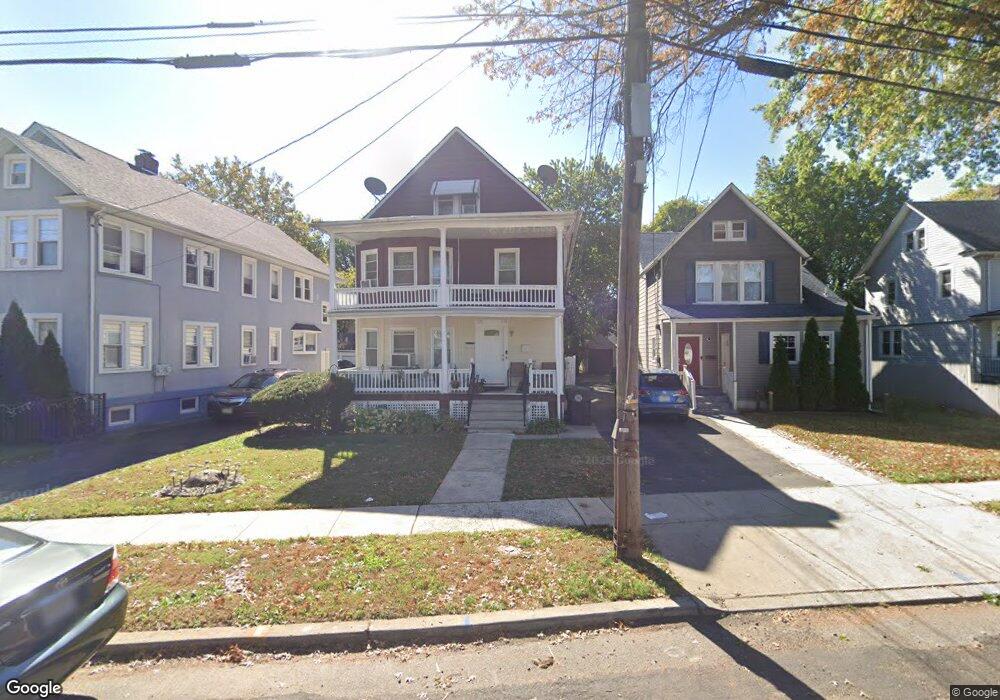
270 Netherwood Ave Unit 72 Plainfield, NJ 07062
Estimated Value: $379,000 - $723,000
--
Bed
--
Bath
2,432
Sq Ft
$237/Sq Ft
Est. Value
About This Home
This home is located at 270 Netherwood Ave Unit 72, Plainfield, NJ 07062 and is currently estimated at $577,530, approximately $237 per square foot. 270 Netherwood Ave Unit 72 is a home located in Union County with nearby schools including Emerson Community School, Maxson Middle School, and Plainfield High School.
Ownership History
Date
Name
Owned For
Owner Type
Purchase Details
Closed on
Jun 7, 2001
Sold by
Condelli Joanne T and Basso Andrew E
Bought by
Carter Ernestine
Current Estimated Value
Home Financials for this Owner
Home Financials are based on the most recent Mortgage that was taken out on this home.
Original Mortgage
$114,000
Outstanding Balance
$43,457
Interest Rate
7.15%
Estimated Equity
$534,073
Purchase Details
Closed on
Aug 1, 1995
Sold by
Basso Andrew and Cannova Margaret
Bought by
Basso Robert and Basso Andrew
Create a Home Valuation Report for This Property
The Home Valuation Report is an in-depth analysis detailing your home's value as well as a comparison with similar homes in the area
Home Values in the Area
Average Home Value in this Area
Purchase History
| Date | Buyer | Sale Price | Title Company |
|---|---|---|---|
| Carter Ernestine | $120,000 | -- | |
| Basso Robert | -- | -- | |
| Basso Robert | -- | -- |
Source: Public Records
Mortgage History
| Date | Status | Borrower | Loan Amount |
|---|---|---|---|
| Open | Carter Ernestine | $114,000 |
Source: Public Records
Tax History Compared to Growth
Tax History
| Year | Tax Paid | Tax Assessment Tax Assessment Total Assessment is a certain percentage of the fair market value that is determined by local assessors to be the total taxable value of land and additions on the property. | Land | Improvement |
|---|---|---|---|---|
| 2025 | $11,194 | $128,200 | $35,200 | $93,000 |
| 2024 | $11,084 | $128,200 | $35,200 | $93,000 |
| 2023 | $11,084 | $128,200 | $35,200 | $93,000 |
| 2022 | $10,844 | $128,200 | $35,200 | $93,000 |
| 2021 | $10,750 | $128,200 | $35,200 | $93,000 |
| 2020 | $10,719 | $128,200 | $35,200 | $93,000 |
| 2019 | $10,719 | $128,200 | $35,200 | $93,000 |
| 2018 | $10,494 | $128,200 | $35,200 | $93,000 |
| 2017 | $10,238 | $128,200 | $35,200 | $93,000 |
| 2016 | $10,029 | $128,200 | $35,200 | $93,000 |
| 2015 | $9,733 | $128,200 | $35,200 | $93,000 |
| 2014 | -- | $128,200 | $35,200 | $93,000 |
Source: Public Records
Map
Nearby Homes
- 258 Netherwood Ave Unit 60
- 343 Netherwood Ave Unit 45
- 1107 North Ave Unit 11
- 1107-11 North Ave
- 1123 E 3rd St Unit 25
- 213 Netherwood Ave Unit 15
- 823 E 3rd St Unit 25
- 358-400 E 2nd St
- 836 E 2nd St Unit 38
- 808 E 3rd St
- 1206 E 2nd St Unit 8
- 1255 Columbia Ave Unit 57
- 153-55 Leland Ave
- 225 Sumner Ave Unit 27
- 125 Leland Ave Unit 27
- 949 E Front St
- 949 E Front St Unit A
- 959 E Front St Unit D
- 812 E 6th St
- 1003 E Front St Unit A
- 274 Netherwood Ave Unit 76
- 266 Netherwood Ave Unit 68
- 274-76 Netherwood Ave
- 262 Netherwood Ave Unit 64
- 278 Netherwood Ave Unit 82
- 1009 George St Unit 11
- 284 Netherwood Ave Unit 86
- 259 Garfield Ave Unit 61
- 269 Garfield Ave Unit 73
- 269 Garfield Ave Unit 73
- 254-56 Netherwood Ave
- 254 Netherwood Ave Unit 56
- 275 Garfield Ave Unit 79
- 263 Garfield Ave Unit 67
- 255 Garfield Ave Unit 57
- 263 Netherwood Ave
- 248 Netherwood Ave Unit 52
- 251 Garfield Ave Unit 53
- 269 Netherwood Ave Unit 71
- 273 Netherwood Ave