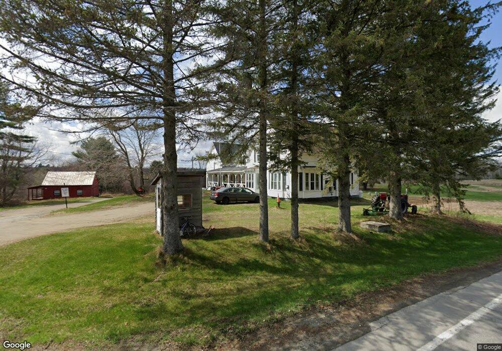
270 Red Bridge Rd Canaan, ME 04924
Estimated Value: $270,461 - $319,000
4
Beds
2
Baths
2,280
Sq Ft
$131/Sq Ft
Est. Value
About This Home
This home is located at 270 Red Bridge Rd, Canaan, ME 04924 and is currently estimated at $298,615, approximately $130 per square foot. 270 Red Bridge Rd is a home located in Somerset County.
Ownership History
Date
Name
Owned For
Owner Type
Purchase Details
Closed on
Sep 3, 2009
Sold by
Teixeira Dean E and Teixeira Catherine R
Bought by
Runnells Gary G and Runnells Lori A
Current Estimated Value
Purchase Details
Closed on
Oct 14, 2008
Sold by
Us Bank Na
Bought by
Runnells Gary and Runnells Lori
Purchase Details
Closed on
May 27, 2008
Sold by
Us Bank Na
Bought by
Us Bank Na
Purchase Details
Closed on
Dec 13, 2005
Sold by
Teixeira Dean E
Bought by
Teixeira Dean E and Teixeira Catherine R
Purchase Details
Closed on
Nov 28, 2005
Sold by
Teixeira Dean E
Bought by
Teixeira Catherine R
Create a Home Valuation Report for This Property
The Home Valuation Report is an in-depth analysis detailing your home's value as well as a comparison with similar homes in the area
Home Values in the Area
Average Home Value in this Area
Purchase History
| Date | Buyer | Sale Price | Title Company |
|---|---|---|---|
| Runnells Gary G | -- | -- | |
| Runnells Gary | -- | -- | |
| Us Bank Na | -- | -- | |
| Teixeira Dean E | -- | -- | |
| Teixeira Catherine R | -- | -- |
Source: Public Records
Tax History Compared to Growth
Tax History
| Year | Tax Paid | Tax Assessment Tax Assessment Total Assessment is a certain percentage of the fair market value that is determined by local assessors to be the total taxable value of land and additions on the property. | Land | Improvement |
|---|---|---|---|---|
| 2024 | $2,377 | $224,200 | $47,200 | $177,000 |
| 2023 | $2,253 | $118,600 | $28,900 | $89,700 |
| 2022 | $1,957 | $118,600 | $28,900 | $89,700 |
| 2021 | $2,087 | $118,600 | $28,900 | $89,700 |
| 2020 | $2,016 | $118,600 | $28,900 | $89,700 |
| 2019 | $2,004 | $118,600 | $28,900 | $89,700 |
| 2018 | $1,933 | $118,600 | $28,900 | $89,700 |
| 2017 | $1,815 | $118,600 | $28,900 | $89,700 |
| 2016 | $1,657 | $114,300 | $28,900 | $85,400 |
| 2015 | $1,795 | $114,300 | $28,900 | $85,400 |
| 2014 | $1,829 | $114,300 | $28,900 | $85,400 |
| 2013 | $1,852 | $114,300 | $28,900 | $85,400 |
Source: Public Records
Map
Nearby Homes
- Lot 7 Oak Pond Rd
- Lot 6 Oak Pond Rd
- Lot 5 Oak Pond Rd
- Lot 4 Oak Pond Rd
- Lot 3 Oak Pond Rd
- Lot 2 Oak Pond Rd
- Lot 1 Oak Pond Rd
- 376 Battle Ridge Rd
- Skowhegan Po M11 L46 Woodcock Ln
- 777 Hinckley Rd
- 22 Tobey Rd
- 236 Main St
- 289 Main St
- Lot 52 Ella Gerald Rd
- 1242 Canaan Rd
- 648 Battle Ridge Rd
- 180 Lambert Rd
- 420 Main St
- 13 Aspen Ln
- 189 Pinnacle Rd
- 404 Hinckley Rd
- 262 Red Bridge Rd
- 17 Crooked Creek Dr
- 433 Hinckley Rd
- 454 Hinckley Rd
- 460 Hinckley Rd
- 334 Hinckley Rd
- 0 Red Bridge Rd Unit 734111
- 0 Red Bridge Rd Unit 1083736
- 0 Red Bridge Rd Unit 1160732
- 0 Red Bridge Rd Unit 1519010
- 206 Red Bridge Rd
- 327 Hinckley Rd
- 326 Hinckley Rd
- 313 Hinckley Rd
- 20 Stream Ln
- 489 Hinckley Rd
- 186 Red Bridge Rd
- 174 Red Bridge Rd
- 294 Hinckley Rd