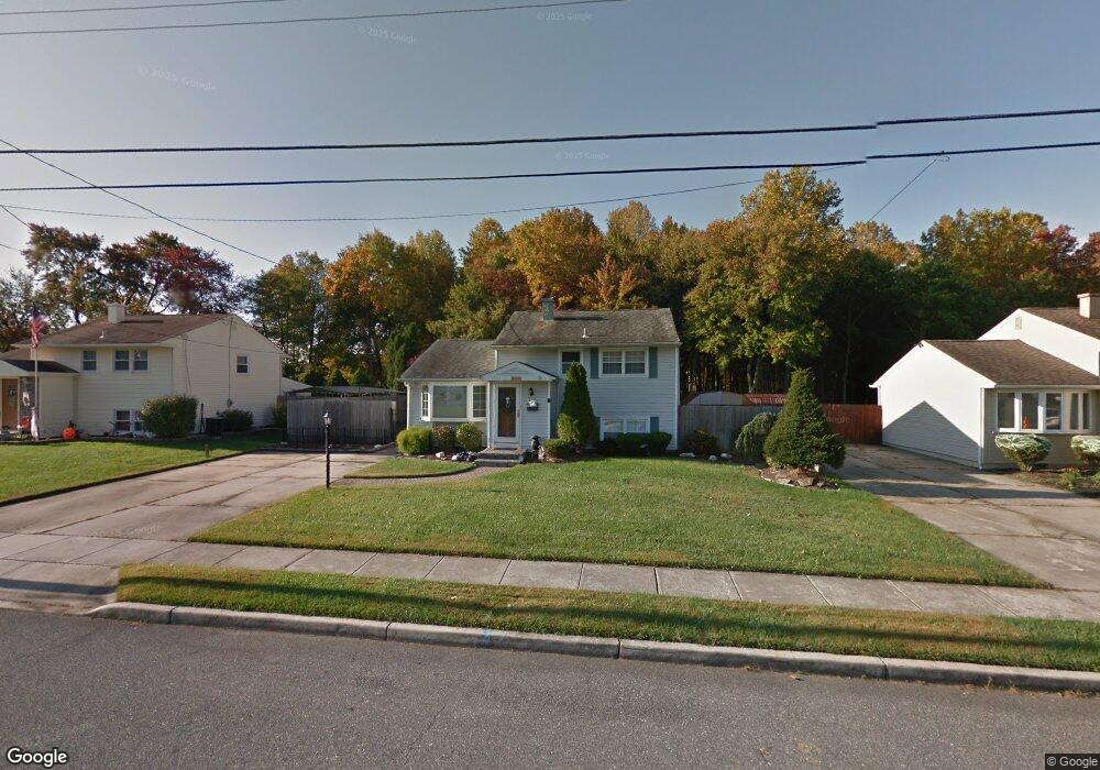
270 Stanford Ave Wenonah, NJ 08090
Deptford Township NeighborhoodEstimated Value: $307,656 - $329,000
3
Beds
1
Bath
1,348
Sq Ft
$239/Sq Ft
Est. Value
About This Home
This home is located at 270 Stanford Ave, Wenonah, NJ 08090 and is currently estimated at $321,664, approximately $238 per square foot. 270 Stanford Ave is a home located in Gloucester County with nearby schools including Deptford Township High School and St Margaret Regional School.
Ownership History
Date
Name
Owned For
Owner Type
Purchase Details
Closed on
Aug 20, 2009
Sold by
Colligon David E and Colligon Zena M
Bought by
Williams Jeffrey R and Pagano Laura L
Current Estimated Value
Home Financials for this Owner
Home Financials are based on the most recent Mortgage that was taken out on this home.
Original Mortgage
$176,739
Outstanding Balance
$115,646
Interest Rate
5.28%
Mortgage Type
FHA
Estimated Equity
$206,018
Purchase Details
Closed on
Apr 30, 2003
Sold by
Morace Robert M and Morace Dawn M
Bought by
Colligon David E and Colligon Zena M
Home Financials for this Owner
Home Financials are based on the most recent Mortgage that was taken out on this home.
Original Mortgage
$146,775
Interest Rate
5.93%
Mortgage Type
VA
Purchase Details
Closed on
Aug 30, 1995
Sold by
Dinicola Frank and Dinicola Roxanne
Bought by
Morace Robert and Plunkett Dawn
Create a Home Valuation Report for This Property
The Home Valuation Report is an in-depth analysis detailing your home's value as well as a comparison with similar homes in the area
Home Values in the Area
Average Home Value in this Area
Purchase History
| Date | Buyer | Sale Price | Title Company |
|---|---|---|---|
| Williams Jeffrey R | $180,000 | Group 21 Title Agency | |
| Colligon David E | $142,500 | Congress | |
| Morace Robert | $86,600 | Sentry Land Title Agency Inc |
Source: Public Records
Mortgage History
| Date | Status | Borrower | Loan Amount |
|---|---|---|---|
| Open | Williams Jeffrey R | $176,739 | |
| Previous Owner | Colligon David E | $146,775 |
Source: Public Records
Tax History Compared to Growth
Tax History
| Year | Tax Paid | Tax Assessment Tax Assessment Total Assessment is a certain percentage of the fair market value that is determined by local assessors to be the total taxable value of land and additions on the property. | Land | Improvement |
|---|---|---|---|---|
| 2025 | $5,388 | $150,300 | $38,900 | $111,400 |
| 2024 | $5,215 | $150,300 | $38,900 | $111,400 |
| 2023 | $5,215 | $150,300 | $38,900 | $111,400 |
| 2022 | $5,178 | $150,300 | $38,900 | $111,400 |
| 2021 | $5,104 | $150,300 | $38,900 | $111,400 |
| 2020 | $5,046 | $150,300 | $38,900 | $111,400 |
| 2019 | $4,949 | $150,300 | $38,900 | $111,400 |
| 2018 | $4,838 | $150,300 | $38,900 | $111,400 |
| 2017 | $4,709 | $150,300 | $38,900 | $111,400 |
| 2016 | $4,613 | $150,300 | $38,900 | $111,400 |
| 2015 | $4,470 | $150,300 | $38,900 | $111,400 |
| 2014 | $4,354 | $150,300 | $38,900 | $111,400 |
Source: Public Records
Map
Nearby Homes
- 114 Buddy Powell Ln
- 100 Buddy Powell Ln
- 916 Georgetown Rd
- 7 Manchester Ct
- 313 Ogden Station Rd
- 315 Ogden Station Rd
- 711 Howard Ave
- 629 Vassar Rd
- 525 Westminster Rd
- 505 University Blvd
- 136 Vanderbilt Ave
- 748 Dartmouth Dr
- 125 Ivy Ln
- 213 Barclay Ct
- 477 Bucknell Ave
- 111 Cove Rd
- 807 Saint Regis Ct
- 417 Auburn St
- 418 Westminster Rd
- 441 Bucknell Ave
- 266 Stanford Ave
- 274 Stanford Ave
- 262 Stanford Ave
- 278 Stanford Ave
- 633 Franklin Rd
- 632 Westminister Rd
- 258 Stanford Ave
- 629 Franklin Rd
- 628 Westminister Rd
- 133 Buddy Powell Ln Unit GM 606
- 131 Buddy Powell Ln
- 632 Franklin Rd
- 129 Buddy Powell Ln Unit GM 604
- 135 Buddy Powell Ln
- 254 Stanford Ave
- 127 Buddy Powell Ln
- 127 Buddy Powell Lan Buddy Powell Ln
- 286 Stanford Ave
- 125 Buddy Powell Ln
- 137 Buddy Powell Ln