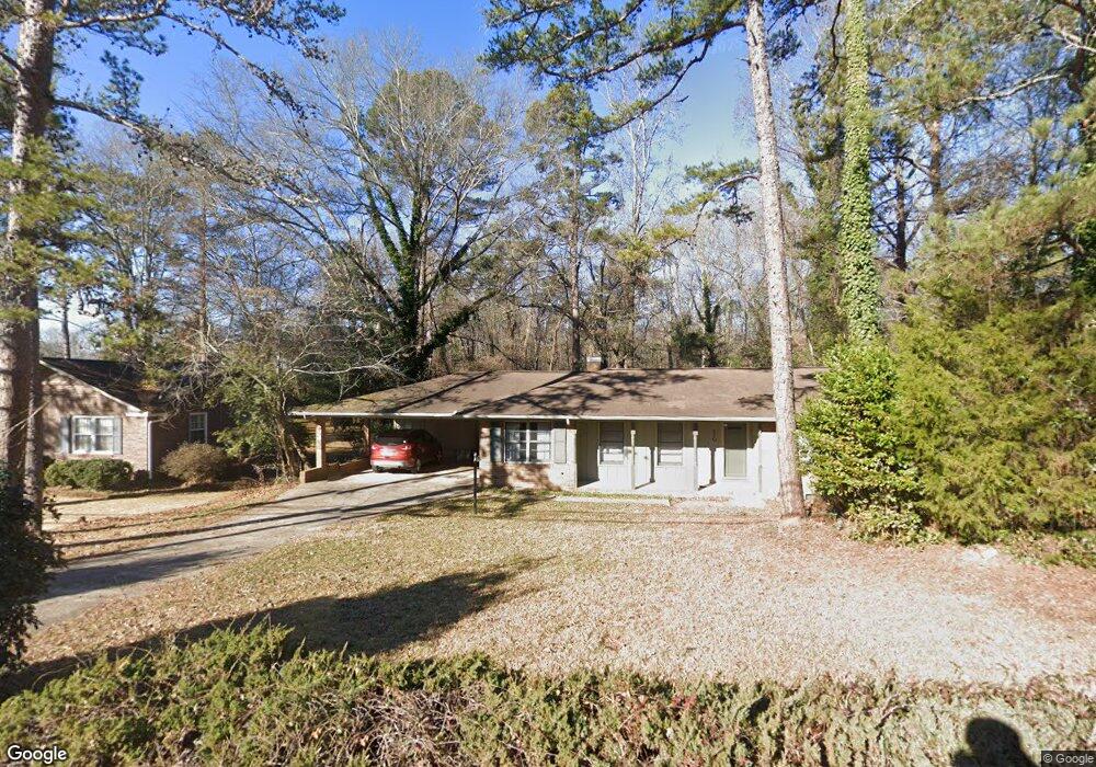
270 University Cir Athens, GA 30605
Estimated Value: $292,419 - $332,000
3
Beds
2
Baths
1,634
Sq Ft
$192/Sq Ft
Est. Value
About This Home
This home is located at 270 University Cir, Athens, GA 30605 and is currently estimated at $313,605, approximately $191 per square foot. 270 University Cir is a home located in Clarke County with nearby schools including Barnett Shoals Elementary School, Hilsman Middle School, and Cedar Shoals High School.
Ownership History
Date
Name
Owned For
Owner Type
Purchase Details
Closed on
Mar 30, 2020
Sold by
Hofmeister Erik
Bought by
Hofmeister Erik and Hofmeister Erik
Current Estimated Value
Purchase Details
Closed on
Feb 27, 2009
Sold by
Abbott Douglas O
Bought by
Hofmeister Erik
Home Financials for this Owner
Home Financials are based on the most recent Mortgage that was taken out on this home.
Original Mortgage
$84,000
Interest Rate
5.14%
Mortgage Type
New Conventional
Purchase Details
Closed on
Feb 11, 1999
Sold by
Jablonski Charles C and Jablonski Karen A
Bought by
Abbott Douglas O and Mary Lou Abbott
Purchase Details
Closed on
Sep 30, 1993
Sold by
Tillotson Marian L
Bought by
Jablonski Charles C and Jablo Karen A
Purchase Details
Closed on
Jun 27, 1989
Sold by
Faulkner Deborah A
Bought by
Tillotson Marian L
Create a Home Valuation Report for This Property
The Home Valuation Report is an in-depth analysis detailing your home's value as well as a comparison with similar homes in the area
Home Values in the Area
Average Home Value in this Area
Purchase History
| Date | Buyer | Sale Price | Title Company |
|---|---|---|---|
| Hofmeister Erik | -- | -- | |
| Hofmeister Erik | $120,000 | -- | |
| Abbott Douglas O | $94,900 | -- | |
| Jablonski Charles C | $75,000 | -- | |
| Tillotson Marian L | $65,000 | -- |
Source: Public Records
Mortgage History
| Date | Status | Borrower | Loan Amount |
|---|---|---|---|
| Previous Owner | Hofmeister Erik | $84,000 |
Source: Public Records
Tax History Compared to Growth
Tax History
| Year | Tax Paid | Tax Assessment Tax Assessment Total Assessment is a certain percentage of the fair market value that is determined by local assessors to be the total taxable value of land and additions on the property. | Land | Improvement |
|---|---|---|---|---|
| 2025 | $3,311 | $106,626 | $12,000 | $94,626 |
| 2024 | $3,311 | $98,368 | $12,000 | $86,368 |
| 2023 | $3,074 | $92,476 | $12,000 | $80,476 |
| 2022 | $2,564 | $80,370 | $12,000 | $68,370 |
| 2021 | $2,169 | $64,359 | $12,000 | $52,359 |
| 2020 | $2,021 | $59,980 | $12,000 | $47,980 |
| 2019 | $1,953 | $57,520 | $12,000 | $45,520 |
| 2018 | $1,870 | $55,077 | $12,000 | $43,077 |
| 2017 | $1,612 | $47,477 | $12,000 | $35,477 |
| 2016 | $1,625 | $47,849 | $12,000 | $35,849 |
| 2015 | $1,631 | $47,960 | $12,000 | $35,960 |
| 2014 | $1,650 | $48,453 | $12,000 | $36,453 |
Source: Public Records
Map
Nearby Homes
- 270 University Cir Unit 270 University Circl
- 280 University Cir
- 260 University Cir
- 240 University Cir
- 290 University Cir
- 275 University Cir
- 285 University Cir
- 140 Spalding Cir
- 245 University Cir
- 220 University Cir
- 295 University Cir
- 150 Spalding Cir
- 300 University Cir
- 210 University Cir
- 110 Vista Dr
- 106 Stafford Dr
- 160 Vista Dr
- 112 Stafford Dr
- 305 University Cir
- 118 Stafford Dr