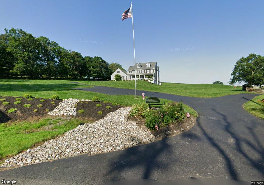
2700 Allentown Rd Quakertown, PA 18951
Milford-Quakertown NeighborhoodEstimated Value: $615,000 - $708,000
4
Beds
3
Baths
2,822
Sq Ft
$239/Sq Ft
Est. Value
About This Home
This home is located at 2700 Allentown Rd, Quakertown, PA 18951 and is currently estimated at $675,079, approximately $239 per square foot. 2700 Allentown Rd is a home with nearby schools including Pfaff Elementary School, Quakertown Community Senior High School, and Providence Hybrid Academy.
Ownership History
Date
Name
Owned For
Owner Type
Purchase Details
Closed on
Jan 8, 2015
Sold by
Clemens Randy S and Clemens Deborah L
Bought by
Herd Ronald J and Herd Celia J
Current Estimated Value
Home Financials for this Owner
Home Financials are based on the most recent Mortgage that was taken out on this home.
Original Mortgage
$329,600
Interest Rate
3.99%
Mortgage Type
New Conventional
Create a Home Valuation Report for This Property
The Home Valuation Report is an in-depth analysis detailing your home's value as well as a comparison with similar homes in the area
Home Values in the Area
Average Home Value in this Area
Purchase History
| Date | Buyer | Sale Price | Title Company |
|---|---|---|---|
| Herd Ronald J | -- | First American Title Ins Co |
Source: Public Records
Mortgage History
| Date | Status | Borrower | Loan Amount |
|---|---|---|---|
| Closed | Herd Ronald J | $329,600 |
Source: Public Records
Tax History Compared to Growth
Tax History
| Year | Tax Paid | Tax Assessment Tax Assessment Total Assessment is a certain percentage of the fair market value that is determined by local assessors to be the total taxable value of land and additions on the property. | Land | Improvement |
|---|---|---|---|---|
| 2025 | $8,730 | $43,290 | $5,870 | $37,420 |
| 2024 | $8,730 | $43,290 | $5,870 | $37,420 |
| 2023 | $8,643 | $43,290 | $5,870 | $37,420 |
| 2022 | $8,497 | $43,290 | $5,870 | $37,420 |
| 2021 | $8,497 | $43,290 | $5,870 | $37,420 |
| 2020 | $8,497 | $43,290 | $5,870 | $37,420 |
| 2019 | $8,261 | $43,290 | $5,870 | $37,420 |
| 2018 | $7,975 | $43,290 | $5,870 | $37,420 |
| 2017 | $7,728 | $43,290 | $5,870 | $37,420 |
| 2016 | $7,728 | $43,290 | $5,870 | $37,420 |
| 2015 | -- | $5,870 | $5,870 | $0 |
| 2014 | -- | $56,280 | $10,280 | $46,000 |
Source: Public Records
Map
Nearby Homes
- 2565 Allentown Rd
- 1770 Joanne Dr
- 1710 Joanne Dr
- 2453 Hieter Rd
- Lot 135-003 Trolley Bridge Rd
- 0 Trolley Bridge Rd
- 2420 Bannerstone Dr
- 7338 Grant Rd
- 7302 Leh St
- 2385 W Zion Hill Rd
- 8769 Spinnerstown Rd
- 2349 Edna Ave
- 2255 Spinnerstown Rd
- 6596 Chestnut Hill Church Rd
- 1500 Gable Dr
- 1321 Sheridan Rd
- 2120 Brinkman Rd
- 1999 Crossing Way
- 3421 Old Bethlehem Pike
- 1525 Clay Ave
- 2710 Allentown Rd
- 1860 Cassel Rd
- 2680 Allentown Rd
- 2690 Allentown Rd
- 2660 Steinsburg Rd
- 2670 Allentown Rd
- 1870 Cassel Rd
- 2670 Steinsburg Rd
- 2715 Allentown Rd
- 2680 Steinsburg Rd
- 2660 Allentown Rd
- 2695 Allentown Rd
- 2691 Allentown Rd
- 2685 Allentown Rd
- 2665 Steinsburg Rd
- 2675 Allentown Rd
- 2730 Allentown Rd
- 2735 Allentown Rd
- 2685 Steinsburg Rd
- 2675 Steinsburg Rd