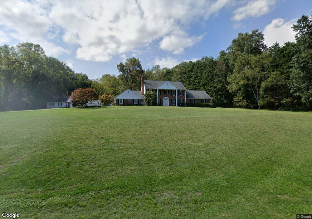
2700 Rutland Rd Davidsonville, MD 21035
Davidsonville NeighborhoodEstimated Value: $925,000 - $1,102,000
--
Bed
3
Baths
3,288
Sq Ft
$309/Sq Ft
Est. Value
About This Home
This home is located at 2700 Rutland Rd, Davidsonville, MD 21035 and is currently estimated at $1,017,207, approximately $309 per square foot. 2700 Rutland Rd is a home located in Anne Arundel County with nearby schools including Davidsonville Elementary School, Central Middle School, and South River High School.
Ownership History
Date
Name
Owned For
Owner Type
Purchase Details
Closed on
Jun 11, 2020
Sold by
Buchanan Thomas R and Buchanan Bonnie A
Bought by
Buchanan Thomas R and Buchanan Bonnie A
Current Estimated Value
Purchase Details
Closed on
May 5, 1992
Sold by
Schaefer Robert J
Bought by
Buchanan Thomas R and Buchanan Bonnie A
Home Financials for this Owner
Home Financials are based on the most recent Mortgage that was taken out on this home.
Original Mortgage
$170,000
Interest Rate
8.84%
Purchase Details
Closed on
Dec 9, 1986
Sold by
Woodbridge Construction Corp
Bought by
Schaefer Robert J
Create a Home Valuation Report for This Property
The Home Valuation Report is an in-depth analysis detailing your home's value as well as a comparison with similar homes in the area
Home Values in the Area
Average Home Value in this Area
Purchase History
| Date | Buyer | Sale Price | Title Company |
|---|---|---|---|
| Buchanan Thomas R | -- | None Available | |
| Buchanan Thomas R | $249,000 | -- | |
| Schaefer Robert J | $48,000 | -- |
Source: Public Records
Mortgage History
| Date | Status | Borrower | Loan Amount |
|---|---|---|---|
| Closed | Buchanan Thomas R | $170,000 |
Source: Public Records
Tax History Compared to Growth
Tax History
| Year | Tax Paid | Tax Assessment Tax Assessment Total Assessment is a certain percentage of the fair market value that is determined by local assessors to be the total taxable value of land and additions on the property. | Land | Improvement |
|---|---|---|---|---|
| 2025 | $7,953 | $714,033 | -- | -- |
| 2024 | $7,953 | $706,267 | $0 | $0 |
| 2023 | $7,764 | $698,500 | $385,000 | $313,500 |
| 2022 | $7,279 | $685,600 | $0 | $0 |
| 2021 | $14,296 | $672,700 | $0 | $0 |
| 2020 | $6,983 | $659,800 | $365,000 | $294,800 |
| 2019 | $6,859 | $643,700 | $0 | $0 |
| 2018 | $6,364 | $627,600 | $0 | $0 |
| 2017 | $6,435 | $611,500 | $0 | $0 |
| 2016 | -- | $582,467 | $0 | $0 |
| 2015 | -- | $553,433 | $0 | $0 |
| 2014 | -- | $524,400 | $0 | $0 |
Source: Public Records
Map
Nearby Homes
- 1118 Quince Apple Place
- 2744 Swann Way
- 2577 Rutland Rd
- 1045 Ashe St
- 2578 Bell Creek Dr
- 2602 Le Compte Ln
- 1306 Lavall Dr
- 1101 Meredith Ln
- 671 Discovery Ct
- 2901 George Howard Way
- 2545 Lavall Ct
- 2415 Pebblebrook Ct
- 3305 Blackberry Ln
- 1805 Stillview Acres Rd
- Preston Plan at Stillview Acres
- Stonehaven Plan at Stillview Acres
- Hampton II Plan at Stillview Acres
- 3313 Strawberry Run
- 738 Intrepid Way
- 513 Broad Stream Ln
- 2710 Rutland Rd
- 1221 Village Lake Dr
- 1211 Village Lake Dr
- 1231 Village Lake Dr
- 1109 Quince Apple Place
- 1111 Quince Apple Place
- 1201 Village Lake Dr
- 1113 Quince Apple Place
- 1015 Howard Grove Ct
- 1200 Village Lake Dr
- 1013 Howard Grove Ct
- 1241 Village Lake Dr
- 1230 Village Lake Dr
- 1115 Quince Apple Place
- 1011 Howard Grove Ct
- 1251 Village Lake Dr
- 1240 Village Lake Dr
- 1014 Howard Grove Ct
- 1206 Village Lake Dr
- 1117 Quince Apple Place