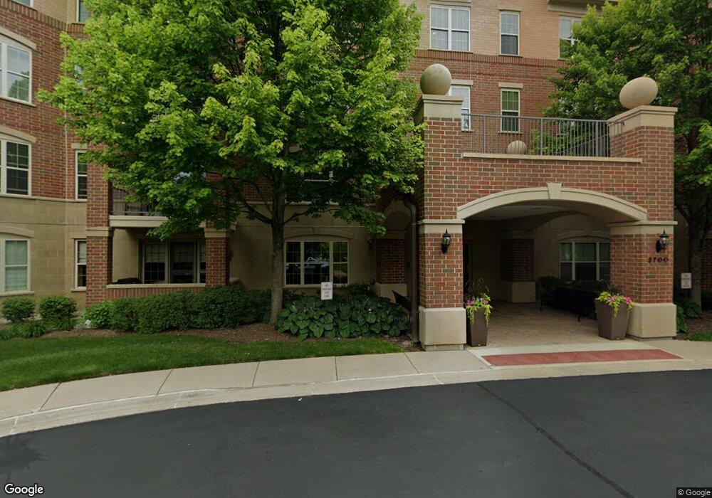
2700 Summit Dr Unit 212 Glenview, IL 60025
Estimated Value: $574,485 - $646,000
3
Beds
3
Baths
1,900
Sq Ft
$318/Sq Ft
Est. Value
About This Home
This home is located at 2700 Summit Dr Unit 212, Glenview, IL 60025 and is currently estimated at $603,621, approximately $317 per square foot. 2700 Summit Dr Unit 212 is a home located in Cook County with nearby schools including Lyon Elementary School, Pleasant Ridge Elementary School, and Attea Middle School.
Ownership History
Date
Name
Owned For
Owner Type
Purchase Details
Closed on
Mar 22, 2017
Sold by
Mb Financial Bank N A
Bought by
Kossof Teddie and Kossof Ildiko
Current Estimated Value
Home Financials for this Owner
Home Financials are based on the most recent Mortgage that was taken out on this home.
Original Mortgage
$275,000
Interest Rate
4.14%
Mortgage Type
New Conventional
Purchase Details
Closed on
Jun 30, 2016
Sold by
Choi Mee
Bought by
Mb Financial Bank Na
Purchase Details
Closed on
Jul 8, 2015
Sold by
Choi Mee and Choi Jung
Bought by
Choi Mee
Purchase Details
Closed on
May 1, 2005
Sold by
Haverford Venture Llc
Bought by
Choi Mee and Choi Harold
Home Financials for this Owner
Home Financials are based on the most recent Mortgage that was taken out on this home.
Original Mortgage
$390,000
Interest Rate
4.87%
Mortgage Type
Fannie Mae Freddie Mac
Create a Home Valuation Report for This Property
The Home Valuation Report is an in-depth analysis detailing your home's value as well as a comparison with similar homes in the area
Home Values in the Area
Average Home Value in this Area
Purchase History
| Date | Buyer | Sale Price | Title Company |
|---|---|---|---|
| Kossof Teddie | $375,000 | None Available | |
| Mb Financial Bank Na | -- | None Available | |
| Choi Mee | -- | Cambridge Title Company | |
| Choi Mee | $485,500 | Chicago Title Insurance Comp |
Source: Public Records
Mortgage History
| Date | Status | Borrower | Loan Amount |
|---|---|---|---|
| Previous Owner | Kossof Teddie | $275,000 | |
| Previous Owner | Choi Mee | $390,000 |
Source: Public Records
Tax History
| Year | Tax Paid | Tax Assessment Tax Assessment Total Assessment is a certain percentage of the fair market value that is determined by local assessors to be the total taxable value of land and additions on the property. | Land | Improvement |
|---|---|---|---|---|
| 2025 | $8,194 | $53,325 | $5,167 | $48,158 |
| 2024 | $8,194 | $42,988 | $4,379 | $38,609 |
| 2023 | $7,922 | $42,988 | $4,379 | $38,609 |
| 2022 | $7,922 | $42,988 | $4,379 | $38,609 |
| 2021 | $7,895 | $37,713 | $2,101 | $35,612 |
| 2020 | $9,275 | $37,713 | $2,101 | $35,612 |
| 2019 | $8,646 | $41,450 | $2,101 | $39,349 |
| 2018 | $7,859 | $34,170 | $1,050 | $33,120 |
| 2017 | $7,649 | $34,170 | $1,050 | $33,120 |
| 2016 | $7,228 | $34,170 | $1,050 | $33,120 |
| 2015 | $7,226 | $30,342 | $1,488 | $28,854 |
| 2014 | $7,093 | $30,342 | $1,488 | $28,854 |
| 2013 | $6,877 | $30,342 | $1,488 | $28,854 |
Source: Public Records
Map
Nearby Homes
- 2700 Summit Dr Unit 101
- 1827 Waterbury Cir
- 1819 Dunhill Cir
- 947 Kensington Dr Unit 7E3
- 431 4th St
- 1720 Wildberry Dr Unit B
- 1821 Wildberry Dr Unit A
- 2220 Founders Dr Unit 213
- 2220 Founders Dr Unit 107
- 2220 Founders Dr Unit P102
- 2220 Founders Dr Unit 316
- 2220 Founders Dr Unit 119
- 2220 Founders Dr Unit 325
- 2220 Founders Dr Unit 314
- 2220 Founders Dr Unit 116
- 2220 Founders Dr Unit 113
- 2220 Founders Dr Unit 117A
- 2220 Founders Dr Unit 227
- 831 Balmoral Ln
- 2150 Founders Dr Unit 247
- 2700 Summit Dr Unit 205
- 2700 Summit Dr Unit 408
- 2700 Summit Dr Unit 402
- 2700 Summit Dr Unit 306
- 2700 Summit Dr Unit 303
- 2700 Summit Dr Unit 208
- 2700 Summit Dr Unit 201
- 2700 Summit Dr Unit 104
- 2700 Summit Dr Unit 103
- 2700 Summit Dr Unit 106
- 2700 Summit Dr Unit 111
- 2700 Summit Dr Unit 301
- 2700 Summit Dr Unit 210
- 2700 Summit Dr Unit 410
- 2700 Summit Dr Unit 207
- 2700 Summit Dr Unit 411
- 2700 Summit Dr Unit 404
- 2700 Summit Dr Unit 405
- 2700 Summit Dr Unit 403
- 2700 Summit Dr Unit 407
Your Personal Tour Guide
Ask me questions while you tour the home.