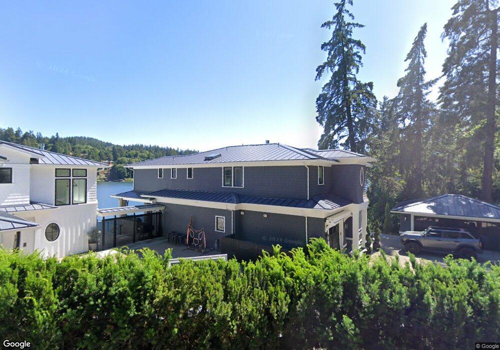
2700 Summit Dr Lake Oswego, OR 97034
Lakeview-Summit NeighborhoodEstimated Value: $3,584,262 - $5,376,000
5
Beds
3
Baths
4,472
Sq Ft
$985/Sq Ft
Est. Value
About This Home
This home is located at 2700 Summit Dr, Lake Oswego, OR 97034 and is currently estimated at $4,405,754, approximately $985 per square foot. 2700 Summit Dr is a home located in Clackamas County with nearby schools including Lake Grove Elementary School, Lake Oswego Junior High School, and Lake Oswego Senior High School.
Ownership History
Date
Name
Owned For
Owner Type
Purchase Details
Closed on
May 6, 2022
Sold by
Hammersley Grant W
Bought by
Grant W Hammersley & Heidi J M Hammersley Rev
Current Estimated Value
Home Financials for this Owner
Home Financials are based on the most recent Mortgage that was taken out on this home.
Original Mortgage
$3,000,000
Outstanding Balance
$2,768,084
Interest Rate
2.88%
Mortgage Type
New Conventional
Estimated Equity
$1,637,670
Purchase Details
Closed on
Dec 20, 2012
Sold by
Davis Century Farms Llc
Bought by
Hammersley Grant W and Hammersley Heidi Jean Marie
Purchase Details
Closed on
Dec 30, 2011
Sold by
Nelson Victor A
Bought by
Davis Farms Llc
Purchase Details
Closed on
Oct 28, 2005
Sold by
Nelson Bette R and Nelson Bette R
Bought by
Nelson Bette R and Bette R Nelson Trust
Create a Home Valuation Report for This Property
The Home Valuation Report is an in-depth analysis detailing your home's value as well as a comparison with similar homes in the area
Home Values in the Area
Average Home Value in this Area
Purchase History
| Date | Buyer | Sale Price | Title Company |
|---|---|---|---|
| Grant W Hammersley & Heidi J M Hammersley Rev | $103,000 | National Deed Network Inc | |
| Hammersley Grant W | $1,753,875 | Wfg Title | |
| Davis Farms Llc | -- | Lawyers | |
| Nelson Bette R | -- | None Available |
Source: Public Records
Mortgage History
| Date | Status | Borrower | Loan Amount |
|---|---|---|---|
| Open | Grant W Hammersley & Heidi J M Hammersley Rev | $3,000,000 |
Source: Public Records
Tax History Compared to Growth
Tax History
| Year | Tax Paid | Tax Assessment Tax Assessment Total Assessment is a certain percentage of the fair market value that is determined by local assessors to be the total taxable value of land and additions on the property. | Land | Improvement |
|---|---|---|---|---|
| 2025 | $54,611 | $2,843,710 | -- | -- |
| 2024 | $53,155 | $2,760,884 | -- | -- |
| 2023 | $53,155 | $2,680,470 | $0 | $0 |
| 2022 | $50,062 | $2,602,399 | $0 | $0 |
| 2021 | $46,239 | $2,526,601 | $0 | $0 |
| 2020 | $45,077 | $2,453,011 | $0 | $0 |
| 2019 | $43,968 | $2,381,565 | $0 | $0 |
| 2018 | $41,812 | $2,312,199 | $0 | $0 |
| 2017 | $40,345 | $2,244,853 | $0 | $0 |
| 2016 | $36,730 | $2,179,469 | $0 | $0 |
| 2015 | $35,346 | $2,107,662 | $0 | $0 |
| 2014 | $17,601 | $1,032,331 | $0 | $0 |
Source: Public Records
Map
Nearby Homes
- 15948 Twin Fir Rd
- 2240 Summit Ct
- 15947 Twin Fir Rd
- 1990 Indian Trail
- 16878 Canyon Dr
- 3525 Lake Grove Ave
- 0 S Shore Blvd
- 3537 Lake Grove Ave
- 2255 Glen Haven Rd
- 2703 Glen Eagles Rd
- 15370 Twin Fir Rd
- 2560 Glen Eagles Place
- 3548 Lakeview Blvd
- 1931 Park Forest Ct
- 3600 Lakeview Blvd
- 2217 Prestwick Rd
- 3730 Upper Dr
- 2627 Park Rd
- 1847 Woodland Terrace
- 3850 Lake Grove Ave
- 2720 Summit Dr
- 2646 Summit Dr
- 2624 Summit Dr
- 2625 Summit Dr
- 2711 Summit Dr
- 2600 Summit Dr
- 2751 Summit Dr
- 2738 Summit Dr
- 15848 Springbrook Ct
- 15847 Springbrook Ct
- 2552 Summit Dr
- 15821 Springbrook Ct
- 2575 Summit Dr
- 2796 Lakeview Blvd
- 15818 Springbrook Ct
- 2711 Lakeview Blvd
- 2532 Summit Dr
- 15815 Springbrook Ct
- 2808 Lakeview Blvd
- 2461 Summit Dr