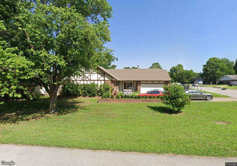
2700 W Freeport St Broken Arrow, OK 74012
Country Aire Estates NeighborhoodEstimated Value: $266,641 - $299,000
5
Beds
2
Baths
2,262
Sq Ft
$123/Sq Ft
Est. Value
About This Home
This home is located at 2700 W Freeport St, Broken Arrow, OK 74012 and is currently estimated at $278,910, approximately $123 per square foot. 2700 W Freeport St is a home located in Tulsa County with nearby schools including Peters Elementary School, Union 8th Grade Center, and Union 6th-7th Grade Center.
Ownership History
Date
Name
Owned For
Owner Type
Purchase Details
Closed on
Apr 6, 2015
Sold by
Mccoy Edith D
Bought by
Hoyt Michael T
Current Estimated Value
Purchase Details
Closed on
Aug 14, 2009
Sold by
Marak Renee
Bought by
Hoyt Michael T
Home Financials for this Owner
Home Financials are based on the most recent Mortgage that was taken out on this home.
Original Mortgage
$121,600
Interest Rate
5.19%
Mortgage Type
New Conventional
Purchase Details
Closed on
Feb 10, 2005
Sold by
Bachus Carolyn J
Bought by
Bachus Carolyn Jane and Carolyn Jane Bachus Revocable Living Tr
Purchase Details
Closed on
Jul 1, 1989
Create a Home Valuation Report for This Property
The Home Valuation Report is an in-depth analysis detailing your home's value as well as a comparison with similar homes in the area
Home Values in the Area
Average Home Value in this Area
Purchase History
| Date | Buyer | Sale Price | Title Company |
|---|---|---|---|
| Hoyt Michael T | -- | None Available | |
| Hoyt Michael T | $128,000 | First American Title & Abstr | |
| Bachus Carolyn Jane | -- | -- | |
| -- | $87,500 | -- |
Source: Public Records
Mortgage History
| Date | Status | Borrower | Loan Amount |
|---|---|---|---|
| Previous Owner | Hoyt Michael T | $121,600 |
Source: Public Records
Tax History Compared to Growth
Tax History
| Year | Tax Paid | Tax Assessment Tax Assessment Total Assessment is a certain percentage of the fair market value that is determined by local assessors to be the total taxable value of land and additions on the property. | Land | Improvement |
|---|---|---|---|---|
| 2025 | $2,211 | $16,837 | $2,201 | $14,636 |
| 2024 | $2,041 | $16,317 | $2,433 | $13,884 |
| 2023 | $2,041 | $16,813 | $2,429 | $14,384 |
| 2022 | $1,994 | $15,323 | $2,822 | $12,501 |
| 2021 | $1,938 | $14,847 | $2,734 | $12,113 |
| 2020 | $1,890 | $14,386 | $3,325 | $11,061 |
| 2019 | $1,829 | $13,938 | $3,221 | $10,717 |
| 2018 | $1,766 | $13,502 | $3,120 | $10,382 |
| 2017 | $1,734 | $14,080 | $3,254 | $10,826 |
| 2016 | $1,711 | $14,080 | $3,254 | $10,826 |
| 2015 | $1,712 | $14,080 | $3,254 | $10,826 |
| 2014 | $1,702 | $14,080 | $3,254 | $10,826 |
Source: Public Records
Map
Nearby Homes
- 2605 W Detroit St
- 2604 W Broadway St
- 3902 W Kenosha St
- 2509 W Broadway St
- 2600 W Commercial St
- 2701 W Madison St
- 3309 W Freeport St
- 1218 N Elder Ave
- Lee II Plan at Bricktown East - Broken Arrow
- 1331 N Beech St
- Hampton III Plan at Bricktown East - Broken Arrow
- Walker FH Plan at Bricktown East - Broken Arrow
- Hamilton Plan at Bricktown East - Broken Arrow
- Dorsey V Plan at Bricktown East - Broken Arrow
- Hampton IV 3C Plan at Bricktown East - Broken Arrow
- Washington Plan at Bricktown East - Broken Arrow
- Brenda MG Plan at Bricktown East - Broken Arrow
- Walker ll Plan at Bricktown East - Broken Arrow
- Ridgway III Plan at Bricktown East - Broken Arrow
- Brenda Plan at Bricktown East - Broken Arrow
- 2704 W Freeport St
- 2705 W Greeley St
- 2608 W Freeport St
- 2708 W Freeport St
- 416 N Fir Ave
- 2709 W Greeley St
- 421 N Fir Ave
- 2605 W Greeley St
- 2604 W Freeport St
- 2713 W Greeley St
- 2712 W Freeport St
- 2705 W Freeport St
- 417 N Fir Ave
- 2700 W Greeley St
- 2704 W Greeley St
- 412 N Fir Ave
- 2601 W Greeley St
- 424 N Elder Ave
- 2708 W Greeley St
