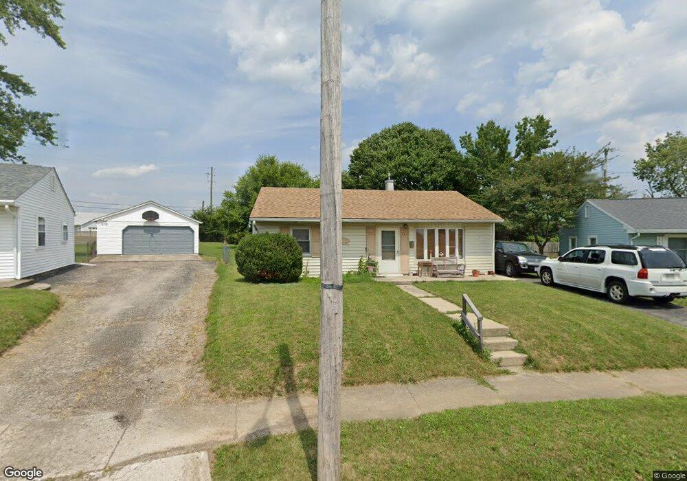
2702 Dorothy Layne Springfield, OH 45505
Estimated Value: $113,000 - $137,000
3
Beds
1
Bath
816
Sq Ft
$153/Sq Ft
Est. Value
About This Home
This home is located at 2702 Dorothy Layne, Springfield, OH 45505 and is currently estimated at $124,779, approximately $152 per square foot. 2702 Dorothy Layne is a home located in Clark County with nearby schools including Mann Elementary School, Schaefer Middle School, and Springfield High School.
Ownership History
Date
Name
Owned For
Owner Type
Purchase Details
Closed on
May 5, 2022
Sold by
Fairbanks David C and Fairbanks Angela C
Bought by
Banks6 Llc
Current Estimated Value
Purchase Details
Closed on
Oct 26, 2011
Sold by
Secretary Of Housing & Urban Development
Bought by
Fairbanks David
Purchase Details
Closed on
Jul 5, 2011
Sold by
Colwell Cathy
Bought by
The Secretary Of Housing & Urban Develop
Purchase Details
Closed on
Dec 14, 2007
Sold by
Colwell Charles
Bought by
Colwell Cathy E and Logan Cathy E
Purchase Details
Closed on
Jul 2, 1992
Create a Home Valuation Report for This Property
The Home Valuation Report is an in-depth analysis detailing your home's value as well as a comparison with similar homes in the area
Home Values in the Area
Average Home Value in this Area
Purchase History
| Date | Buyer | Sale Price | Title Company |
|---|---|---|---|
| Banks6 Llc | -- | Becker & Lilly Llc | |
| Fairbanks David | $27,000 | Attorney | |
| The Secretary Of Housing & Urban Develop | $41,000 | None Available | |
| Colwell Cathy E | -- | Attorney | |
| -- | -- | -- |
Source: Public Records
Tax History Compared to Growth
Tax History
| Year | Tax Paid | Tax Assessment Tax Assessment Total Assessment is a certain percentage of the fair market value that is determined by local assessors to be the total taxable value of land and additions on the property. | Land | Improvement |
|---|---|---|---|---|
| 2024 | $1,080 | $21,870 | $5,250 | $16,620 |
| 2023 | $1,080 | $21,870 | $5,250 | $16,620 |
| 2022 | $1,107 | $21,870 | $5,250 | $16,620 |
| 2021 | $765 | $13,920 | $3,610 | $10,310 |
| 2020 | $767 | $13,920 | $3,610 | $10,310 |
| 2019 | $769 | $13,920 | $3,610 | $10,310 |
| 2018 | $805 | $13,990 | $3,000 | $10,990 |
| 2017 | $804 | $14,606 | $3,003 | $11,603 |
| 2016 | $805 | $14,606 | $3,003 | $11,603 |
| 2015 | $1,006 | $14,175 | $3,003 | $11,172 |
| 2014 | $1,002 | $14,175 | $3,003 | $11,172 |
| 2013 | $991 | $14,175 | $3,003 | $11,172 |
Source: Public Records
Map
Nearby Homes
- 184 Willis Ave
- 120 S Fostoria Ave
- 360 Buxton Ave
- 2702 Maplewood Ave
- 327 Buxton Ave
- 2422 Lexington Ave
- 3012 E High St
- 2434 Irwin Ave
- 2753 Van Buren Ave
- 112 N Burnett Rd
- 438 Lawnview Ave
- 2751 Share St
- 2345 Irwin Ave
- 2733 Elmore Dr
- 351 S Clairmont Ave
- 528 Geron Dr
- 3154 Sherwood Park Dr
- 2226 E High St
- 127 Bellevue Ave
- 2201 Elmwood Ave
- 2702 Dorothy Ln
- 2706 Dorothy Layne
- 301 Gruen Dr
- 2706 Dorothy Ln
- 305 Gruen Dr
- 302 Gruen Dr
- 2712 Dorothy Ln
- 311 Gruen Dr
- 2711 Dorothy Ln
- 312 Gruen Dr
- 2716 Dorothy Ln
- 317 Gruen Dr
- 2722 Dorothy Layne Ave
- 2717 Dorothy Layne
- 316 Gruen Dr
- 321 Gruen Dr
- 2723 Dorothy Layne Ave
- 320 Gruen Dr
- 2728 Dorothy Layne
- 324 Gruen Dr