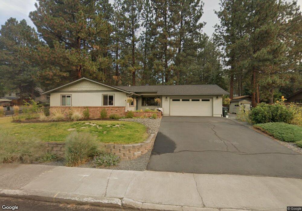
2702 NW Polarstar Ave Bend, OR 97701
Summit West NeighborhoodEstimated Value: $835,000 - $981,000
3
Beds
2
Baths
1,504
Sq Ft
$592/Sq Ft
Est. Value
About This Home
This home is located at 2702 NW Polarstar Ave, Bend, OR 97701 and is currently estimated at $889,814, approximately $591 per square foot. 2702 NW Polarstar Ave is a home located in Deschutes County with nearby schools including High Lakes Elementary School, Pacific Crest Middle School, and Summit High School.
Ownership History
Date
Name
Owned For
Owner Type
Purchase Details
Closed on
Dec 10, 2014
Sold by
Zimmerman E Virginia
Bought by
Struhs Justin D and Struhs Sara L
Current Estimated Value
Home Financials for this Owner
Home Financials are based on the most recent Mortgage that was taken out on this home.
Original Mortgage
$345,022
Outstanding Balance
$263,810
Interest Rate
3.95%
Mortgage Type
VA
Estimated Equity
$626,004
Create a Home Valuation Report for This Property
The Home Valuation Report is an in-depth analysis detailing your home's value as well as a comparison with similar homes in the area
Home Values in the Area
Average Home Value in this Area
Purchase History
| Date | Buyer | Sale Price | Title Company |
|---|---|---|---|
| Struhs Justin D | $334,000 | Amerititle |
Source: Public Records
Mortgage History
| Date | Status | Borrower | Loan Amount |
|---|---|---|---|
| Open | Struhs Justin D | $345,022 |
Source: Public Records
Tax History Compared to Growth
Tax History
| Year | Tax Paid | Tax Assessment Tax Assessment Total Assessment is a certain percentage of the fair market value that is determined by local assessors to be the total taxable value of land and additions on the property. | Land | Improvement |
|---|---|---|---|---|
| 2025 | $4,924 | $291,410 | -- | -- |
| 2024 | $4,737 | $282,930 | -- | -- |
| 2023 | $4,391 | $274,690 | $0 | $0 |
| 2022 | $4,097 | $258,930 | $0 | $0 |
| 2021 | $4,103 | $251,390 | $0 | $0 |
| 2020 | $3,893 | $251,390 | $0 | $0 |
| 2019 | $3,784 | $244,070 | $0 | $0 |
| 2018 | $3,678 | $236,970 | $0 | $0 |
| 2017 | $3,636 | $230,070 | $0 | $0 |
| 2016 | $3,471 | $223,370 | $0 | $0 |
| 2015 | $3,376 | $216,870 | $0 | $0 |
| 2014 | $2,989 | $210,560 | $0 | $0 |
Source: Public Records
Map
Nearby Homes
- 2234 NW Reserve Camp Ct
- 2382 NW Summerhill Dr
- 3019 NW Polarstar Ave
- 2424 NW Summerhill Dr
- 2947 NW Polarstar Ave
- 2954 NW Wild Meadow Dr
- 2627 NW Rainbow Ridge Dr
- 2580 NW Shields Dr
- 2992 NW Polarstar Ave Unit 23
- 2996 NW Polarstar Ave Unit Lot 24
- 3000 NW Polarstar Ave Unit Lot 25
- 2999 NW Polarstar Ave Unit 45
- 1650 NW Lewis St Unit 4
- 1676 NW William Clark St
- 2414 NW Brickyard St
- 3023 NW Polarstar Ave
- 2612 NW Lemhi Pass Dr
- 3032 NW Polarstar Ave Unit Lot 33
- 1399 NW Fort Clatsop St Unit 1&2
- 2589 NW Lemhi Pass Dr
- 2624 NW Polarstar Ave
- 2326 NW Torsway St
- 2321 NW Torsway St
- 2623 NW Polarstar Ave
- 2703 NW Polarstar Ave
- 2325 NW Torsway St
- 2613 NW Robert Way
- 2612 NW Polarstar Ave
- 2330 NW Torsway St
- 2611 NW Polarstar Ave
- 2625 NW Robert Way
- 2717 NW Polarstar Ave
- 2331 NW Torsway St
- 2607 NW Polarstar Ave
- 2332 NW Marken Place
- 2718 NW Marken St
- 2618 NW Marken St
- 2320 NW Marken Place
- 2342 NW Torsway St
- 2730 NW Marken St