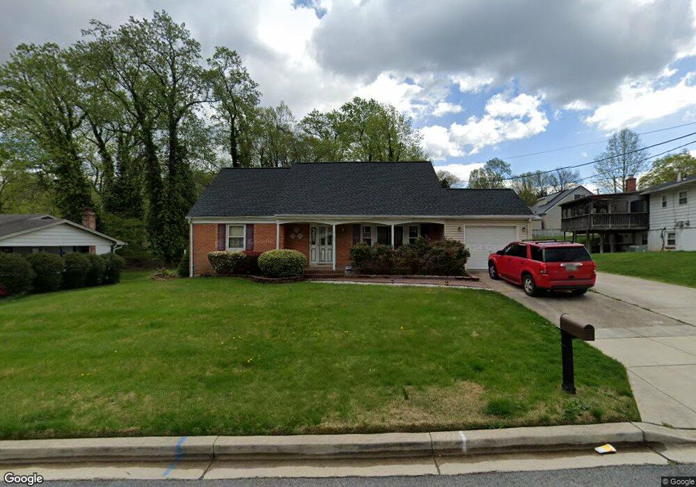
2703 Cator Dr Fort Washington, MD 20744
Estimated Value: $436,000 - $478,000
--
Bed
3
Baths
1,668
Sq Ft
$275/Sq Ft
Est. Value
About This Home
This home is located at 2703 Cator Dr, Fort Washington, MD 20744 and is currently estimated at $459,401, approximately $275 per square foot. 2703 Cator Dr is a home located in Prince George's County with nearby schools including Apple Grove Elementary School, Friendly High School, and National Christian Academy.
Ownership History
Date
Name
Owned For
Owner Type
Purchase Details
Closed on
Feb 7, 2007
Sold by
Hunt Ernest D and Hunt Michelle A
Bought by
Brooking Thomas
Current Estimated Value
Home Financials for this Owner
Home Financials are based on the most recent Mortgage that was taken out on this home.
Original Mortgage
$77,000
Outstanding Balance
$46,037
Interest Rate
6.31%
Mortgage Type
Purchase Money Mortgage
Estimated Equity
$413,364
Purchase Details
Closed on
Dec 1, 2006
Sold by
Hunt Ernest D and Hunt Michelle A
Bought by
Brooking Thomas
Home Financials for this Owner
Home Financials are based on the most recent Mortgage that was taken out on this home.
Original Mortgage
$308,000
Interest Rate
7.25%
Mortgage Type
Purchase Money Mortgage
Purchase Details
Closed on
Jan 30, 1996
Sold by
Hood Robert and Hood Barbara G
Bought by
Hunt Ernest D and Hunt Michelle A
Create a Home Valuation Report for This Property
The Home Valuation Report is an in-depth analysis detailing your home's value as well as a comparison with similar homes in the area
Home Values in the Area
Average Home Value in this Area
Purchase History
| Date | Buyer | Sale Price | Title Company |
|---|---|---|---|
| Brooking Thomas | $385,000 | -- | |
| Brooking Thomas | $385,000 | -- | |
| Hunt Ernest D | $140,000 | -- |
Source: Public Records
Mortgage History
| Date | Status | Borrower | Loan Amount |
|---|---|---|---|
| Open | Brooking Thomas | $77,000 | |
| Open | Brooking Thomas | $308,000 | |
| Closed | Brooking Thomas | $77,000 | |
| Previous Owner | Brooking Thomas | $308,000 |
Source: Public Records
Tax History Compared to Growth
Tax History
| Year | Tax Paid | Tax Assessment Tax Assessment Total Assessment is a certain percentage of the fair market value that is determined by local assessors to be the total taxable value of land and additions on the property. | Land | Improvement |
|---|---|---|---|---|
| 2025 | $5,890 | $389,300 | -- | -- |
| 2024 | $5,890 | $369,500 | $76,600 | $292,900 |
| 2023 | $5,710 | $357,500 | $0 | $0 |
| 2022 | $5,532 | $345,500 | $0 | $0 |
| 2021 | $5,354 | $333,500 | $75,800 | $257,700 |
| 2020 | $5,098 | $316,267 | $0 | $0 |
| 2019 | $4,841 | $299,033 | $0 | $0 |
| 2018 | $4,585 | $281,800 | $75,800 | $206,000 |
| 2017 | $4,309 | $263,233 | $0 | $0 |
| 2016 | -- | $244,667 | $0 | $0 |
| 2015 | $3,926 | $226,100 | $0 | $0 |
| 2014 | $3,926 | $226,100 | $0 | $0 |
Source: Public Records
Map
Nearby Homes
- 7512 Greer Dr
- 7512 Harpers Dr
- 7407 Bellefield Ave
- 3002 Ivy Bridge Rd
- 2910 Lumar Dr
- 7808 Den Meade Ave
- 2520 Bellefield Ct
- 7219 Crafford Place
- 2901 Henson Bridge Terrace
- 8016 Bock Rd
- 0 Bock Rd
- 7718 Klovstad Dr
- 2105 Calhoun St
- 8211 Joselle Ct
- 3413 Captain Wendell Pruitt Way
- 6903 Bock Rd
- 8136 Comet Dr
- 7013 Noah Dr
- 7009 Shagbark Ct
- 7810 Pats Ln
- 2705 Cator Dr
- 7608 Blanford Dr
- 7610 Blanford Dr
- 7603 Den Meade Ave
- 2707 Cator Dr
- 2702 Cator Dr
- 7606 Blanford Dr
- 7612 Blanford Dr
- 7605 Den Meade Ave
- 2704 Cator Dr
- 2706 Cator Dr
- 7607 Blanford Dr
- 7609 Blanford Dr
- 7507 Den Meade Ave
- 7607 Den Meade Ave
- 7604 Blanford Dr
- 7605 Blanford Dr
- 7614 Blanford Dr
- 7611 Blanford Dr
- 7609 Den Meade Ave