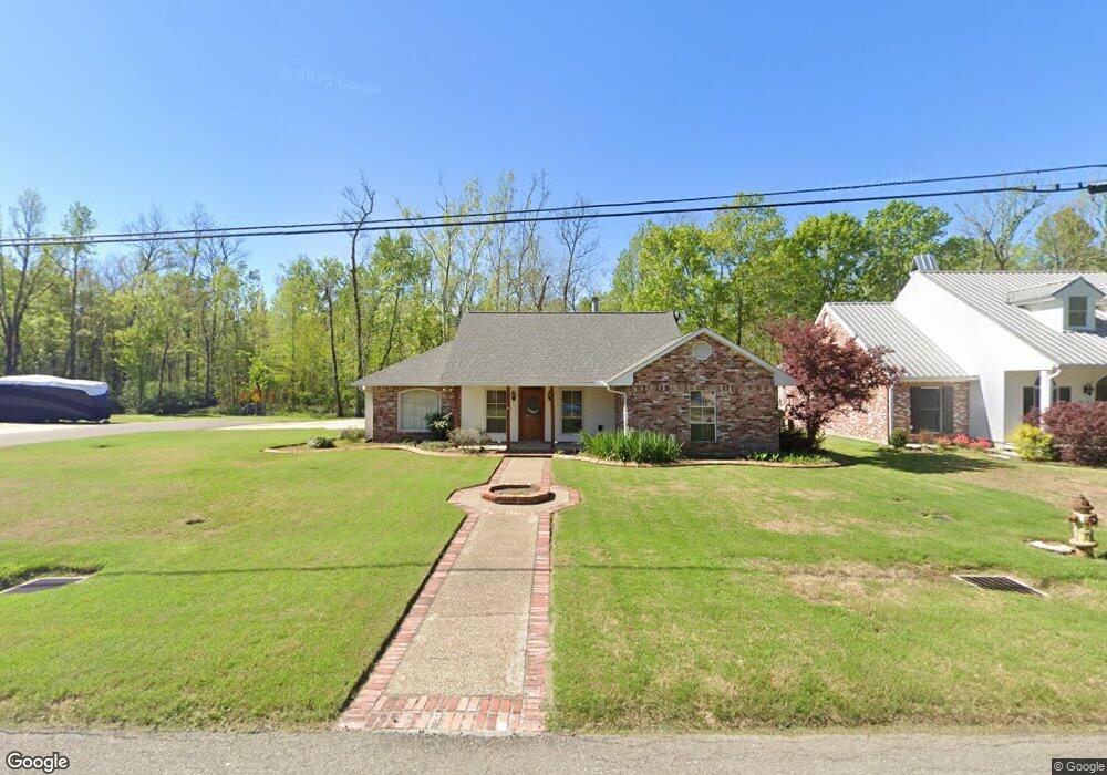
2703 Riverside Dr Port Allen, LA 70767
West Baton Rouge Parish NeighborhoodEstimated Value: $289,980 - $345,000
--
Bed
--
Bath
1,893
Sq Ft
$164/Sq Ft
Est. Value
About This Home
This home is located at 2703 Riverside Dr, Port Allen, LA 70767 and is currently estimated at $310,745, approximately $164 per square foot. 2703 Riverside Dr is a home located in West Baton Rouge Parish with nearby schools including Brusly Elementary School, Lukeville Upper Elementary School, and Brusly Middle School.
Ownership History
Date
Name
Owned For
Owner Type
Purchase Details
Closed on
Jun 23, 2017
Sold by
Landry Lucien Andrew
Bought by
Lefebvre Chantelle Landry and Lefebvre Everett
Current Estimated Value
Home Financials for this Owner
Home Financials are based on the most recent Mortgage that was taken out on this home.
Original Mortgage
$237,500
Outstanding Balance
$197,171
Interest Rate
3.95%
Mortgage Type
New Conventional
Estimated Equity
$113,574
Create a Home Valuation Report for This Property
The Home Valuation Report is an in-depth analysis detailing your home's value as well as a comparison with similar homes in the area
Home Values in the Area
Average Home Value in this Area
Purchase History
| Date | Buyer | Sale Price | Title Company |
|---|---|---|---|
| Lefebvre Chantelle Landry | $250,000 | None Available |
Source: Public Records
Mortgage History
| Date | Status | Borrower | Loan Amount |
|---|---|---|---|
| Open | Lefebvre Chantelle Landry | $237,500 |
Source: Public Records
Tax History Compared to Growth
Tax History
| Year | Tax Paid | Tax Assessment Tax Assessment Total Assessment is a certain percentage of the fair market value that is determined by local assessors to be the total taxable value of land and additions on the property. | Land | Improvement |
|---|---|---|---|---|
| 2024 | $1,612 | $24,140 | $5,500 | $18,640 |
| 2023 | $1,482 | $21,770 | $4,000 | $17,770 |
| 2022 | $2,283 | $21,770 | $4,000 | $17,770 |
| 2021 | $2,335 | $21,770 | $4,000 | $17,770 |
| 2020 | $2,122 | $19,590 | $3,600 | $15,990 |
| 2019 | $2,043 | $18,110 | $3,320 | $14,790 |
| 2018 | $2,080 | $18,110 | $3,320 | $14,790 |
| 2017 | $1,921 | $18,110 | $3,320 | $14,790 |
| 2015 | $1,529 | $17,800 | $3,010 | $14,790 |
| 2014 | $1,504 | $17,800 | $3,010 | $14,790 |
| 2013 | $1,504 | $17,800 | $3,010 | $14,790 |
Source: Public Records
Map
Nearby Homes
- 2488 Oak Alley Dr
- 2742 Emily Dr
- 1959 Fairview Ave
- 4747 Evergreen Dr
- 2218 Silverstone Ave
- 2217 Silverstone Ave
- 1394 Rue Riviere
- 1152 Freeman Ln
- 2.509 ACRES Louisiana 415
- 6455 Louisiana 1
- 6312 Louisiana 1
- 3200 Orleans Quarters Dr
- 2209 Live Oak Dr
- 2382 Ory Dr
- 2809 Live Oak Dr
- 2821 Live Oak Dr
- 526 Gwin St
- 540 Bourgeois St
- 2805 Live Oak Dr
- 2820 Live Oak Dr
- 2709 Riverside Dr
- 2649 Riverside Dr
- 2704 Riverside Dr
- 2710 Riverside Dr
- 2650 Riverside Dr
- 2643 Riverside Dr
- 2644 Riverside Dr
- 2637 Riverside Dr
- 2638 Riverside Dr
- 2631 Riverside Dr
- 2632 Riverside Dr
- 2625 Riverside Dr
- 2626 Riverside Dr
- 2619 Riverside Dr
- 2620 Riverside Dr
- 2613 Riverside Dr
- 2614 Riverside Dr
- 2608 Riverside Dr
- 2547 Riverside Dr
- 2548 Riverside Dr