Estimated Value: $251,000 - $284,000
3
Beds
2
Baths
1,069
Sq Ft
$252/Sq Ft
Est. Value
About This Home
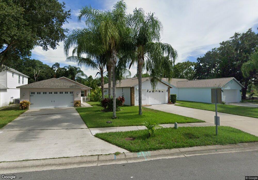
This home is located at 2703 Winchester Dr, Cocoa, FL 32926 and is currently estimated at $269,680, approximately $252 per square foot. 2703 Winchester Dr is a home located in Brevard County with nearby schools including Cocoa High School, Saturn Elementary School, and Space Coast Christian Academy.
Ownership History
Date
Name
Owned For
Owner Type
Purchase Details
Closed on
Apr 7, 2008
Sold by
Cohen Jack A and Cohen Cathy C
Bought by
Morneau Matthew C
Current Estimated Value
Home Financials for this Owner
Home Financials are based on the most recent Mortgage that was taken out on this home.
Original Mortgage
$82,800
Outstanding Balance
$53,130
Interest Rate
6.22%
Mortgage Type
Purchase Money Mortgage
Estimated Equity
$216,550
Purchase Details
Closed on
Oct 31, 1997
Sold by
Heberer Robert C and Brettelle King George
Bought by
Cohen Jack A
Purchase Details
Closed on
Jun 7, 1994
Sold by
Brettelle King George
Bought by
Brettelle King George
Create a Home Valuation Report for This Property
The Home Valuation Report is an in-depth analysis detailing your home's value as well as a comparison with similar homes in the area
Home Values in the Area
Average Home Value in this Area
Purchase History
| Date | Buyer | Sale Price | Title Company |
|---|---|---|---|
| Morneau Matthew C | $103,500 | Fidelity Land Title & Escrow | |
| Cohen Jack A | $62,000 | -- | |
| Brettelle King George | -- | -- |
Source: Public Records
Mortgage History
| Date | Status | Borrower | Loan Amount |
|---|---|---|---|
| Open | Morneau Matthew C | $82,800 |
Source: Public Records
Tax History
| Year | Tax Paid | Tax Assessment Tax Assessment Total Assessment is a certain percentage of the fair market value that is determined by local assessors to be the total taxable value of land and additions on the property. | Land | Improvement |
|---|---|---|---|---|
| 2025 | $3,975 | $227,810 | -- | -- |
| 2024 | $3,791 | $226,140 | -- | -- |
| 2023 | $3,791 | $221,570 | $0 | $0 |
| 2022 | $3,231 | $194,620 | $0 | $0 |
| 2021 | $2,907 | $147,060 | $35,000 | $112,060 |
| 2020 | $2,665 | $137,350 | $35,000 | $102,350 |
| 2019 | $2,525 | $131,110 | $35,000 | $96,110 |
| 2018 | $2,284 | $122,860 | $35,000 | $87,860 |
| 2017 | $2,072 | $99,540 | $20,000 | $79,540 |
| 2016 | $1,962 | $91,830 | $18,000 | $73,830 |
| 2015 | $1,816 | $79,780 | $18,000 | $61,780 |
| 2014 | $1,669 | $74,170 | $16,000 | $58,170 |
Source: Public Records
Map
Nearby Homes
- 2713 Winchester Dr
- 3125 Winchester Dr
- 3120 Winchester Dr
- 0000 Unknown
- 00 N Unknown
- 2111 Otterbein Ave
- 2211 Longbow Rd
- 3363 Echo Ridge Place
- 3660 Longbow Rd
- 3393 Echo Ridge Place
- 3487 Rocky Gap Place
- 1933 Quail Ridge Ct Unit 1101
- 1942 Quail Ridge Ct Unit 504
- 3723 W Malory Ct
- 1956 Quail Ridge Ct Unit 1802
- 1954 Quail Ridge Ct Unit 1701
- 3728 W Malory Ct
- 3806 Parapet Dr
- 2426 Granville Dr
- 1612 Calvados Dr
- 2705 Winchester Dr
- 2701 Winchester Dr
- 2707 Winchester Dr
- 2709 Winchester Dr
- 2711 Winchester Dr
- 2700 Winchester Dr
- 2704 Winchester Dr
- 2801 Dunhill Dr
- 2706 Winchester Dr
- 2803 Dunhill Dr
- 2708 Winchester Dr
- 2715 Winchester Dr
- 2805 Dunhill Dr
- 2710 Winchester Dr
- 2717 Winchester Dr
- 2733 Wentworth Place
- 2807 Dunhill Dr
- 2735 Wentworth Place
- 2712 Winchester Dr
- 2737 Wentworth Place
Your Personal Tour Guide
Ask me questions while you tour the home.