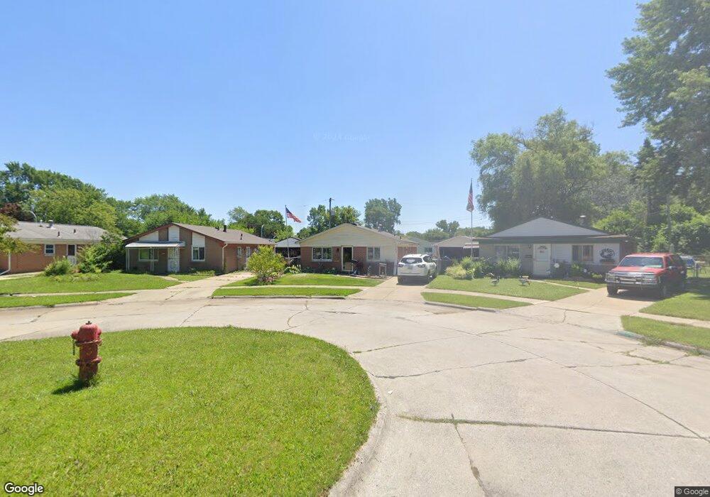
27039 Jeannette Ct Taylor, MI 48180
Estimated Value: $164,670 - $173,000
3
Beds
1
Bath
1,021
Sq Ft
$165/Sq Ft
Est. Value
About This Home
This home is located at 27039 Jeannette Ct, Taylor, MI 48180 and is currently estimated at $168,168, approximately $164 per square foot. 27039 Jeannette Ct is a home located in Wayne County with nearby schools including Holland Elementary School, Hoover Middle School, and Taylor High School.
Ownership History
Date
Name
Owned For
Owner Type
Purchase Details
Closed on
Oct 25, 2021
Sold by
Eillott Daniel Ernest
Bought by
Snider Daniel Robert
Current Estimated Value
Home Financials for this Owner
Home Financials are based on the most recent Mortgage that was taken out on this home.
Original Mortgage
$76,600
Outstanding Balance
$70,083
Interest Rate
2.88%
Mortgage Type
New Conventional
Estimated Equity
$98,085
Purchase Details
Closed on
Sep 19, 2008
Sold by
Anderson Mary E
Bought by
Elliott Daniel E
Create a Home Valuation Report for This Property
The Home Valuation Report is an in-depth analysis detailing your home's value as well as a comparison with similar homes in the area
Home Values in the Area
Average Home Value in this Area
Purchase History
| Date | Buyer | Sale Price | Title Company |
|---|---|---|---|
| Snider Daniel Robert | $135,000 | None Available | |
| Elliott Daniel E | $74,400 | Michigan Title Insurance Age |
Source: Public Records
Mortgage History
| Date | Status | Borrower | Loan Amount |
|---|---|---|---|
| Open | Snider Daniel Robert | $76,600 |
Source: Public Records
Tax History Compared to Growth
Tax History
| Year | Tax Paid | Tax Assessment Tax Assessment Total Assessment is a certain percentage of the fair market value that is determined by local assessors to be the total taxable value of land and additions on the property. | Land | Improvement |
|---|---|---|---|---|
| 2025 | $2,492 | $74,200 | $0 | $0 |
| 2024 | $2,492 | $66,200 | $0 | $0 |
| 2023 | $3,037 | $61,600 | $0 | $0 |
| 2022 | $2,378 | $52,100 | $0 | $0 |
| 2021 | $2,021 | $43,400 | $0 | $0 |
| 2020 | $1,999 | $36,900 | $0 | $0 |
| 2019 | $198,623 | $41,200 | $0 | $0 |
| 2018 | $1,608 | $31,000 | $0 | $0 |
| 2017 | $767 | $31,500 | $0 | $0 |
| 2016 | $1,961 | $30,700 | $0 | $0 |
| 2015 | $2,550 | $26,800 | $0 | $0 |
| 2013 | $2,540 | $26,400 | $0 | $0 |
| 2012 | $1,118 | $25,600 | $6,900 | $18,700 |
Source: Public Records
Map
Nearby Homes
- 6211 Inkster Rd
- 6221 Inkster Rd
- 6368 Hazel St
- 5970 John Daly St
- 5993 John Daly St
- 6107 John Daly St
- 5526 Sylvia St
- 6370 Hampden St
- 6075 Duncan St
- 6319 Duncan St
- 27523 Powers St
- 26532 Powers Ave
- 26215 Beverly Rd
- 6179 Fellrath St
- 4863 Glenis St
- 6338 Marvin St
- 27620 Newcastle St
- 5961 Marvin St
- 25908 Beverly Rd
- 6018 Frederick St Unit 83
- 27039 Jeanette St
- 27029 Jeannette Ct
- 27049 Jeannette Ct
- 27029 Jeanette St
- 27040 Debra Ct
- 27019 Jeanette St
- 27019 Jeannette Ct
- 27030 Debra Ct
- 27059 Jeannette Ct
- 27050 Debra Ct
- 27020 Debra Ct
- 27009 Jeannette Ct
- 27058 Jeannette Ct
- 27060 Debra Ct
- 27010 Debra Ct
- 27048 Jeannette Ct
- 27038 Jeannette Ct
- 27061 Debra Ct
- 27008 Jeannette St
- 27008 Jeanette St