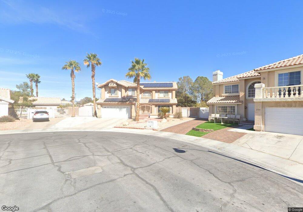
2704 Quail Roost Way Las Vegas, NV 89117
The Section Seven NeighborhoodEstimated Value: $563,000 - $694,000
4
Beds
3
Baths
2,655
Sq Ft
$243/Sq Ft
Est. Value
About This Home
This home is located at 2704 Quail Roost Way, Las Vegas, NV 89117 and is currently estimated at $646,158, approximately $243 per square foot. 2704 Quail Roost Way is a home located in Clark County with nearby schools including M J Christensen Elementary School, Clifford J Lawrence Junior High School, and Bonanza High School.
Ownership History
Date
Name
Owned For
Owner Type
Purchase Details
Closed on
Mar 5, 2013
Sold by
Flores Gregorio C and Flores Roberta J
Bought by
Mereb Inocensio B
Current Estimated Value
Purchase Details
Closed on
May 14, 2002
Sold by
Zalaoras Mark L and Zalaoras Maureen
Bought by
Flores Gregorio C and Flores Roberta J
Home Financials for this Owner
Home Financials are based on the most recent Mortgage that was taken out on this home.
Original Mortgage
$218,950
Interest Rate
7.13%
Create a Home Valuation Report for This Property
The Home Valuation Report is an in-depth analysis detailing your home's value as well as a comparison with similar homes in the area
Home Values in the Area
Average Home Value in this Area
Purchase History
| Date | Buyer | Sale Price | Title Company |
|---|---|---|---|
| Mereb Inocensio B | $245,000 | Nations Title Co Of Ne | |
| Flores Gregorio C | $230,500 | Lawyers Title |
Source: Public Records
Mortgage History
| Date | Status | Borrower | Loan Amount |
|---|---|---|---|
| Previous Owner | Flores Gregorio C | $218,950 |
Source: Public Records
Tax History Compared to Growth
Tax History
| Year | Tax Paid | Tax Assessment Tax Assessment Total Assessment is a certain percentage of the fair market value that is determined by local assessors to be the total taxable value of land and additions on the property. | Land | Improvement |
|---|---|---|---|---|
| 2025 | $3,091 | $126,323 | $40,810 | $85,513 |
| 2024 | $3,001 | $126,323 | $40,810 | $85,513 |
| 2023 | $3,001 | $124,288 | $42,350 | $81,938 |
| 2022 | $2,919 | $108,523 | $32,725 | $75,798 |
| 2021 | $2,837 | $102,542 | $30,030 | $72,512 |
| 2020 | $2,750 | $100,478 | $28,105 | $72,373 |
| 2019 | $2,669 | $102,742 | $30,993 | $71,749 |
| 2018 | $2,592 | $100,000 | $30,590 | $69,410 |
| 2017 | $3,177 | $99,548 | $28,578 | $70,970 |
| 2016 | $2,453 | $91,444 | $20,125 | $71,319 |
| 2015 | $2,449 | $79,375 | $18,918 | $60,457 |
| 2014 | $2,459 | $72,785 | $10,063 | $62,722 |
Source: Public Records
Map
Nearby Homes
- 2712 Quail Roost Way
- 2913 Domino Way
- 9113 Anchor Cove Ct
- 8913 Antioch Way
- 8932 Antioch Way
- 9100 Shelter Cove Ct
- 9429 Abalone Way
- 2200 S Fort Apache Rd Unit 1025
- 2200 S Fort Apache Rd Unit 2202
- 2200 S Fort Apache Rd Unit 1077
- 2200 S Fort Apache Rd Unit 2073
- 2200 S Fort Apache Rd Unit 2237
- 2200 S Fort Apache Rd Unit 2192
- 2200 S Fort Apache Rd Unit 1038
- 2200 S Fort Apache Rd Unit 1050
- 2200 S Fort Apache Rd Unit 1168
- 2200 S Fort Apache Rd Unit 2017
- 2757 Lodestone Dr Unit 59
- 2761 Lodestone Dr Unit 63
- 9021 Feather River Ct
- 2708 Quail Roost Way
- 2700 Quail Roost Way
- 2701 Quail Roost Way
- 2705 Quail Roost Way
- 2716 Quail Roost Way
- 2709 Quail Roost Way
- 2704 Cloudsdale Cir
- 2705 Tidewater Ct Unit 4
- 2709 Tidewater Ct
- 2720 Quail Roost Way
- 2713 Quail Roost Way
- 2713 Tidewater Ct
- 2701 Tidewater Ct
- 2708 Cloudsdale Cir
- 2717 Tidewater Ct
- 2712 Cloudsdale Cir
- 2724 Quail Roost Way
- 2717 Quail Roost Way
- 2700 Cloudsdale Cir
- 2721 Tidewater Ct