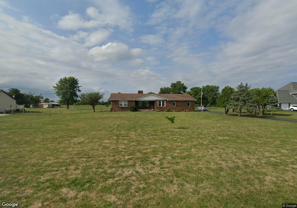
2704 Weigand Rd Lockbourne, OH 43137
Estimated Value: $493,401 - $783,000
4
Beds
3
Baths
2,326
Sq Ft
$274/Sq Ft
Est. Value
About This Home
This home is located at 2704 Weigand Rd, Lockbourne, OH 43137 and is currently estimated at $636,350, approximately $273 per square foot. 2704 Weigand Rd is a home located in Pickaway County.
Ownership History
Date
Name
Owned For
Owner Type
Purchase Details
Closed on
Jul 19, 2017
Sold by
Estate Of Myrtle Brown Adkins
Bought by
Brown Leonard
Current Estimated Value
Purchase Details
Closed on
Oct 21, 2004
Sold by
Brown Ballard and Brown Myrtle L
Bought by
Brown Ballard and Brown Myrtle L
Create a Home Valuation Report for This Property
The Home Valuation Report is an in-depth analysis detailing your home's value as well as a comparison with similar homes in the area
Home Values in the Area
Average Home Value in this Area
Purchase History
| Date | Buyer | Sale Price | Title Company |
|---|---|---|---|
| Brown Leonard | -- | None Available | |
| Brown Ballard | -- | None Available |
Source: Public Records
Tax History Compared to Growth
Tax History
| Year | Tax Paid | Tax Assessment Tax Assessment Total Assessment is a certain percentage of the fair market value that is determined by local assessors to be the total taxable value of land and additions on the property. | Land | Improvement |
|---|---|---|---|---|
| 2024 | -- | $123,290 | $28,350 | $94,940 |
| 2023 | $4,677 | $123,290 | $28,350 | $94,940 |
| 2022 | $4,068 | $98,340 | $23,310 | $75,030 |
| 2021 | $3,851 | $98,340 | $23,310 | $75,030 |
| 2020 | $3,857 | $98,340 | $23,310 | $75,030 |
| 2019 | $3,020 | $86,060 | $22,330 | $63,730 |
| 2018 | $3,160 | $86,060 | $22,330 | $63,730 |
| 2017 | $4,617 | $86,060 | $22,330 | $63,730 |
| 2016 | $2,920 | $77,830 | $21,350 | $56,480 |
| 2015 | $2,922 | $77,830 | $21,350 | $56,480 |
| 2014 | $2,923 | $77,830 | $21,350 | $56,480 |
| 2013 | $3,281 | $83,710 | $21,350 | $62,360 |
Source: Public Records
Map
Nearby Homes
- 12382 Bulen Pierce Rd
- 62 Cider Mill Dr
- Bellamy Plan at Walnut Mill
- Chatham Plan at Walnut Mill
- Juniper Plan at Walnut Mill
- 57 Cider Mill Dr
- 50 Cider Mill Dr
- 61 Cider Mill Dr
- 54 Cider Mill Dr
- 58 Cider Mill Dr
- Henley Plan at Walnut Mill
- 60 Cider Mill Dr
- Sienna Plan at Walnut Mill
- 44 Cider Mill Dr
- Pendleton Plan at Walnut Mill
- Aldridge Plan at Walnut Mill
- Stamford Plan at Walnut Mill
- Fairton Plan at Walnut Mill
- 52 Cider Mill Dr
- 53 Cider Mill Dr
- 2720 Weigand Rd
- 2662 Weigand Rd
- 2630 Weigand Rd
- 2600 Weigand Rd
- 2542 Weigand Rd
- 2520 Weigand Rd
- 12402 Bulen Pierce Rd
- 0 Weigand Rd
- 0 Weigand Rd
- 12465 Bulen Pierce Rd
- 12417 Bulen Pierce Rd
- 12300 Bulen Pierce Rd
- 12399 Bulen Pierce Rd
- 2415 Weigand Rd
- 2395 Weigand Rd
- 12240 Bulen Pierce Rd
- 12313 Bulen Pierce Rd
- 2358 Weigand Rd
- 2363 Weigand Rd
- 12206 Bulen Pierce Rd