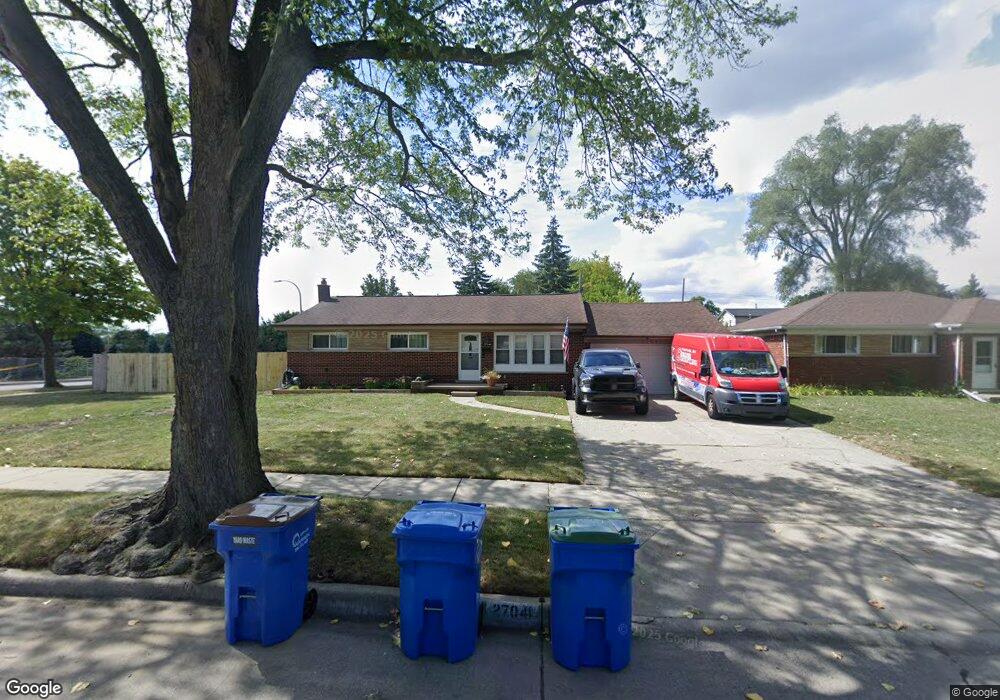
27041 Sylvan Ave Unit Bldg-Unit Warren, MI 48093
Northeast Warren NeighborhoodEstimated Value: $261,145 - $311,000
3
Beds
2
Baths
1,431
Sq Ft
$198/Sq Ft
Est. Value
About This Home
This home is located at 27041 Sylvan Ave Unit Bldg-Unit, Warren, MI 48093 and is currently estimated at $283,536, approximately $198 per square foot. 27041 Sylvan Ave Unit Bldg-Unit is a home located in Macomb County with nearby schools including Crothers Elementary School, Wolfe Middle School, and Center Line High School.
Ownership History
Date
Name
Owned For
Owner Type
Purchase Details
Closed on
Jun 1, 2018
Sold by
Wunchee Properties Llc
Bought by
Jacobs Kevin
Current Estimated Value
Purchase Details
Closed on
Aug 28, 2017
Sold by
Wells Fargo Bank Na
Bought by
Wunchee Properties Llc
Purchase Details
Closed on
Oct 28, 2016
Sold by
Achatz Christopher and Achatz Jackie
Bought by
Wells Fargo Bank Na
Purchase Details
Closed on
Oct 30, 2001
Sold by
Evennou Raymond
Bought by
Achatz Christopher
Create a Home Valuation Report for This Property
The Home Valuation Report is an in-depth analysis detailing your home's value as well as a comparison with similar homes in the area
Home Values in the Area
Average Home Value in this Area
Purchase History
| Date | Buyer | Sale Price | Title Company |
|---|---|---|---|
| Jacobs Kevin | $176,500 | Devon Title Agency | |
| Wunchee Properties Llc | $114,000 | None Available | |
| Wells Fargo Bank Na | $136,069 | None Available | |
| Achatz Christopher | $30,000 | -- |
Source: Public Records
Tax History Compared to Growth
Tax History
| Year | Tax Paid | Tax Assessment Tax Assessment Total Assessment is a certain percentage of the fair market value that is determined by local assessors to be the total taxable value of land and additions on the property. | Land | Improvement |
|---|---|---|---|---|
| 2025 | $6,054 | $127,810 | $0 | $0 |
| 2024 | $5,908 | $119,280 | $0 | $0 |
| 2023 | $5,721 | $105,560 | $0 | $0 |
| 2022 | $5,528 | $93,330 | $0 | $0 |
| 2021 | $5,623 | $85,930 | $0 | $0 |
| 2020 | $5,483 | $82,620 | $0 | $0 |
| 2019 | $5,381 | $81,110 | $0 | $0 |
| 2018 | $4,537 | $64,770 | $0 | $0 |
| 2017 | $2,913 | $57,470 | $12,170 | $45,300 |
| 2016 | $2,944 | $57,470 | $0 | $0 |
| 2015 | -- | $46,550 | $0 | $0 |
| 2013 | $5,593 | $44,500 | $0 | $0 |
Source: Public Records
Map
Nearby Homes
- 8457 Potomac
- 8475 Stout Ave
- 27263 Arsenal Ave
- 8458 Garbor
- 27524 Gail Dr
- 27506 Lorraine Ave
- 8150 Menge
- 8475 Farnum Ave
- 26615 Richard Dr
- 8434 Virginia Park
- 8210 Hettenberger Ave
- 8460 Busko Ave
- 27116 Seyburn Ave
- 27125 Gilbert Dr
- 8147 Busko St
- 8134 Lillian
- 8330 Sunburst
- 28031 Lorraine Ave
- 27321 Baldwin Ave
- 8115 Busch
- 27041 Sylvan Ave
- 27061 Sylvan Ave
- 8477 E 11 Mile Rd
- 8468 Baird Ave
- 27081 Sylvan Ave Unit Bldg-Unit
- 27081 Sylvan Ave
- 27040 Sylvan Ave
- 8460 Baird Ave
- 27060 Sylvan Ave
- 27021 Eleven Mile
- 27111 Sylvan Ave
- 8452 Baird Ave
- 27080 Sylvan Ave
- 27110 Sylvan Ave
- 27135 Sylvan Ave
- 27075 Gail Dr
- 8428 Baird Ave
- 27085 Gail Dr
- 27095 Gail Dr
- 27130 Sylvan Ave